Bird watching on Spectacle Island

While close enough to the city to swim to and accessible enough to feel like a public park, Spectacle island is home to an abundance of wildlife. Among the species inhabiting the island is the beautiful red‒winged blackbird. I was lucky enough to catch a glimpse of one earlier today.

Here he is sitting on top of a tree looking at the city:

spectacle island

In flight:

blackbird

Hanging out looking for lunch:

spectacle island

Taking off again:

spectacle island

Some of my other views of Spectacle Island can be seen here. Some additional information about the Redwing Blackbird can be seen on this helpful site.

Posted in Boston Harbor Birds, Boston Harbor Day Boat Trips, Visiting Boston Harbor | Tagged , , , | Comments Off on Bird watching on Spectacle Island

Picture of the week: Boston Light at Sunset

As the sun sets over Black Rock Beach in Cohasset, Boston Light is visible in the distance, as are some other distant lights from the North Shore:

black rock beach

Posted in Boston Harbor Picture of the Week, good views, Uncategorized | Comments Off on Picture of the week: Boston Light at Sunset

Boats that you might see in Boston Harbor

When out on Boston Harbor, there are a great variety of interesting boats which one may see. In addition to the large number of private recreational boats and fishing vessels out there, here is a list of some of the unique and frequently seen boats out on the harbor ranging from ferries to fire & police boats to cruse ships. Should you want to take a ride on any of these boats, a few links are available below.

Ferries:

The Salacia. This is the largest and fastest of the ferries on Boston Harbor. It is used for the Hingham/Boston commute in the winter, and runs from Long Wharf to Provincetown in the summer months.
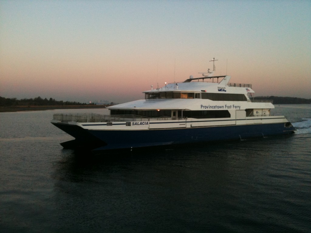
boston harbor

The Aurora and Asteria: These two nearly identical fast ferries are catamaran hulls like the Salacia, but are smaller. They are used for the Hingham commute as well as whale watches in the summer months.
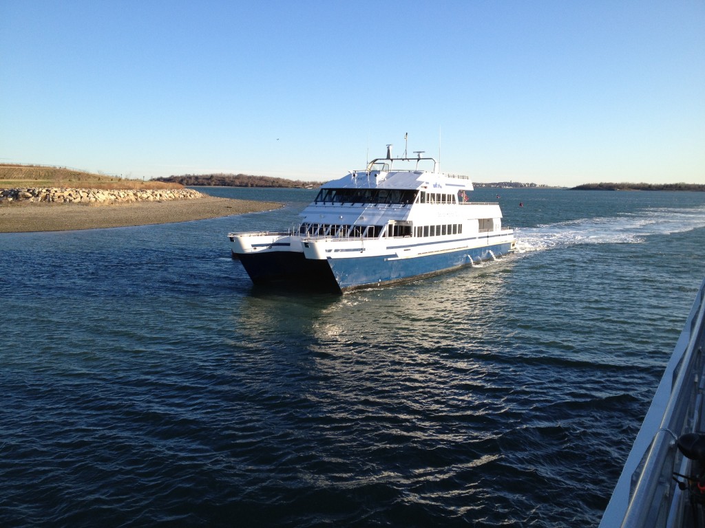
boston

The Voyager: A whale watch vessel that also does the Quincy Ferry run. It is smaller than the Aurora and Asteria, but faster. It is also designed specifically for whale watching.
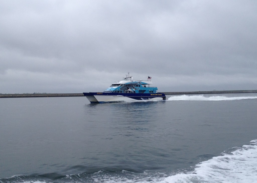
boston harbor

Ruth E. Hughes: This is one of the older passenger ferries serving the Hingham commuter run to Rowes wharf. She throws off a hell of a big wake, so watch out if you are passing her!
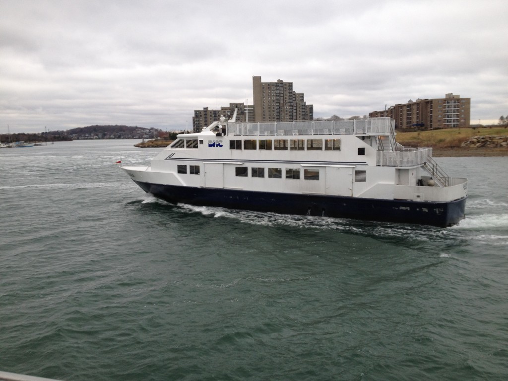
laura

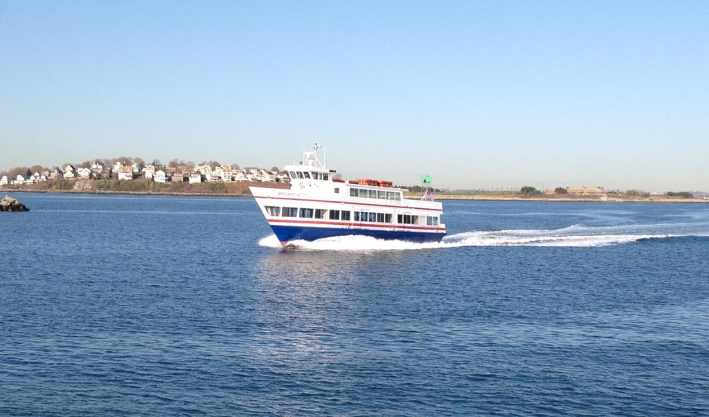
Massachusetts: Also performing the Hingham Run, the Massachusetts can be seen doing tours of Boston Harbor in the summer months. It is known for its friendly crew.
boston harbor

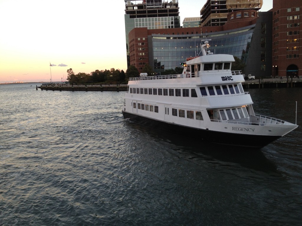
Regency: Ocassionally used as a Hingham Ferry, this vessel is mainly a party boat, as it is equipped with a full bar and dance floor. She makes up for lack of speed with fun.
boston harbor

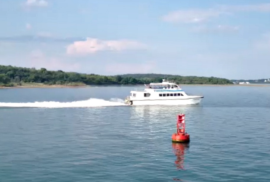
Lightning and Flying Cloud: These two little catamaran fast ferries are basically identical and serve the Quincy/Hull/Logan Airport ferry route.
boston harbor

Party Boats:

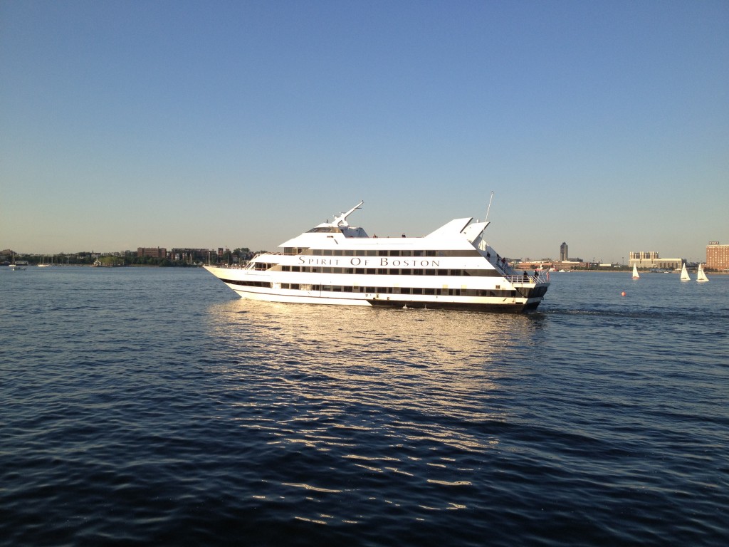
The Spirit of Boston: For about two decades this ship has served as an evening harbor cruise and party boat. It departs from the Seaport beside Pier 4.
boston harbor

Odyssey: This is an elegant party cruise boat which departs from Rowes Wharf nightly.

boston harbor

Island Discovery: This is the boat that you can catch at Long Wharf to head out to Spectacle Island or Georges Island. Both are highly recommended trips and a link for the service can be found here. Here is the discovery as she pulls up to Spectacle Island:
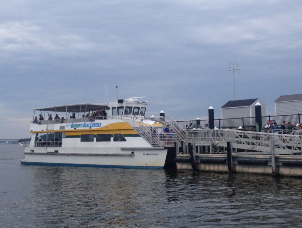
boston harbor beacon

Codzilla: One can’t forget Codzilla, and ultra high speed cruise and wake jumping event in the outer harbor. One can catch a ride on this cruise from Long Wharf.
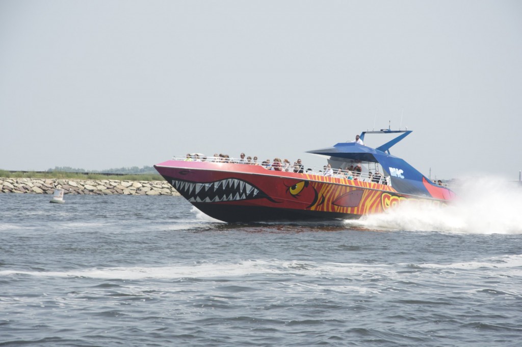
boston harbor fast cruise

Fredrick L. Nolan: A Boston tour and cruise boat departing from Long Wharf.
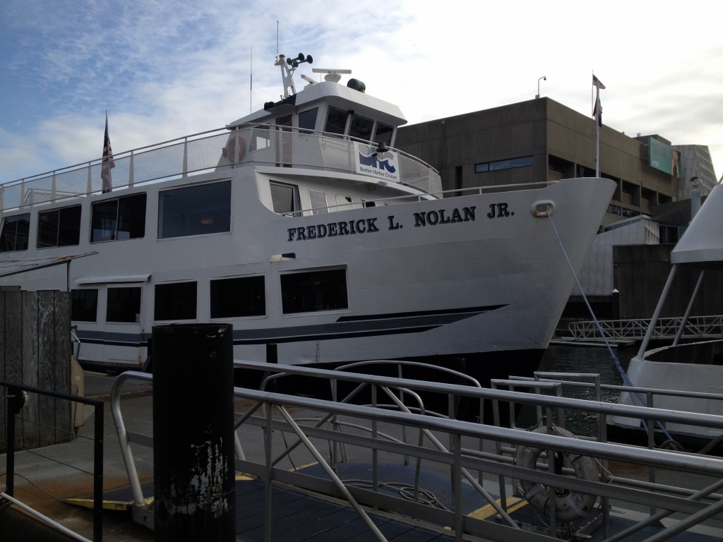
boston harbor

Fort Independence: Another tour and cruise boat departing from Long Wharf.
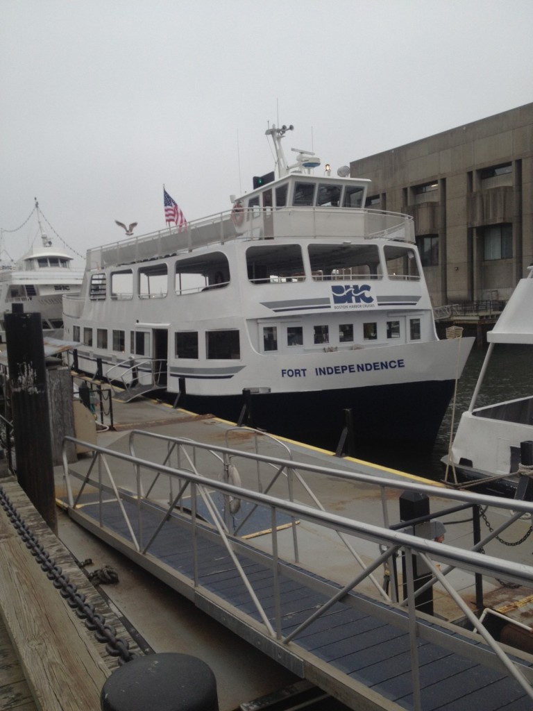
boston harbor

Freedom: A harbor cruise vessel departing from Rowes Wharf.
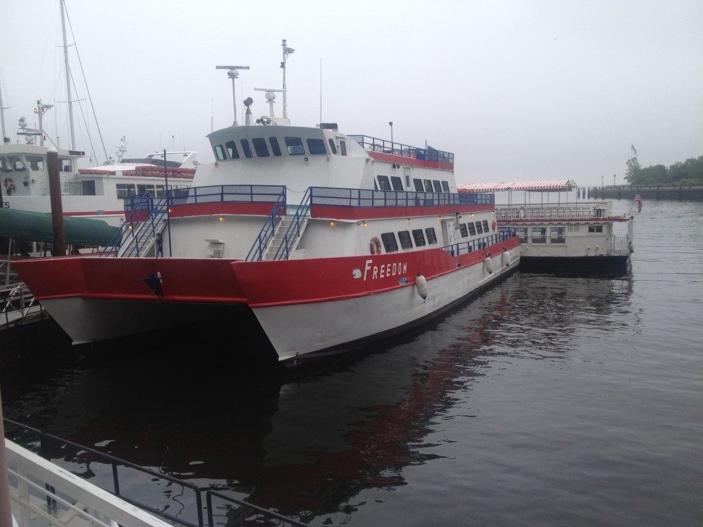
boston harbor

Provincetown II: In addition to occasionally serving as a party boat, this vessel makes the run down to Provincetown from the Seaport in 2.5 hours.
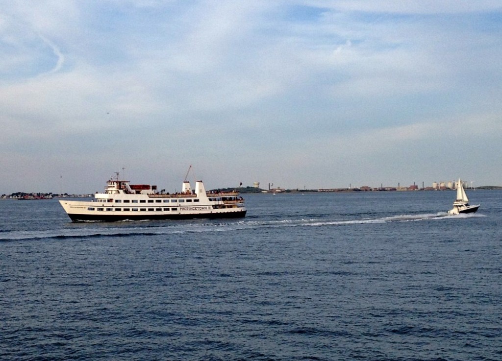
boston harbor

The Provincetown III: A fast ferry making the trip to Provincetown in 1.5 hours from the Seaport. Here it is docked next to the Provincetown II and the Seaport Elite.
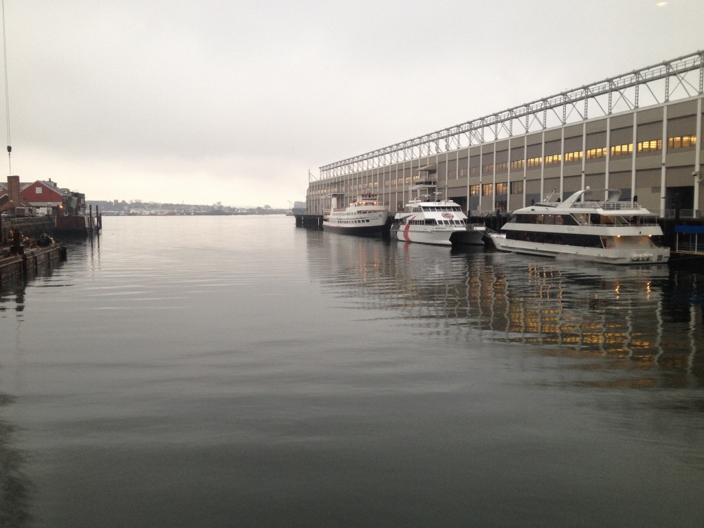
boston harbor

The New Boston: A party boat leaving Rowes Wharf for fun cruises, sometimes with a live band onboard.
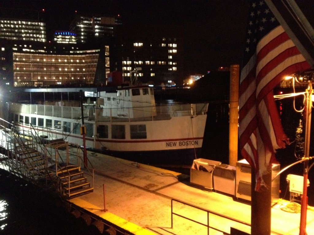
ferry

Majesty: A large cruise boat out of Long Wharf that is available for private parties and Weddings. Here is the link to reserve her.
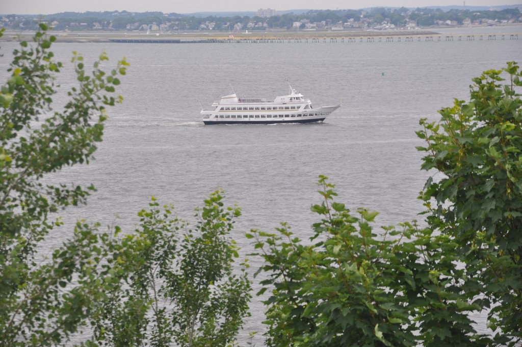
boston harbor cruises

Rita: A small cruise boat out of Long Wharf.
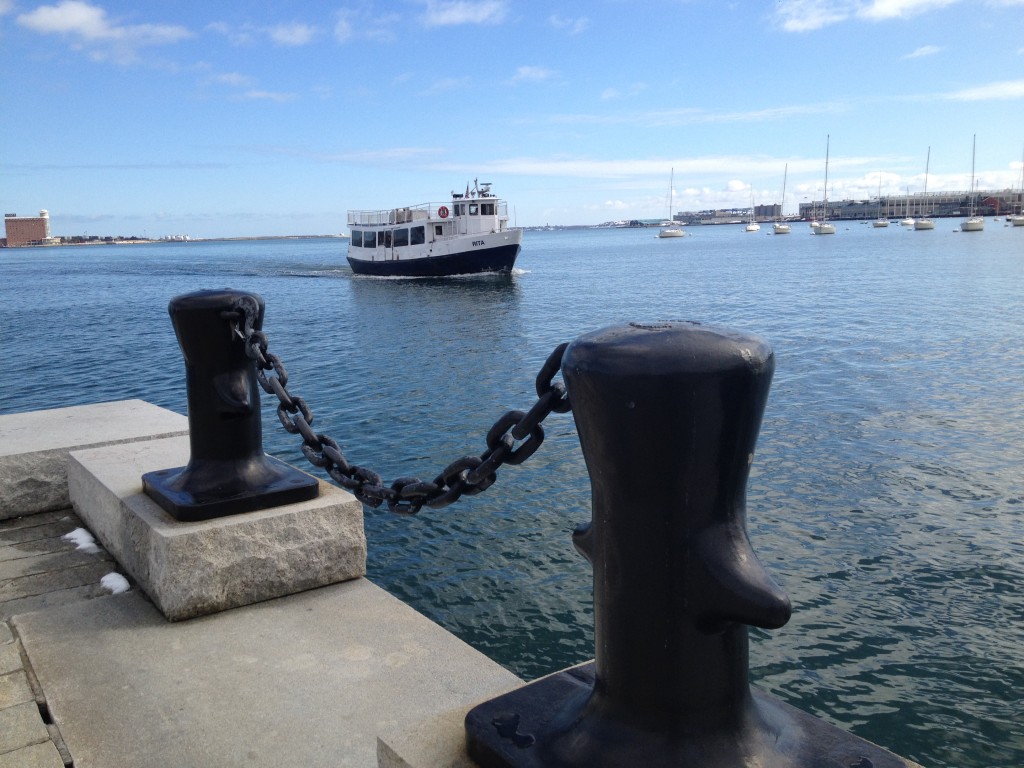
boston harbor

Nathaniel Bowditch: The Salem Ferry, with its new paint job, sitting at Long Wharf with the rest of the massive BHC fleet:
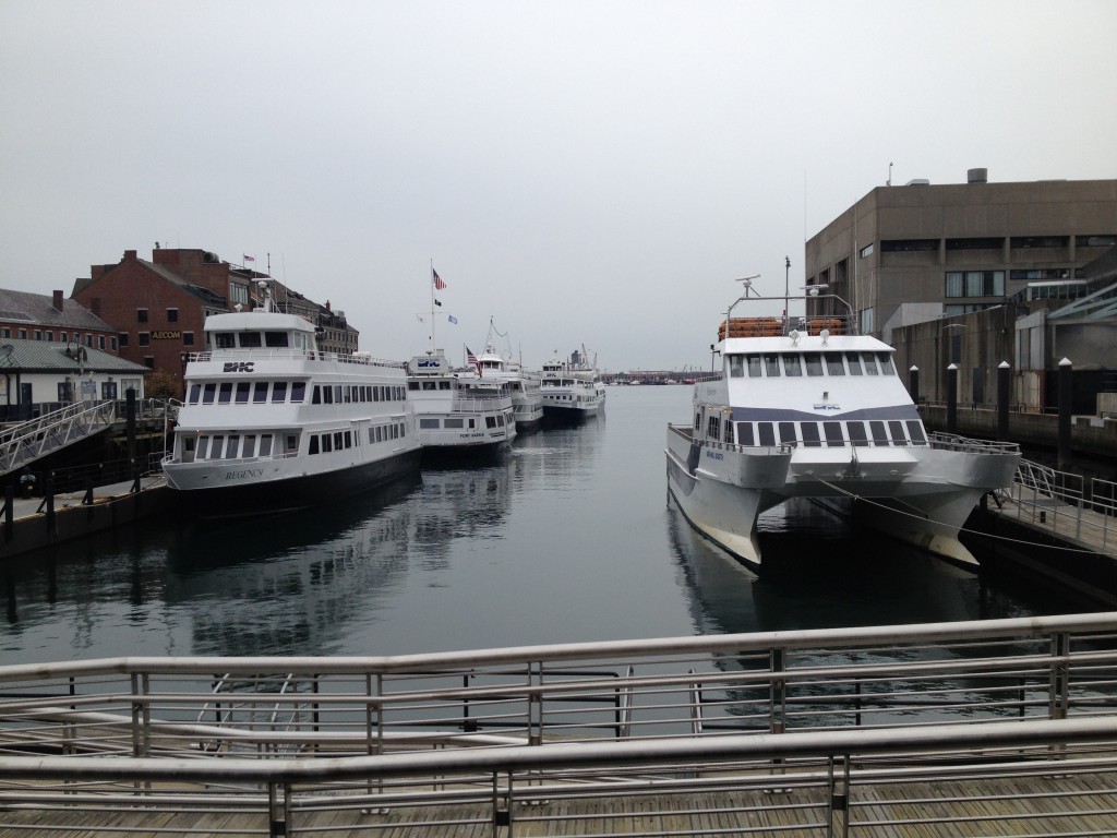
boston habor

Thompson Island Ferry: This boat leaves the Reserve Channel in South Boston to bring people out to Thompson Island.
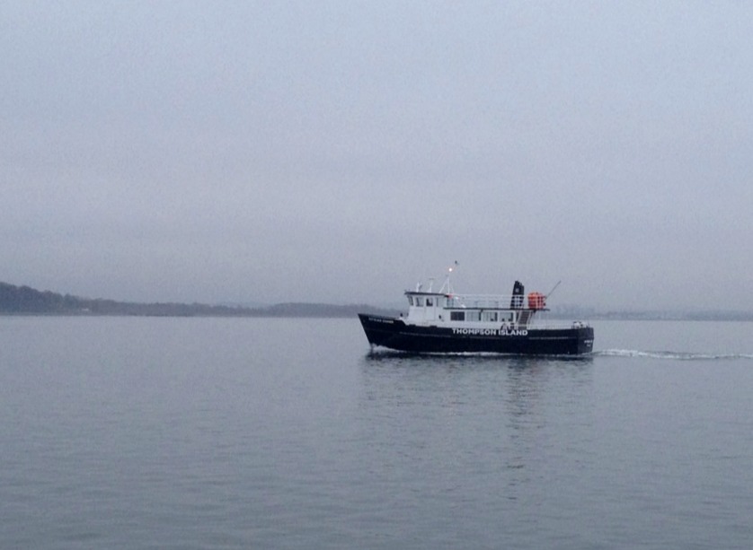
boston harbor

Samuel Clemens: A Riverboat style party cruiser used throughout the summer:

samuel clemens

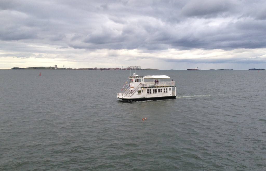
Boston Belle: A smaller riverboat style vessel used for tours and parties:
boston harbor

Historical Ships and Tall Ships:

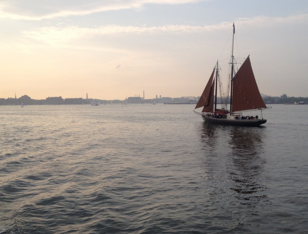
Roseway: A schooner which can be chartered for an evening sail. When not in Boston for the summer, this ship is often spotted cruising the Caribbean.
boston harbor

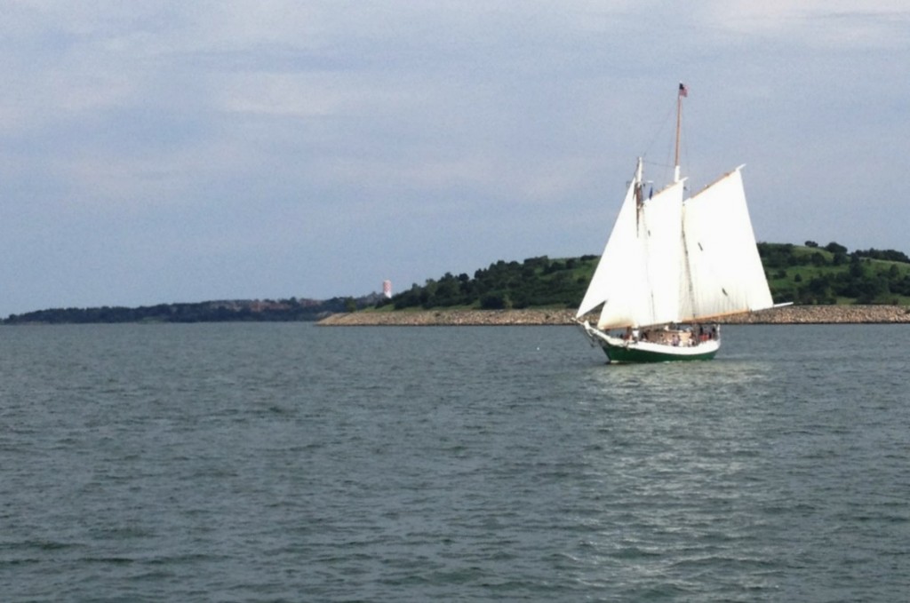
Liberty: Below is the Liberty Star, a smaller version of the Liberty Clipper which frequently sails through Boston. Here is their site.
boston harbor

USS Constitution. Docked in Carlestown Navy Yard, this most famous Boston vessel needs no introduction. She occasionally makes it out for a tour around the harbor, where one can snap a picture as I did here. More information can be seen here.

boston harbor

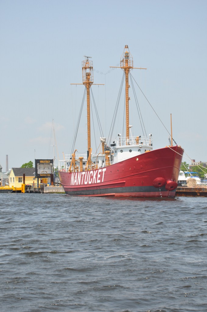
Nantucket Light Ship: Ship LV/112 is docked in East Boston and serves as a museum, commemorating historical nantucket light ships which played an important role in 19th and 20th century navigation before becoming obsolete at the hands of  marine electronics. Light ships were like portable lighthouses, often stationed of dangerous shoals and areas where transatlantic marine traffic was likely to encounter danger.
boston harbor

Police, Fire and Rescue:

Fire engine boat: This boat is probably designed to put out marine fires, but is more frequently seen using its high powered hoses as fountains in celebratory events, such as bringing the USS Constitution out.
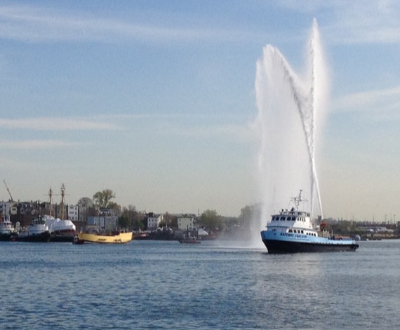
boston harbor

Fire Boat: This is one of Hingham’s new Fire Boats cruising the harbor:
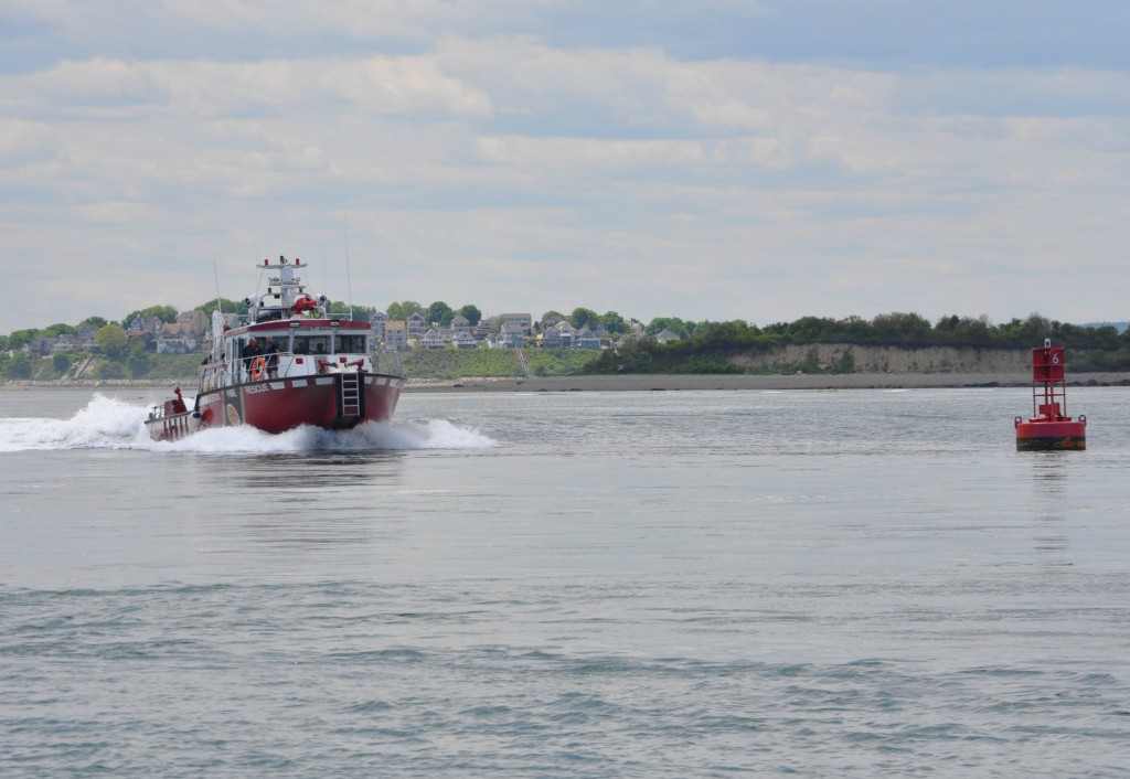
boston harbor

Sea Tow: Based in East Boston, these guys come to the rescue of members who are having trouble out on the water:
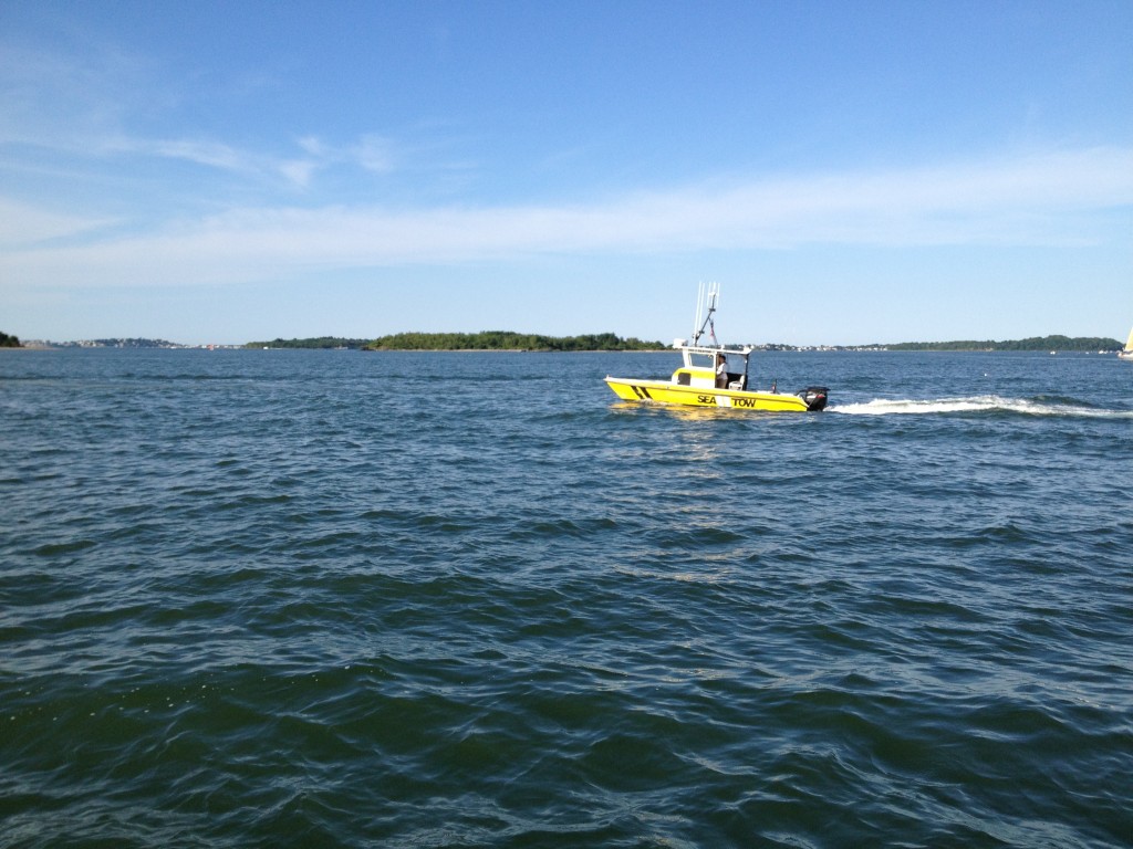
boston harbor

Boston Police Boat: These boats are used for patrolling, assisting large or high profile vessels, and large events like the Tall Ships Exhibit:
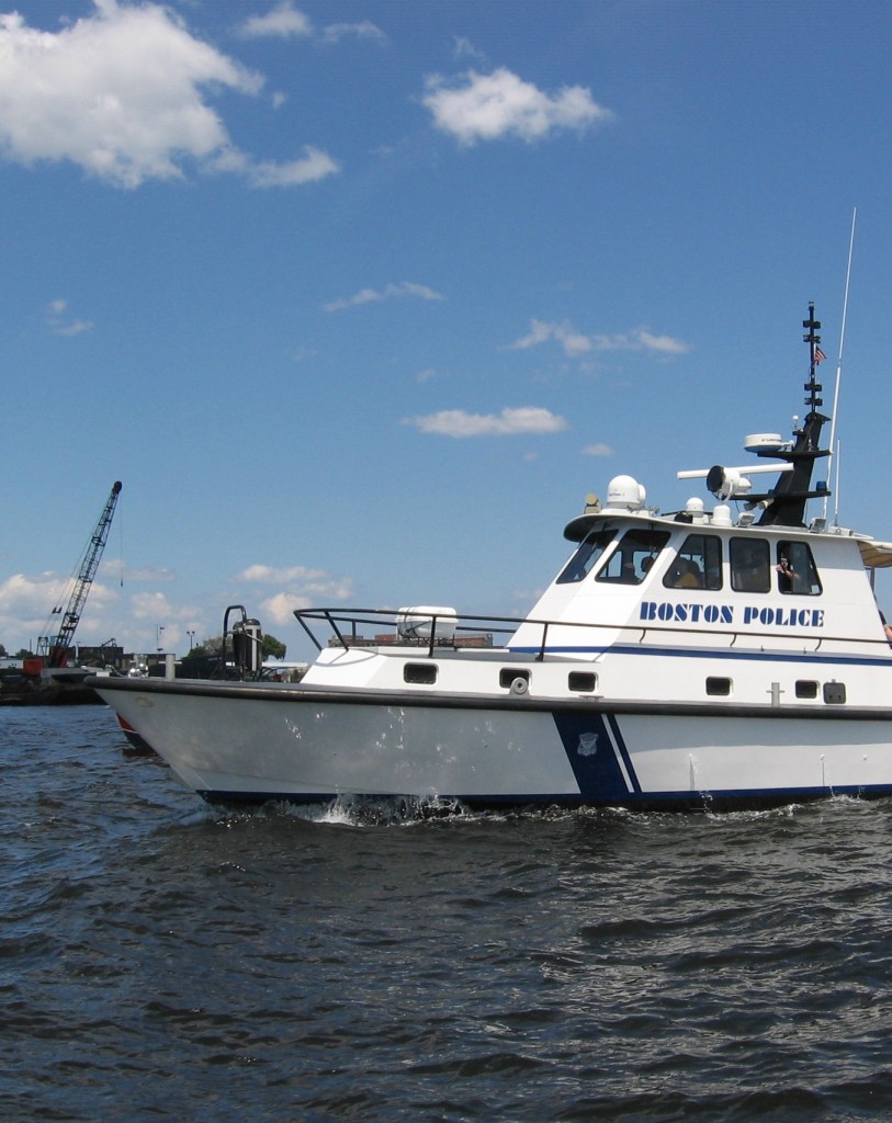
boston harbor

Coast Guard Cutter: There are usually a few of these docked up at the Coast Guard Station in the North End.
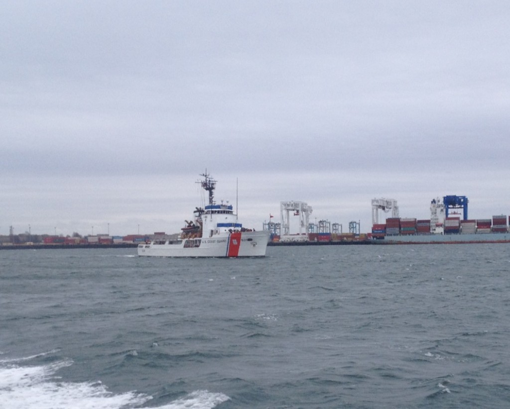
boston harbor

Pilot Boat: These guys guide large vessels like tankers and cruise ships in and out of Boston Harbor.
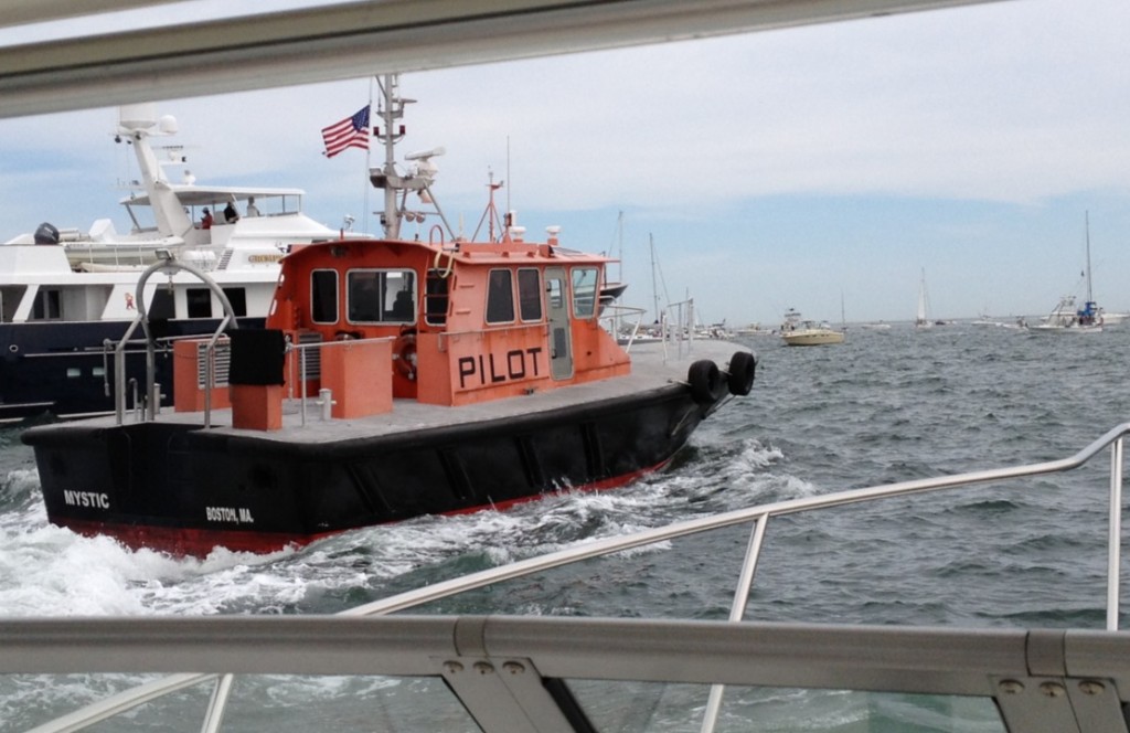
boston harbor

Attack Boat: These are used for law enforcement activities and assisting large vessels. They are operated by multiple agencies including the coast guard (like the one below) in addition to state and local town police departments, as well as the Environmental Police.
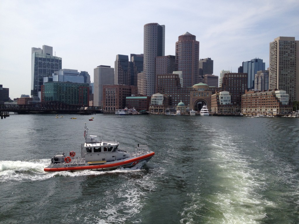
boston harbor

Tug Boat: There are a huge fleet of Tug Boats than push and pull tankers and cruise ships in and out of Boston Harbor. Most of them are docked on the East Boston waterfront. Many of them are operated by Boston Towing & Transportation, outfitted in the red and orange color scheme.
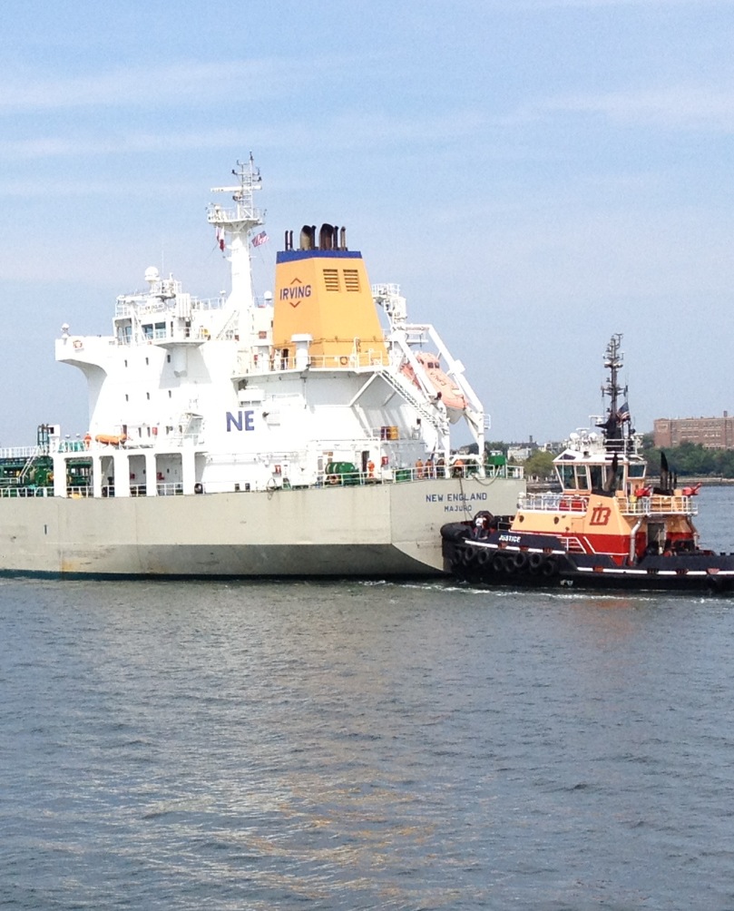
Boston harbor

USS Cassin Young: This destroyer saw some action in WWII, and has been docked in Charlestown Navy Yard normally. She is currently in East Boston after under going some repairs. Here official website can be seen here.
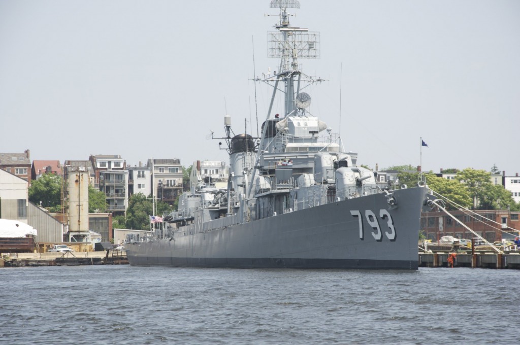
boston harbor navy ship

Large Vessels:

Car Carrier. These huge and strange looking boats bring imported automobiles into the docks in Chelsea and Everett.
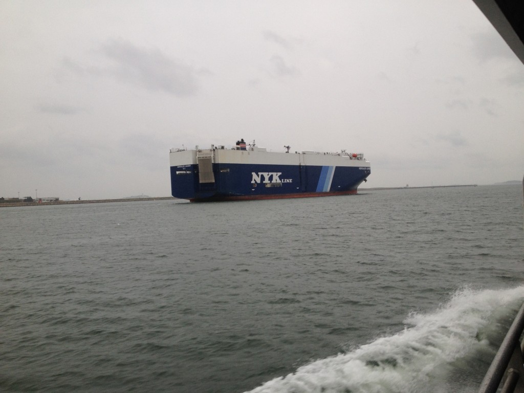
boston harbor

Cruise Ship: A variety of cruise lines operate out of Boston Harbor for trips to the Caribbean, Bermuda, or up to Acadia National Park in Maine.
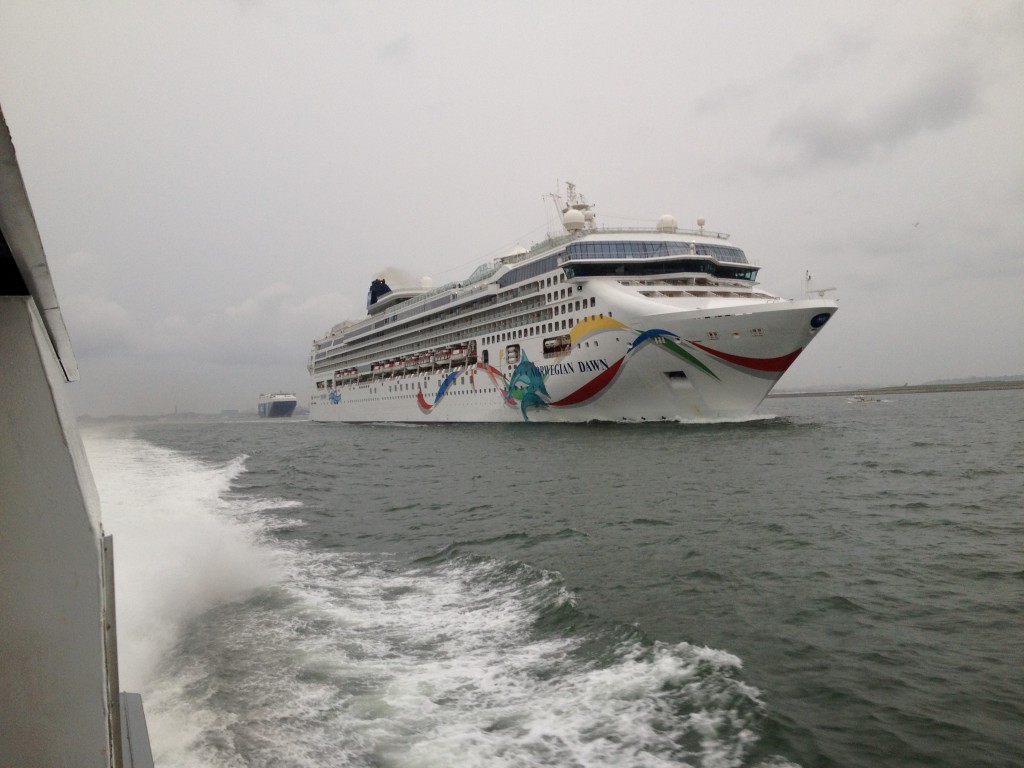
boston harbor

Ocean Liner: Like a cruise ship only built with a bigger hull for transoceanic travel, big ocean liners like the Queen Mary 2 seen below come into Boston occasionally when making their way around the world.
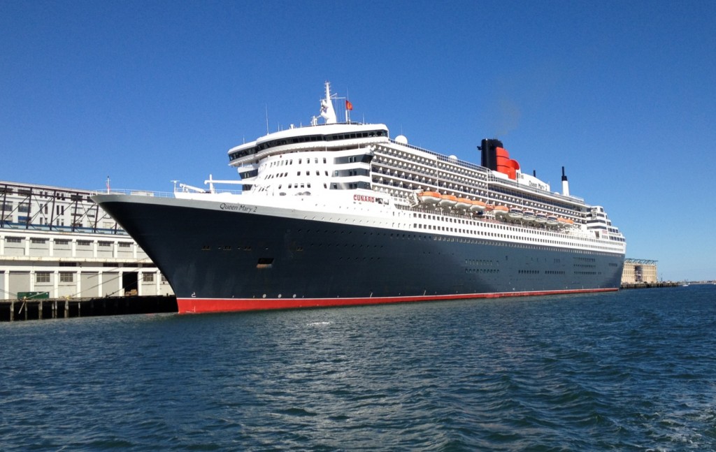
boston harbor

Posted in Boston Harbor Cruises, Boston Harbor Day Boat Trips, Commuter Boat, Tour Boats, Uncategorized, Visiting Boston Harbor | Tagged , , , , , , | 3 Comments

A calm summer day at Minot Light

summer

Yesterday was a calm and bright day off the coast of Boston’s South Shore. The seas around Minot light are very calm in this photo, which is a contrast to how rough they often get during a storm: Its hard to picture that this is the same area where one of Boston’s most infamous shipwrecks, the wreck of the St. John occured.

In the past, I have written a bit about Minot Light and the Scituate/Cohasset areas. Here are some previous posts about Navigating around Minot and Sunrise at Minot Light.

Posted in Boston Harbor Day Boat Trips, Boston Harbor History, Boston Harbor Navigation | Tagged , , | Comments Off on A calm summer day at Minot Light

Fall River and Battleship Cove

Sitting high upon a hill above the Taunton River as it empties into Mount Hope Bay is the old City of Fall River, Massachusetts. Far inland from open ocean, and close to neighboring Rhode Island, this border city bastion of Bristol County holds among its attractions the country’s largest collection of naval ships on display in a museum: Battleship Cove. This nautical and historical treasure is worth a visit, as is the old town surrounding it.

The battleship USS Massachusetts, at Fall River’s Battleship Cove, below:

fall river

The ship sits docked alongside the museum and several other ships, underneath the massive Braga Memorial bridge. The bridge above spans the Taunton River and connects Fall River to neighboring Somerset via route 195.

My visit to the city of Fall River was an off season trip, and was done by car, not by boat. While a great, boating friendly location, Fall River is far from Boston: Getting here on the water from Boston requires making the trip down through the Cape Cod Canal, navigating through Buzzards bay to its end at Sakonnet Point in Little Compton, Rhode Island, and then turning back up North to Mount Hope Bay.

Fall River: Views of the City

Pictured below is the town hall, high on the hill above the down town area. Here one can find architecture of the city’s golden age, the industrial revolution era when this city dominated the global textile manufacturing industry.

church

The Borden Flats Lighthouse, keeping ship traffic passing between the Taunton River and Mount Hope Bay away from the dangerous flats on the Eastern Bank:

Lighthouse

A nautical chart clip of the Fall River area and its waterfront, highlighting the Taunton river, The Borden Flats and Mount Hope Bay. Also highlighted is the location of Battleship Cove and the large Braga Bridge.

Borden flats

Source: NOAA Nautical Chart. See NOAA.gov for disclaimer.

Battleship Cove:

Battleship cove is home to the world’s largest collection of battleships on display. Here is a photo taken from the main deck of the USS Massachusetts. Her 16-inch guns are quite impressive:

fall river

The cove has many naval ships on display, including a destroyer and a cruiser. The display even includes a nuclear submarine. However, most of the other ships in the exhibit are obscurded by the massive battleship USS Massachusetts.

boston harbor

Modern Fall River:

Today, the city of Fall River is adequately modern, but greatly connected to its past. This is evidenced not only by the strong connection to the waterways that were once the lifeblood of the city, but also the industrial landscape: Fall River is scattered with the remains of shuttered factories. Pictured below is the Border City mill, which is located off Route 79 on the North side of the city. This facility was built in the 1870s, and was later abandoned as the domestic industry crumbled under the pressure of low costs imports. Some of the area of these mills has been converted into office space and condos.

factory

Viewed from under the Braga bridge is the Brayton Point power plant. This is a large fossil fuel based plant located across the bay from Fall River in the neighboring town of Somerset, MA:

fall river

There is something special about the architecture in Fall River and its link to the past. It provides a glimpse of how life around these waterways has evolved over the centuries: From the manufacturing might seen in a smokestack, to the transportation infrastructure of a great green highway overpass, to the passing of everyday human life as seen in the old historic church upon the hill. This is Fall River.

church

Posted in Boston Harbor Day Boat Trips, Boston Harbor History, Boston Harbor in the Winter, historical place of the week, Off course, Uncategorized | Tagged , , , , , | Comments Off on Fall River and Battleship Cove

USS Constitution honors Boston Marathon first responders

The USS Constitution was brought out for a turnaround in Boston Harbor yesterday, June 4th, 2013. This was a beautiful sight that made its observers proud: Constitution was out to celebrate the tradition of American heroism. Specifically, to honor the actions of the first responders in the Boston Marathon tragedy a few weeks back. Here are some photos of Boston’s most famous vessel:

Constitution passing by the Schooner Roseway:

boston harbor

A lovely day down at fan pier, the location from which I took the photos of the Constitution. The spring flowers are in bloom:

boston harbor

USS Constitution on June 4th 2013 as she travels through the harbor to honor the Boston Marathon first responders:

boston strong

Posted in Boston Harbor Day Boat Trips, Boston Harbor History, Boston Harbor Navigation, Commuter Boat, good views, historical place of the week, Visiting Boston Harbor | Comments Off on USS Constitution honors Boston Marathon first responders

Picture of the week: Summer Sunrise

A lobster boat heading dropping traps just after sunrise in Hingham Bay late last week. Sunrise comes early these days, and the summer heat has come early this year as well.

hingham bay

Posted in Boston Harbor Picture of the Week, Visiting Boston Harbor, Weather | Tagged , , , | Comments Off on Picture of the week: Summer Sunrise

Great Brewster: The Wild Island

On a clear Boston day, one can stand near the city’s waterfront and see the silhouette of Great Brewster Island’s dunes, far offshore in the outermost reaches of the harbor.

The wild island: Great Brewster Island is a deserted landscape: its rocky beaches give way to fields covered in tall grasses which blow in the ocean breeze. Towering sand dunes, overgrown with brush and wildflowers, offer sweeping views of the distant city skyline to the West and the Atlantic Ocean to the East. These dunes are also home to nesting birds that are so unfamiliar to the rare sight of humans that they often aggressive. The island’s exposed East Side is lined with the broken ruins of a WW-II era seawall which gets lashed by incoming Atlantic swells on rougher days. In this way, Great Brewster is a wild island- overgrown, unkempt seaside wilderness, where it is seems incomprehensible that a major city lies less that ten miles to the West.

From the top of the island’s great dunes, one can get good view of Boston light in the distance, obscured by Great Brewster’s patches of overgrown brush and wildflowers:

great brewster

A deserted landscape and broken seawall, the view upon landing on Great Brewster Island’s barren Eastern shoreline:

boston harbor islands

An unobstructed view of Boston Light from the Dunes, with the South Shore towns of Scituate and Cohasset far in the distance:

boston harbor

About Great Brewster Island: Named for William Brewster, the first preacher of the Plymouth Colony, Great Brewster is the largest of four islands in the chain that bear this name. I have written about these islands before in a previous post. At over nine miles East of the City, this distant island lacks a public dock or any source of public transportation or ferry service. Additionally its remote location and rugged geography make it a challenge to visit. However, if you have access to a boat and a day with calm condition, a trip to this beautiful wild island is worth making.

The views: From the top of the island’s great dunes, one can get good view of Boston light in the distance, obscured by Great Brewster’s patches of overgrown brush and wildflowers. Great Brewster Island contains two drumlins: The large northern Drumlin has eroded away into a large steep dune, which can be seen from miles away, even the South Boston Waterfront or from skyscrapers in downtown Boston. At over one hundred feet, this is the highest naturally occurring place on the harbor (Spectacle Island‘s main drumlin is slightly higher but this Island was not totally naturally created). In this view, both Calf Island and Middle Brewster are visible:

brewster island

Looking down from the dune after anchoring offshore, on the East Side:

great brewster

A view of the ruins of an old summer cottage and its chimney on nearby Calf Island:

great brewster view

 Gazing across Great Brewster’s wild grassy landscape, one can see the city skyline far in the distance, giving some perspective on the island’s remote location. This photo was taken in the center of the island, the area between its two large drumlins.

great brewster

Access: The pathway from the center of the Island between the drumlins (where the sign pictured below is located) is unkempt and not frequently mowed by the park service. This adds to the wild, rugged feel of the place, but explorers should take caution and wear long pants due to the presence of poison ivy, sumac and the risk of tick bourne diseases. Finally, the hike to the top of the dunes is somewhat strenuous, so you better be in shape. (See more below at the end of the article about getting to the island by boat).

tall grass

Heading out toward Great Brewster from the West, its large dunes of the North side of the island come into view, as does nearby Boston Light:

great brewster island

The Dunes: While many of the harbor islands have dunes, some of them large like Peddocks, Great Brewster has the largest and most pronounced dunes of any of the harbor islands.  A view of the dunes on approach to the island:

Walking along the beach near the dunes:

boston harbor

Looking up at the towering dunes from down at the beach:

great brewster island

Here is the view from the top. There is a precariously perched bench up here (seen in picture) which should not be accessed due to erosion. Upon reaching this part of the island, located at a fenced in area at the top of the trail, hikers should use extreme caution due to the unmarked and steep drop offs.  It is a long way down from the top of these dunes!

great brewster island

The view of nearby Little Brewster Island, upon which Boston Light is located. These islands come close to being connected by an exposed spit at a very low tide:

great brewster island

Ruins of WWII infrastructure: Like most of the other island, Great Brewster was used by the military during WWII and contains ruins of the military facilities to this day. A large seawall was constructed to protect the island given its unprotected isolated location of the Eastern edge of the the harbor. The Atlantic Ocean often lashes this seawall, but on some calm days like this one, small swells lap gently against the wall. The seawall remains largely in tact on the North side of the island, but on the East side, it has crumbled. A portion of the Northeastern seawall is visible below:

great brewster island

With its Eastern location, the island was useful during WWII. However, its rugged terrain prevented too large of a facility from being built. The island contained at least one battery, and a mine casemate which was used to control several of Boston’s offshore mine networks. These were used to protect the harbor from Nazi submarine attack, which judging by the amount of fortifications built, the US was quite concerned about. The foundation of a WWII era building below, with the city visible in the far distance:

great brewster

Nesting Birds. Like many of the more remote outer harbor islands, Great Brewster has a large seagull population. These birds nest on the island and are not used to seeing humans. As such, people should stay on the trails and avoid the birds nesting area. While on the trails, the birds do tend to leave visitors alone. However, the birds will let you clearly know when you have gotten to close to a nest. The park service recommends that people avoid visiting this island, along with the other outer islands (Calf, Middle and Outer Brewster) during bird nesting season. These birds were not happy to see me:

brewster island

Visiting Great Brewster Island: The island is wild and beautiful, but not particularly friendly to visitors due to the distance from the city and the terrain (not to mention the birds)! There is no dock, and anchoring off the West side it tricky as one needs to navigate around the large spit which is one of the most dangerous spots on the harbor. Moreover, a typical fair weather southwesterly wind create rough conditions here due to the long wind fetch on the Island’s West side. The East side is rocky and hazardous and will not be accessible if there is any ocean swell. However, on a clear day, it is possible. For more detail, see the NOAA nautical chart below.

nautical chart

Source: NOAA nautical chart. See disclaimer at NOAA.gov

I spent a nice May weekend day at Great Brewster Island this year, and the last time I came on island here was five years ago. I think once every five years is enough!

Posted in Boston Harbor Day Boat Trips, Boston Harbor History, good views, Uncategorized, Visiting Boston Harbor | Tagged , , , , , , | Comments Off on Great Brewster: The Wild Island

Tall Ships Peacemaker and Roseway back for the summer

Over the past week, some of our finest tall ships have been back in town. Here are a few pictures of the Peacemaker, a barquentine which was docked at fan pier most of last week, as well as the Roseway, a schooner which has made its way back from its trip to the Caribbean this winter and is now available for cruise outings in Boston Harbor, as can be viewed on the schooner’s official website here.

The barquentine Peacemaker at Fan Pier last week:

boston harbor

The schooner Roseway on a cruise in Boston Harbor this evening:

Boston Harbor

Posted in Boston Harbor Cruises, Boston Harbor History, Boston Harbor Navigation, Visiting Boston Harbor | Tagged , , , , , | Comments Off on Tall Ships Peacemaker and Roseway back for the summer

Bumpkin Island: Exploring the trails, ruins and views

city of boston

Bumpkin Island: This subliminally beautiful and frankly under-rated island is worth a visit.  The island may be dismissed given its close proximity to the shores of Hull, as well as its strange name (which may be only an adaptation of its original name, Bompkin Island). However, visitors will undoubtedly enjoy this island given its relaxing, rural feel and sweeping views of the Boston Harbor, Hingham Bay and the city skyline. Despite its relatively adandoned appearance, this island is nicely maintained by our park service, whom I would like to thank for the opportunity to visit this place.

boston harbor

Like many of the other islands, Bumpkin is over-run with tough vines and scraggly, scrubby vegitation that has stood up to the high winds, salty air and other rough conditions of its exposed location. Yet through this vegitation is sweeping views of the City of Boston to the West. Below is pictured one of Bumpkin Island’s grassy seaside trails. Who needs to travel all the way to Cape Cod when we have places like this right in Boston Harbor?

boston harbor island trail

Perhaps most moving is the story of this island in a different time: In 1899, a wealthy businessman named Albert Cameron Burrage leased the island to build a hospital for the purposes of caring for sick children. By the time the island was turned over to the military in 1917, hundreds of children had been treated on the island’s facilities each summer. The ruins of these structures can be seen today. This place feels welcoming and authentic as it is was used for a good purpose, and visitors feel part of that purpose.

bumpkin

Pictured above is one of the old roads built in the WWI era and essentially abandoned since. A view of Sheep Island can be seen in the distance. The abandoned and overgrown appearance of this place gives visitors a feeling that is more peaceful than creepy. Below is a photo of the remains of an old farm house, which was used in agricultural operations on the island through the late 1800s:

boston harbor

Below is picture the remains of an old military facility which was constructed on Bumpkin Island in 1917, toward the end of WWI. The facility was used as part of Boston Harbor’s defenses, and remained active through the end of WWII.

WWII

The City Skyline visible across Bumpkin Island’s brush and old ruins:

afternoon

The sand spit: At a very low tide, Bumpkin Island is connected to the mainland via a sand spit which becomes exposed and nearly connects the island with Sunset Point in Hull. This is something boaters should be aware of if approaching from this direction. Unfortunately, the island cannot be accessed from this is point: In addition to being dangerous and not something that should be attempted, the road is surrounded by private property, without any public access to the beach.

bumpkin island

The location of Bumpkin Island: This NOAA nautical chart shows Bumpkin Island (top center) relative to the Hull (right), World’s End (lower right) and the entire Boston Harbor area (inset at top left corner). The island has a large dock, and also has an accessible shore. Kayaking here from Hingham Harbor or Hull is possible on a calm day.

NOAA nautical chart

Source: NOAA nautical chart. Not for official navigation. See disclaimer at NOAA.gov.


Related Posts Plugin for WordPress, Blogger...
Posted in Boston Harbor Day Boat Trips, Boston Harbor History, Boston Harbor Navigation, good views, Uncategorized | Tagged , , , | Comments Off on Bumpkin Island: Exploring the trails, ruins and views