Picture(s) of the Week: Harbor Islands in the spring

The Boston Harbor Islands have turned a bright shade of green as the spring has arrived. Here are some springtime photos of Peddocks Island and Long Island over the past week.

The woods around Peddocks have turned a bright green color over the past week. Here is a photo taken of the Northwest side of Peddocks Island from the water:

spring green

Long Island Light covered in green vegetation:

boston harbor

The sand dunes of Peddocks Island:

dunes

The old abandoned church and military buildings on the East side of Peddocks:

old buildings

Sunset on the Northwest head of Peddocks Island, as seen from Pemberton Point in Hull:

Posted in Boston Harbor Picture of the Week | Tagged , , , , | Comments Off on Picture(s) of the Week: Harbor Islands in the spring

Socked in! Scenes from a day of heavy fog in Boston Harbor

Heavy fog encroaches on the pier at Pemberton Point in Hull:

fog

The term “socked in” refers to being completely surrounded by thick fog to the extent that heading out to sea is impractical. This term was allegedly coined around these parts during WWII: Promptly upon awakening every morning, sailors and naval officers alike would look to their nearest wind sock to evaluate wind speed and direction. In the uncommon event that they could not see the sock at all due to fog, they would-until the advent of modern commercial radar-stay ashore and therefore be “socked in.”

Such was the case this Tuesday in Boston harbor.Thumbs up to the MBTA ferry operators who braved the fog and got us all to work on time!

A view from the stern:

fog

Arriving at the Commercial Wharf pier on Tuesday Morning:

commercial wharf

Shutter Island? Rounding the Northern point of Long Island:

fog

The dunes at Peddocks Island, enshrouded in heavy fog:

fog


Posted in Boston Harbor Navigation, Uncategorized, Visiting Boston Harbor, Weather | Tagged , , , , | Comments Off on Socked in! Scenes from a day of heavy fog in Boston Harbor

NOAA ship Relentless in Boston this week

Gordon Gunter

This week, the Relentless (a.k.a Gordon Gunter) was in Boston Harbor, tied up at the US Coast Guard Station near Battery Wharf. Every so often, when I see a new ship visiting Boston Harbor, I like to check it out and learn a little bit more. It turns out that the Relentless is a ship used by the government for marine surveillance, particularly as it relates to studying marine life. The ship was named for a marine scientist. Here is a link from the NOAA with some additional information about this vessel.

Posted in Boston Harbor Navigation, Visiting Boston Harbor | Tagged , , , | Comments Off on NOAA ship Relentless in Boston this week

Warning markers and beacons in Boston Harbor

boston harbor

Various warning markers, like the one above off sunken ledge in Quincy Bay, are all over Boston Harbor. The marker above is a red light beacon sitting on top of Sunken ledge. Other places one might find a similar beacon in Boston Harbor include the quarantine rocks,  and the rocks at the western end of the Brewster island spit.

Below is a non-lateral navigational aid, known as a diamond day board. These markers are placed to make mariners aware of their location and position. They are typically placed on a landmark or at the entrance to a channel.

Boston harbor

Below is a red day beacon, denoting a large and obvious rock outcrop. A day beacon does not have a light on top, like the larger beacon in the top picture.

boston harbor

Nix’s Mate, possibly the most ominous and dangerous place in the Boston Harbor, is marked with a very unique warning marker- a red and black cone. The picture of low tide below is a reminder of how hazardous this place is to navigate:

boston harbor

Posted in Boston Harbor Day Boat Trips, Boston Harbor Navigation, Uncategorized, Visiting Boston Harbor | Tagged , , , | 1 Comment

Picture of the week: The Crow

hingham harbor

It was a cold, blustery and gray day on a harbor island shore.

The crow flew from the woods, and landed at the beach next to an old piece of dead driftwood that had washed up nearby.

Posted in Boston Harbor Birds, Boston Harbor in the Winter, Boston Harbor Navigation | Tagged , , | Comments Off on Picture of the week: The Crow

Watch where you step! It is horseshoe crab season!

The horseshoe crabs are out in vast numbers across the beaches of Massachusetts this week!! They are looking to breed with each other and bite and sting people so watch where you step!!! (Just kidding about the latter). Here is a great big one I saw on the shores of Hewitts Cove over the weekend:

boston harbor

Originally evolved from stingrays (one can see the resemblance) this creepy creatures crawl along the bottom of the ocean, most often in shallow water. They tend to be not quite as aggressive as some of the other types of crabs were have in this area, such as this monster crab that brutally attacked me last summer.

Posted in Boston Harbor Day Boat Trips, Fishing, Visiting Boston Harbor | Tagged , , | Comments Off on Watch where you step! It is horseshoe crab season!

Salem’s historic waterfront and Fort Pickering

Once the largest port in the Northeast, the city of Salem is today clearly less of a commercial and maritime center than the nearby city of Boston, twenty miles to the south. However, this was not always the case, as Salem was at one time in the late 18th century the largest port in Massachusetts and the sixth largest port in the world. The city of Salem and the large, broad sound lying off its shores is full of dangerous rocks, but also contains several lighthouses, ruins of old resorts, abandoned military structures, and the houses of Salem’s two famous Nathaniels: Hawthorne and Bowditch, that is!

Salem’s lighthouses: The lighthouse at Fort Pickering, with Baker’s Island light visible in the background to the left if one looks carefully:

Salem

This large and naturally protected port that is is a destination worth visiting by boat or by land. (Recall our summer time visit to Salem Sound and Misery Island from Boston last summer). Salem’s history is well preserved due in large part to the significance of Hawthorne and the Salem witch trials. However, the nautical history of Salem- that of Nathaniel Bowditch and Fort Pickering is lesser known but equally intriguing.

Downtown salem, once the 6th largest city in the world, is well preserved. The central square is surrounded with old historic, federal style buildings. A walk down Salem’s Essex Street will yield a view of many houses like the one below:

salem

Salem’s shipping and trading industries where supported by its large wharfs. One such wharf that remains today is Derby Wharf, which was owned by the Derby family and was a major departing point for American ships heading to trade in the Far East. At the end of Derby Wharf sits an old, three-masted sailing vessel, the “Friendship.” It is reminiscent of a time when Salem’s harbor was the busiest in the country:

salem

The Friendship is a replica of an early 19th century Salem vessel of the same name which became famous during an early test of American Diplomacy. In 1831, after leaving Salem, the Friendship was in the city of Quallah Battoo in Sumatra, Indonesia on the spice trade when it was ambushed by natives who killed members of the crew and looted the ship. Later, President Andrew Jackson reportedly dispatched the ship Potomac to negotiate and bring those responsible to justice. The fate of the ship is unknown, although its captain, Charles Endicott escaped the original attack.

Derby Wharf Lighthouse, which sits at the end of the pier:

salem

Salem First Church, made infamous by the Salem Witch Trials which occuered here in the eighteenth century. The nearby Nathaniel Bowditch House, named for the founder of modern navigation, has been converted into a tourist center.

salem

The Nathaniel Bowditch House- He was the “Father of Modern Navigation”and helped further Salem’s position as a leading maritime center of the East Coast:

salem

Fort Pickering, the structure originally built to guard the shores of the city of Salem. At the time it was built, Salem was one of the largest cities in the country:

Salem

Fort Pickering was an integral yet lesser known part of Salem’s nautical history. These defenses were built on a small peninsula of land called Winter Island around the mouth of Salem Harbor. The remains of the Fort and the nearby lighthouse can be visited today. While this is just another one of the many fortifications lining the coast of Massachusetts, this one is less well known due to is small size and lack of prominece.

Below is a clip from old map showing the layout of the fort and winter island in relation to the city. One can imagine that at the time this chart was made, the cities of Salem and Boston handled similar shipping traffic volumes:

fort pickering

Here is a photo of the battery of Fort Pickering, that was used up until WWII. At that time, it had been used as storage for anti-submarine weapons:

salem

An underground bunker in the central part of the fort:

salem

The view of salem sound and Baker’s Island from the top of Fort Pickering:

lighthouse

The darker side of Salem’s history- that of witches and ghost stories, comes to mind when viewing the historical House of Seven Gables, located on the waterfront close to Derby Wharf. It was this old house than was the inspiration for Hawthorne’s namesake novel:

Salem

Posted in Boston Harbor Day Boat Trips, Boston Harbor History, Boston Harbor Navigation, Uncategorized | Tagged , , , , | Comments Off on Salem’s historic waterfront and Fort Pickering

Picture of the week: Fisherman

A lone fisherman stands at the harbor’s edge on a cool spring evening at dusk:

boston harbor

I was able to strike up a conversation with this adventurous angler on the edge of Hull Gut one recent evening. Evidently, the stripers and blues are not in Boston Harbor yet, but we did see several seals, not surprising given that the seals have exploded in population recently. In years past it was not common to see so many seals in this close. Hopefully the Great White Sharks do not follow!

Posted in Boston Harbor Picture of the Week | Tagged , , , | Comments Off on Picture of the week: Fisherman

Along the Neponset River

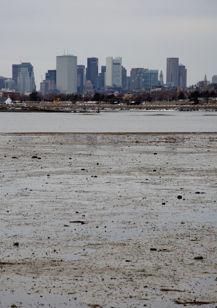
The Neponset area located south of Boston offers some lovely views from boat or land, as one can see in this city view from the estuary where the river meets Dorchester Bay:
boston harbor

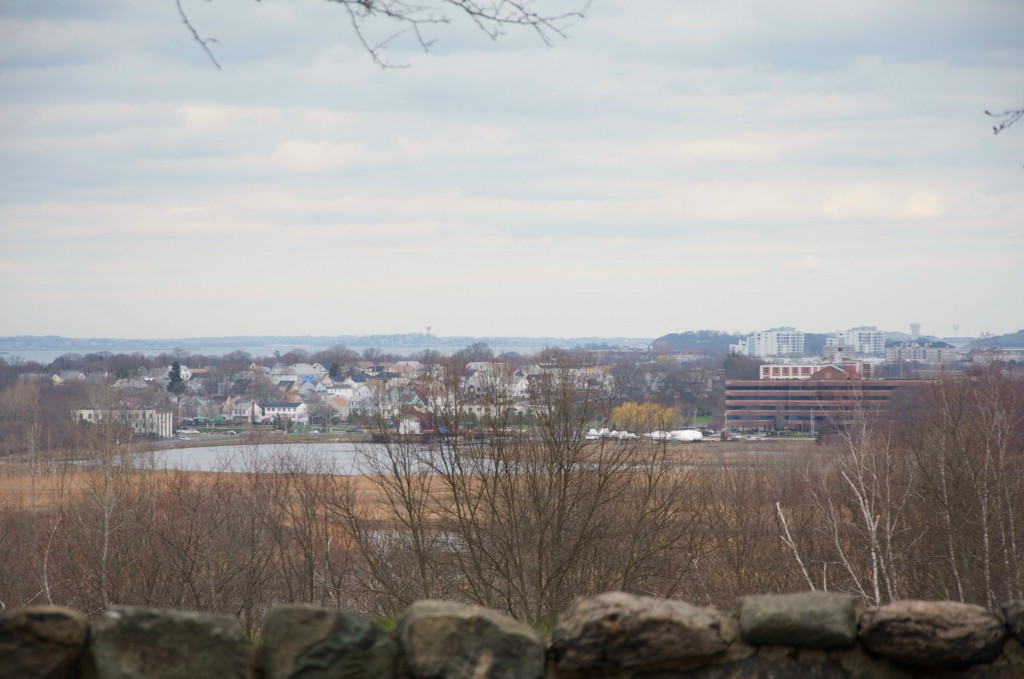
When thinking of rivers near Boston, The Charles comes first to mind for most. A little less known in the Neponset, which many communities South of the City of Boston are built around, particularly Dorchester’s Lower Mills and Milton. While in close proximity to urban area-and even crossed by highway and rail- this area is a marshland, full of aquatic life and waterfowl. A view of the Marshlands around the Neponset River from high on a hill in North Milton, below:
milton

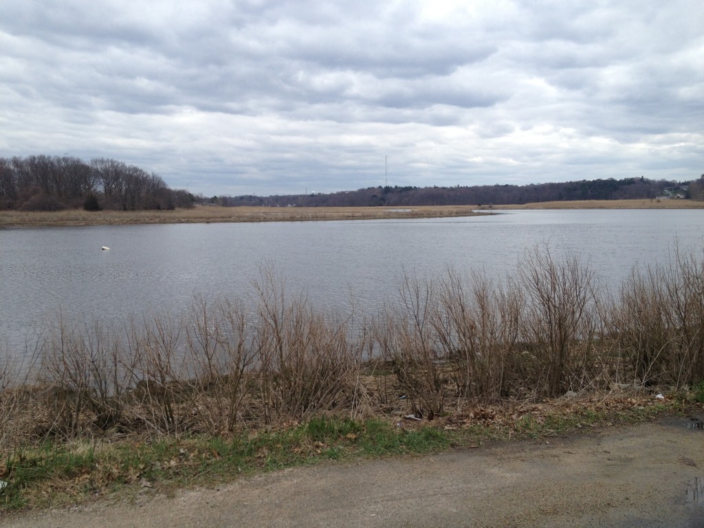
Aside from the Charles there are at least six other major rivers flowing into Boston Harbor. These include the Mystic, the Malden, the Chelsea, the Weymouth Fore and Back Rivers, and the Weir River in Hingham. Bring that number up to at least eight if you want to include Quincy’s Furnace Brook and Winthrop’s Belle Isle Marsh creek as rivers. The Neponset is likely the second largest river into the Harbor in terms of discharge volume, and is one of the cleanest. It’s watershed is unique versus the other major rivers as it is surrounded by marshland, creating a viable habitat for all types of wildlife. Efforts to improve the Herring population, once a staple of the river but now endangered are ongoing. Looking South along the Neponset’s Marsh area from Granite Ave:
quincy

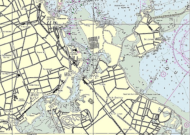
Below is a chart clip of the Neponset as it hits Dorchester Bay on the Southwest side of Boston Harbor. Navigable by boat to at least the Bridge at Granite Ave, boaters should use caution and preferably go at high tide. A trip up the Neponset is ideal for one of those windy summer afternoons where the wind chop in Boston Harbor builds to an uncomfortable height.
boston harbor

*NOAA Nautical Chart. Not for official navigiation. Disclaimer at www.noaa.gov.

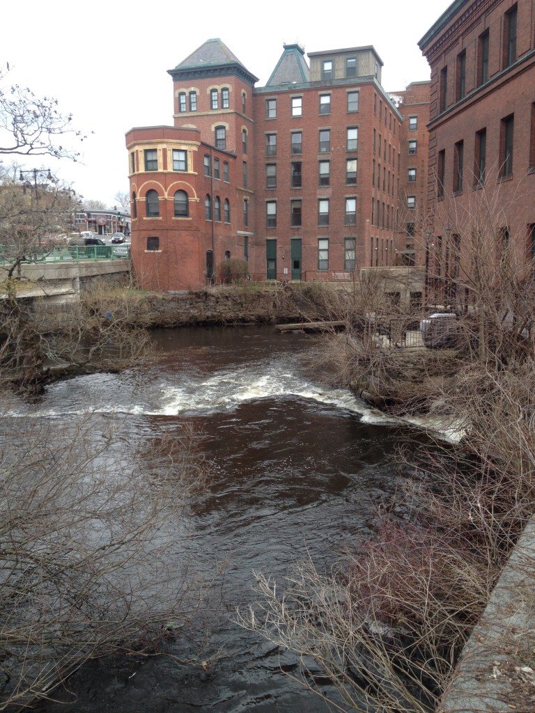
Upon traveling upriver, one can reach Dorchester Lower Mills, the end point of the portion of the river navigable by boat. This is a well preserved part of Boston history that is less well known to outsiders and tourists:
lower mills

The dams at Dorchester Lower Mills, in which the river was used for factory production during America’s 1800s industrial revolution. Many of these structures, most notably a Chocolate factory, are still occupied today. Several have been converted into high end condominiums and have been maintained beautifully.
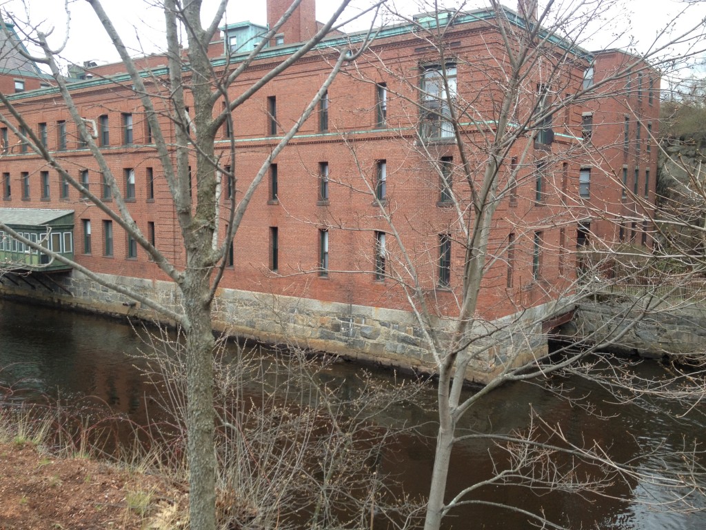
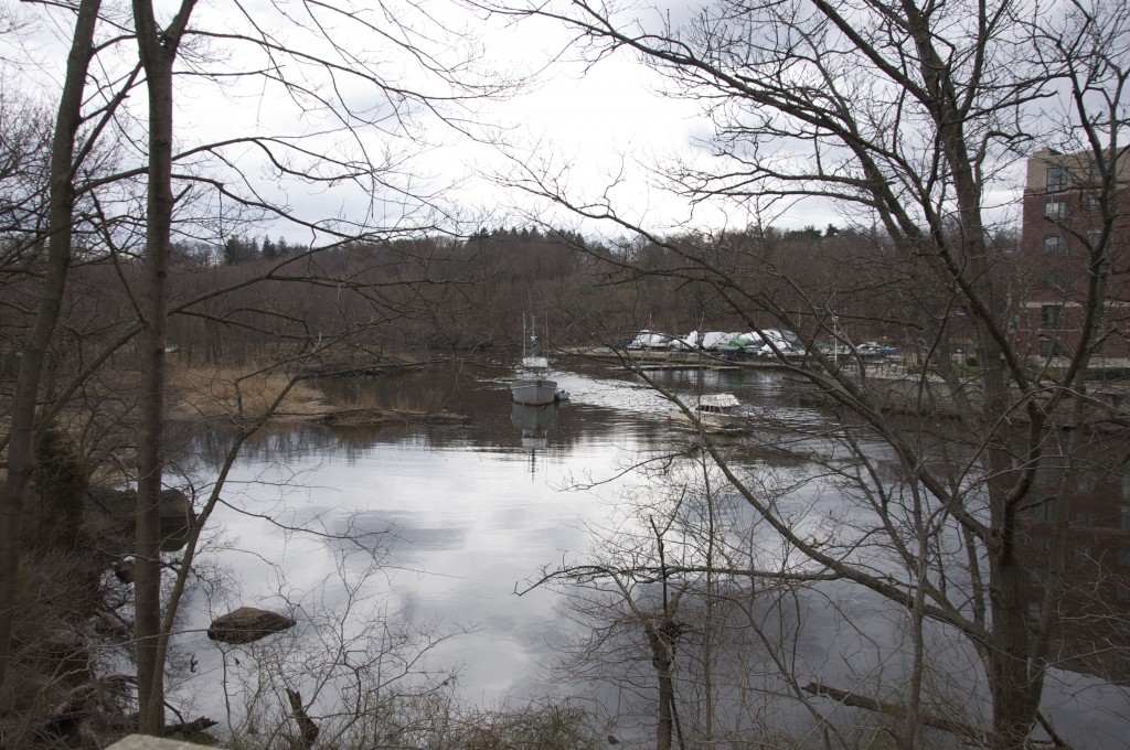
lower millsThe yacht club at Neponset Marina, which is just about as far as boaters can navigate up the river from Boston Harbor:
lower mills

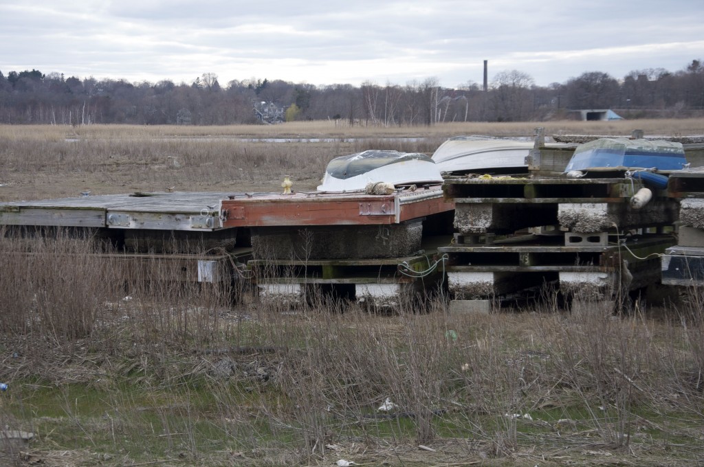
Further down river at the marina near Granite Ave, as boats and docks are stacked for the winter before they go in the water for the season. From this vantage point, one can see the wide marshes adjacent to the river. Just beyond the marina upriver is the intersection with Gulliver’s Creek, where the old stone remains of the Granite Railway loading dock can be seen. Below, the smokestack from Dorchester Lower Mills is visible in the distance:
neponset river

Looking over the Neponset River at dusk, as seen from the Granite Ave intersection:
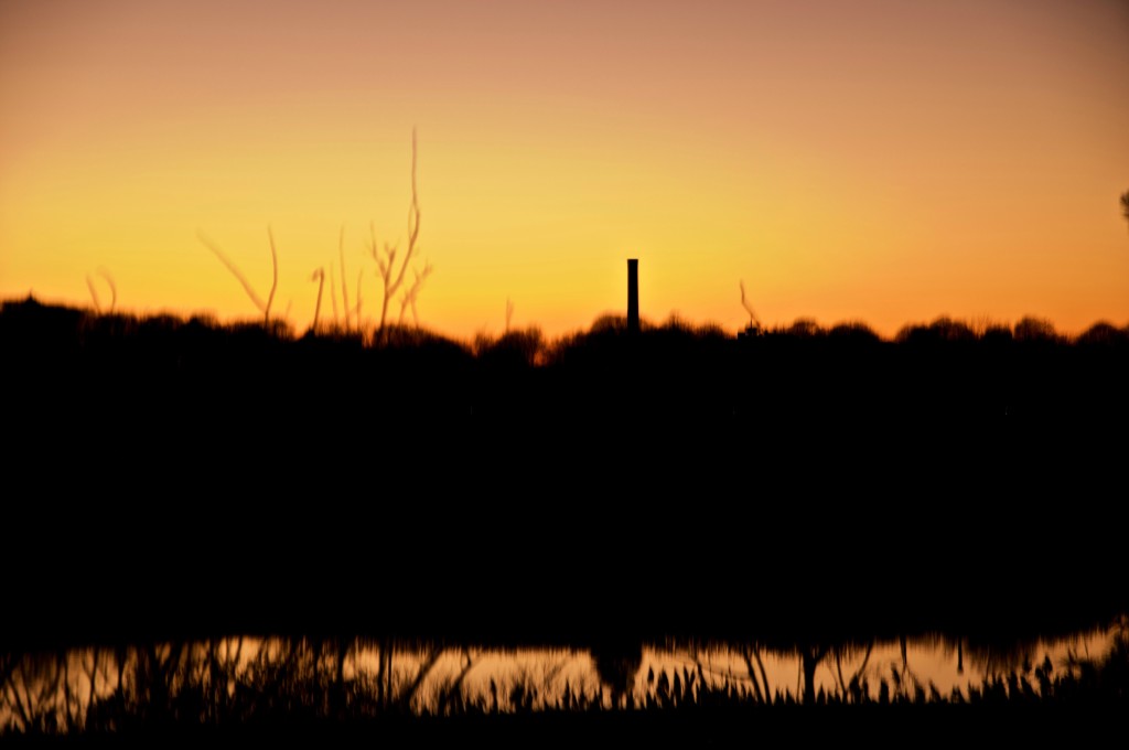
neponset

Near the point where the river winds from Milton into Quincy on its East Bank is the Neponset River Bridge and a nearby rail bridge supporting both the MBTA red line and commuter rail. To the South of these structures is Pope John Paul II park, while to the North is Port Norfolk Tenean Beach and the Squantum section of Quincy. Below is a view looking north from on top of the bridge. One can see the remains of some old structures on the west side of the river, which was the Lawley Shipyard and before that, the Putnam Nail Factory.
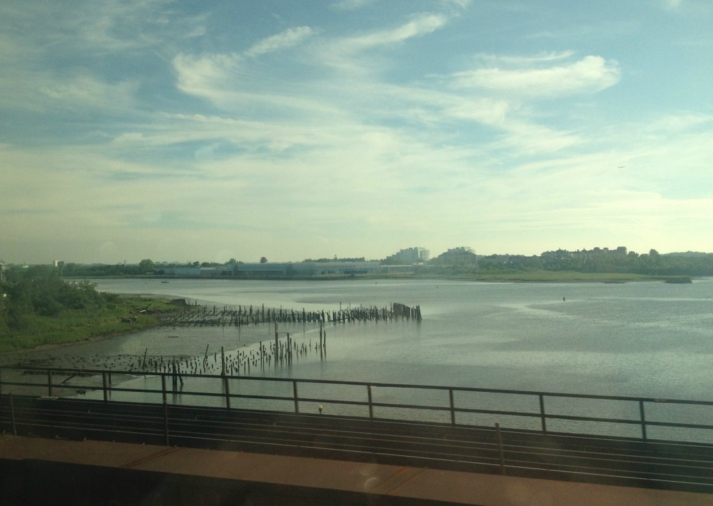
boston harbor

Further downstream, the Neponset opens up into Dorchester Bay, the Southwest corner of Boston Harbor. The landmark Boston Gas tanks jut out into the harbor at the mouth of the river. The last stretch of the river has some deceptively shallow waters than can be dangerous to navigate near low tide.
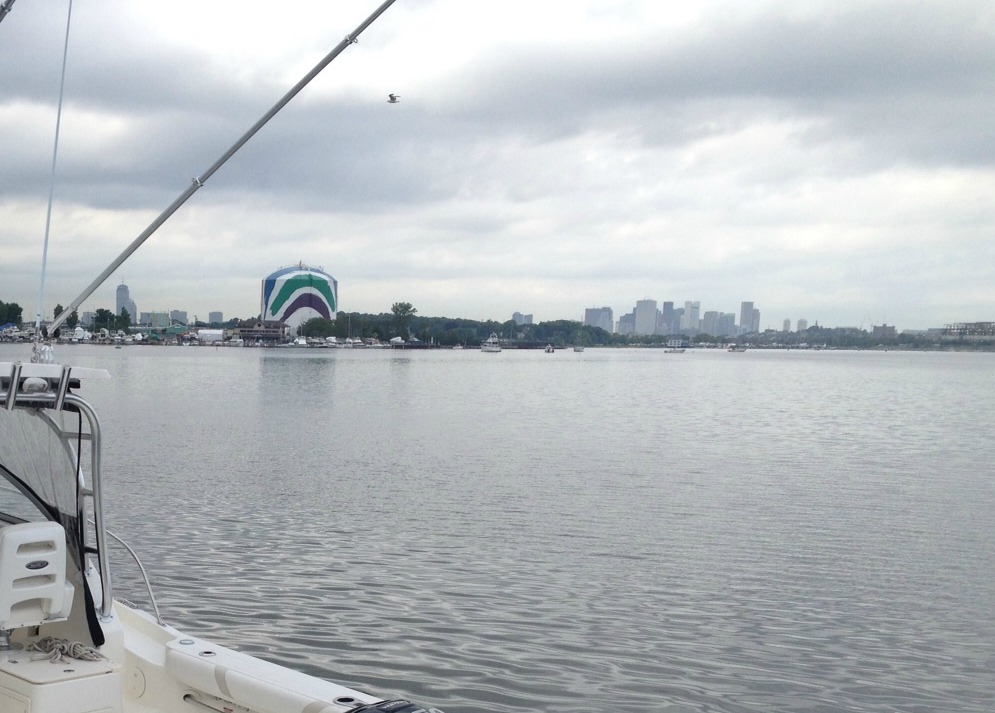
neponset river

Places to view the Neponset from land: Seen below is the running trail from Granite Ave to Lower mills. Running adjacent to the red line extension between Ashmont station and Mattapan, this is a great spot to walk alongside the river. A parking lot is located off Granite Ave, near the lift bridge. Another place to see this Pope John Paul II park, the entrance to which is on Gallivan Blvd. in Dorchester, right before the Neponset Bridge to Quincy on Route 3a.
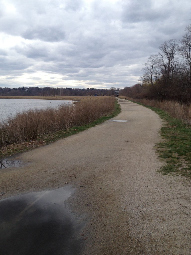
lower mills

The lift bridge near Granite Ave. Navigation by boat past this point may get tricky, especially near low tide. See the nautical chart clip above for reference. It was not far from this area where the Quincy Granite Railroad met the river and stones were loaded onto barges.
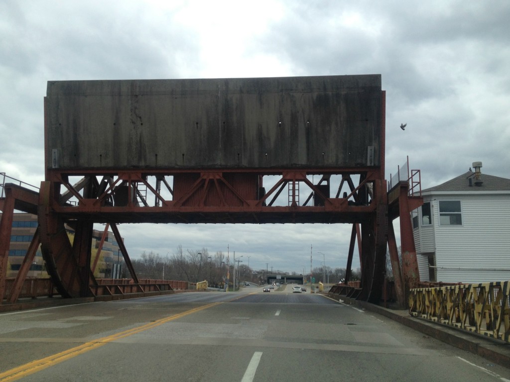
neponset

Hopefully, you will be able to make a trip to see the Neponset, either by boat or on foot, soon!

Posted in Boston Harbor Day Boat Trips, Boston Harbor History, Boston Harbor Navigation, Uncategorized, Visiting Boston Harbor | Tagged , , , , , , , | Comments Off on Along the Neponset River

Good Morning from Scituate Harbor

Here is a photo taken in the beautiful town of Scituate, MA about 25 miles south of Boston. This photo is taken across the channel from the rock jetty at the mouth of Scituate Harbor. This is a great area to visit for a day, either by land or by sea, from Boston. In fact, we have a post about it here.

channel

Related Posts Plugin for WordPress, Blogger...
Posted in Boston Harbor Day Boat Trips, Boston Harbor Navigation, good views | Tagged , , , | Comments Off on Good Morning from Scituate Harbor