Picture of the week: Container ship passing by in the morning.

The glow of the sun hits the waters of Boston Harbor as a container ship comes into port on an early morning last week. The tower in the foreground is the #5 green marker located between Castle Island and Spectacle Island.

boston harbor

Posted in Boston Harbor in the Winter, Boston Harbor Navigation, Boston Harbor Picture of the Week, Uncategorized | Tagged , , | Comments Off on Picture of the week: Container ship passing by in the morning.

An early spring visit to Peddocks Island and Fort Andrews

While not isolated per se- the island is located in close proximity to the population centers of Quincy and Hull- Peddocks does feel desolate. I was fortunate enough to visit Peddocks Island last Saturday, a cold, early spring day. Like all the harbor islands, this one is full of beautiful views and historic places. The view from the bluffs of Peddocks Island to the East is an impressive and unobstructed one:
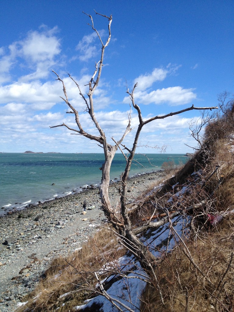
Peddocks Island Winter

A view from Peddocks facing West, back toward the city of Boston over the post-winter landscape of dry, scrubby bushes and brown grass:
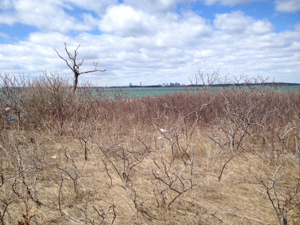
Pedocks Island

Peddocks is one of the largest Islands of Boston Harbor and has a history dating back to pre-historic times, as remains of ancient human inhabitants thousands of years old have been discovered on the island. A nautical chart of Peddocks Island today and its location in the Southeastern part of Boston Harbor:
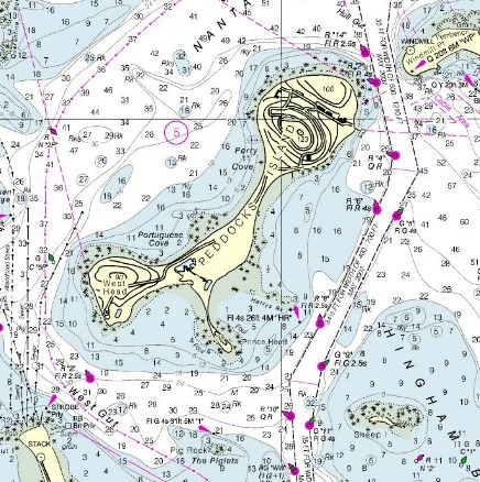
Nautical Chart

NOAA Nautical Chart. See disclaimer at NOAA.gov

While not isolated per se- the island is located in close proximity to the population centers of Quincy and Hull- Peddocks does feel desolate. The desolate and abandoned feel of the island comes from the ruins of its former military operations- Fort Andrews in particular. This fort was built in 1897 and was named after George Leonard Andrews, a Civil War soldier and engineer who helped design Fort Warren on Georges Island. It is not to be confused with Fort Andrew, located at Gurnet Point. Given Boston’s exposed position on the North Atlantic, securing the harbor was a key strategic initiative during WWII, hence the active usage of Fort Andrews during that time. Built in 1897 and used extensively until the end of the second World War, Fort Andrews occupied most of the North side of the Island.  The empty military barracks and the church show that there was once a thriving community here:
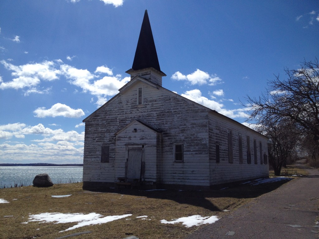
Peddocks Island

It is in this way that Peddocks is an extension of the South Shore: Located far from the city of Boston, it lies just more than a stones throw from Pemberton Point on Hull across Hull Gut to the Northeast, and only a few hundred yards from Nut Island on Quincy’s Hough’s Neck to the Southwest. It is not isolated like the Islands of Outer Brewster, Calf and Green several miles to the Northeast….just desolate.

While the remains of Fort Andrews occupy most of the Northern end of the Island today, the middle parts are occupied by a small number of year-round residences. Below is a photo of the abandoned army barracks:
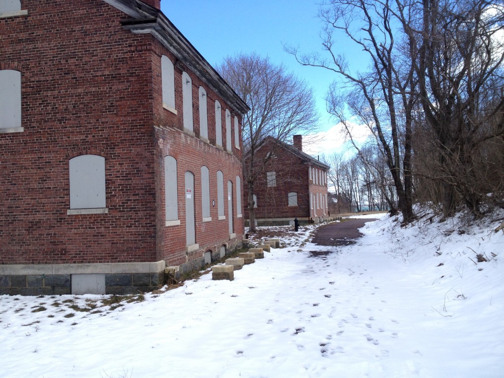
Peddocks Island

A former mortar battery, now abandoned for more than half a century:
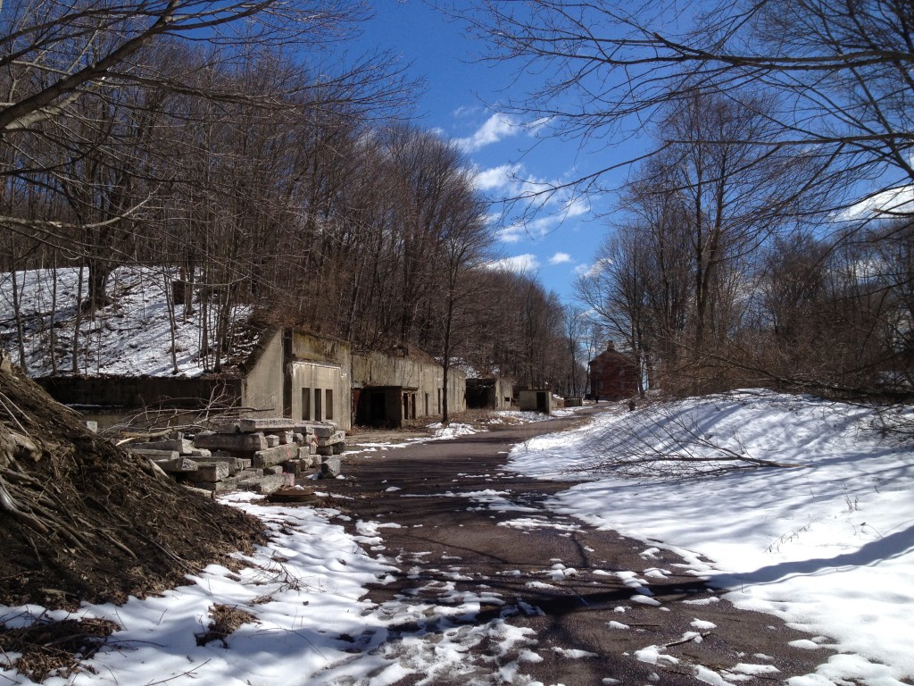
Peddocks Island

 The mortar battery from the tunnels inside:
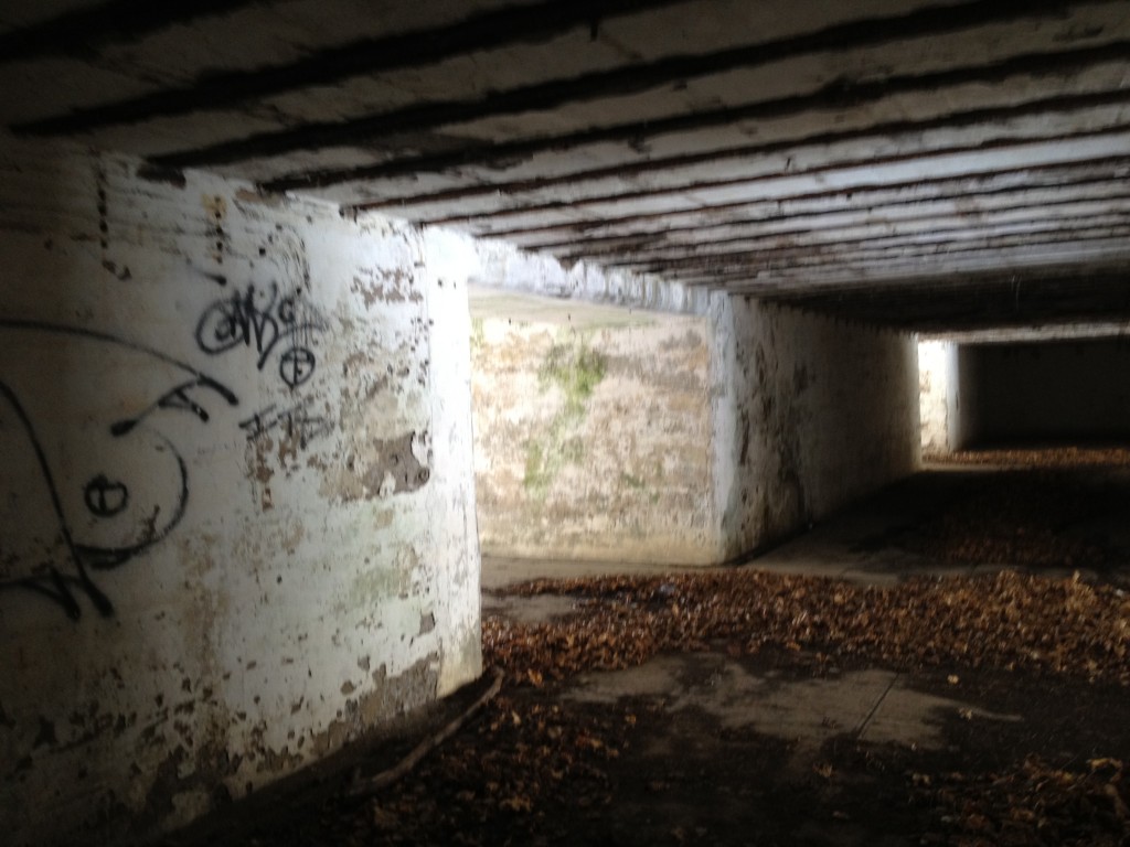
Military Bunker

The small courtyard on the far side of the battery:
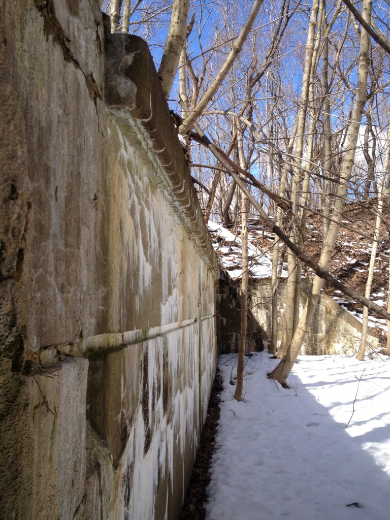
Peddocks Island

The gun stations on the bluffs of the North side of the Island, which were the primary fortifications of Fort Andrews.
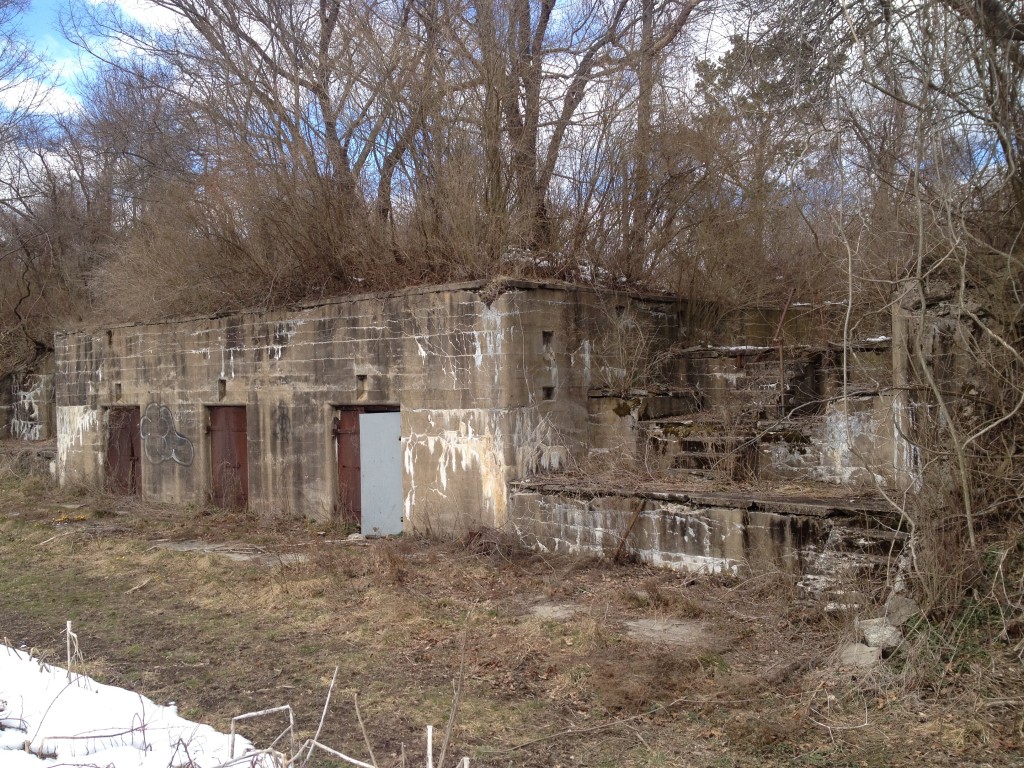
Peddocks Island

The center of Fort Andrew’s former military operations:
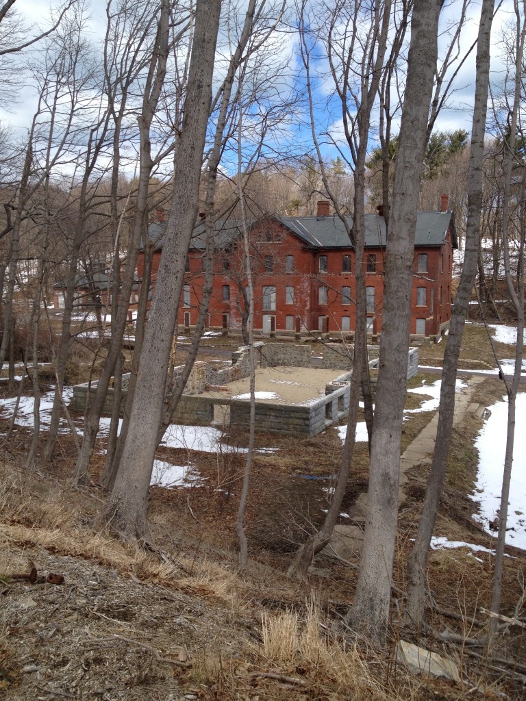
Peddocks

Remnants of Fort Andrews’ day to-day operation now lie in ruins:
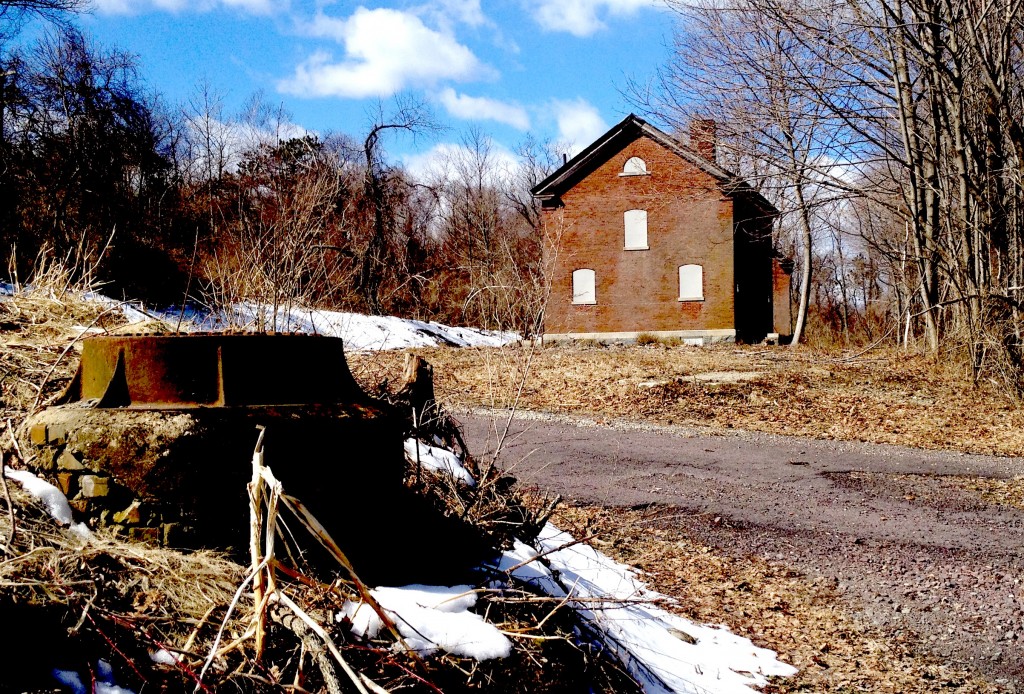
fort andrews

Lots of old rusty junk accumulates on a beach that is not often walked by visitors.
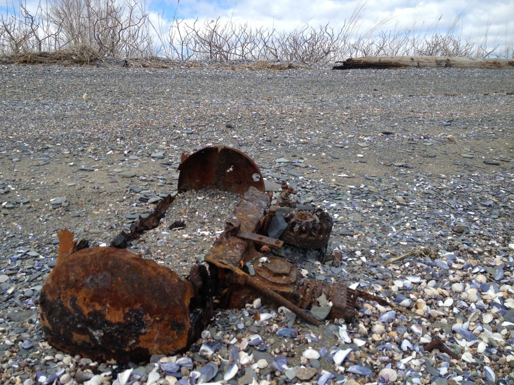
Peddocks

A view of the Western side of the island looking South to Portugese Cove, where there are still some year round inhabitants:
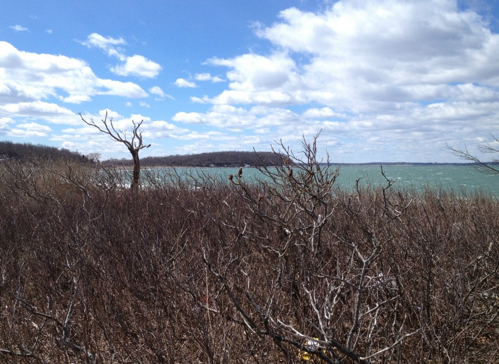
Peddocks Island

Peddocks Island will be open to the public this summer for the first time in several years.  One can visit through one of the cruise companies or by private boat.

Posted in Boston Harbor History, Boston Harbor in the Winter, historical place of the week, Uncategorized | Tagged , , , , | Comments Off on An early spring visit to Peddocks Island and Fort Andrews

Historical place of the week: Hingham Old Ship Church

Hingham’s Old Ship Church is the oldest church in the United States where worship service has been continuously celebrated. The church was one of the first structures constructed by Puritan English Settlers after sailing into Boston Harbor and landing in Bare Cove (modern day Hingham), thereby making it one of the oldest remaining relics of of Boston Harbor history.

Here are several photos of the old ship church taken at dusk on an early spring evening:

hingham

Originally settled by some of the first immigrants from America to England, the town of Hingham was known as Bare Cove at the time. Interestingly, the town of Hingham, England is not a waterfront place of nautical heritage: It is in the north, central part of the island and is not near the water. The Old Ship Church was named from its ceiling, which was known to look like an upside down ship’s hull. You can read more detail about the building’s history here. As one can see from the sign, Hingham’s Lincoln family, early ancestors of Abraham Lincoln, worshiped at this old Church.

Ship church

Behind the ship church lies the old Hingham Burial Ground. Most of the graves are those of Hingham’s original settlers and generations of their offspring. Among the more notable historical figures interred here is Governor John Andrew, the heroic abolitionist who held the office of Massachusetts Governor during the American Civil War. The reason for his burial here is that he was married to Eliza Jane Hersey, a Hingham resident. Andrew has other South Shore connections, such as an old fort at Gurnet Point named for him.

Governor Andrew’s Grave in the Hingham Ship Church Cemetery: 

governor andrew

The church at dusk:

hingham

Posted in Boston Harbor History, Boston Harbor in the Winter, historical place of the week, Uncategorized | Tagged , , , | Comments Off on Historical place of the week: Hingham Old Ship Church

Cape Cod and Islands Aerial Photos

Aerial photos often provide some of the best perspective of the layout of an area. We have posted some of the Boston area previously, but here are some more recent ones from last week, taken while flying south out of Boston.

An aerial photo of Marthas Vineyard looking Southwest. Chappaquiddick, located on the East side of the island can be seen in the foreground, while the Elizabeth Islands are visible in the back.

aerial

Flying over the Southwest entrance of the Cape Cod canal and looking South across Buzzard’s Bay. In the foreground you may be able to make out The rail bridge and Mass Maritime Academy. As you follow Route 28 South on the East side of the bay, you can see Wing’s Neck, Basset Island, Woods Hole, and even the Elizabeth Islands and the Vineyard. On the West side, New Bedford is slightly visible:

Aerial

Looking over Madaket in Eastern Nantucket. The breaking waves are visible in the channel between the mainland and Tukernuck Island. From thing angle you can see just how shallow these waters are- boaters need to be careful here:

Aerial

An angled shot of both Nantucket (foreground) and Martha’s Vineyard (background). The area between the two, known as the Muskeget Channel, and is prime location for Bonito Fishing in the summer time!

aerial

Posted in Boston Harbor in the Winter, Boston Harbor Navigation, good views, Uncategorized | Tagged , , , | Comments Off on Cape Cod and Islands Aerial Photos

Schooner Roseway Spotted in the Carribean!

The beautiful Schooner Roseway, which visits Boston Harbor in the summer months, was spotted last week (by me!) in the Carribean last week….the US Virgin Islands to be precise. A look at the ships Itinerary at the World Ocean School confirms that she is down there and sailing around in the bright sunshine!

carribean

We documented  a couple of neat Roseway sightings here and here last summer.

carribean

Posted in Boston Harbor Cruises, Boston Harbor Day Boat Trips, Boston Harbor History, Boston Harbor in the Winter | Tagged , , , | Comments Off on Schooner Roseway Spotted in the Carribean!

Picture of the week: Fishing boats on a dreary winter day

Fishing boats sit on the harbor on a calm but dreary winter’s day:

winter fishing boats

Posted in Boston Harbor in the Winter, Boston Harbor Picture of the Week, Uncategorized, Visiting Boston Harbor, Weather | Tagged , , | 1 Comment

Evacuation Day in Boston….also known as Saint Patrick’s Day

Evacuation day, occurring on the same day as Saint Patrick’s day, is an important part of Boston Harbor History. As the lesser known of the two holidays of March 17th, Evacuation day commemorates this date in 1776, when the British Navy evacuated Boston, under the threat of bombardment from the American Continental Army.

Dorchester Heights in South Boston, known as Thomas Park today, was the scene of the events back in March of 1776:

Evacuation Day

The background of Evacuation Day: In the winter of 1776, a plan was devised in which the Continential Army would fortify the hills of Dorchester Heights with the heavy artillery it had recently captured at Fort Ticonderoga in Upstate New York. In an operation overseen by Henry Knox, the cannons were secretly moved from Ticonderoga to Boston into a position in which they could be fired directly at the anchored British Fleet. Knowing they had been outmaneuvered and wanting to avoid further losses, the British pulled out of Boston and headed for Nova Scotia on March 17th, thereby marking Evacuation Day. The legend is that the Continental Army’s code word for this operation was “Saint Patrick.”

A view of Fort Ticonderoga. As the most strategic location on the American Continent, Ticonderoga was very heavily fortified. This fort guarded the only real means of passage between the St. Lawrence River (Historically French territory) and the Hudson (British at the Time). Captured in 1775 by Ethan Allen and his colonial militia, the cannons were brought to South Boston.

evacuation day

Present day Dorchester Heights, the location where the cannons were moved to, is now occupied by Thomas Park and its monument. The present day location of the fortifications, can be seen as the circular area on the chart clip below (it is right under the  “U” in South Boston). One can see why this location was strategic given its height and proximity to the harbor. Back in the late 1700s, the layout of Boston was much different, with the Northwest corner of present South Boston (basically the area between Fort Point Channel and Reserve Channel) being underwater at the time:

south boston

NOAA nautical chart. See NOAA.gov for disclaimer.

Posted in Boston Harbor History, Boston Harbor in the Winter, Uncategorized, Visiting Boston Harbor | Tagged , , , , | Comments Off on Evacuation Day in Boston….also known as Saint Patrick’s Day

Boston Skyline and International Place from the Harbor

The towers of International Place and Rowes Wharf as seen from the Boston Harbor.

boston harbor city view

This photo of Boston’s wonderful skyline was taken early on a calm winter morning from the commuter ferry. The sun was bright, and the wind was calm, allowing for a nice reflection of the skyline against the water. This area has become a Boston icon, and is a huge improvement from rat-infested ugly old wharf that occupied the area up until the early 1980s. Here is the official website. During the summer months, boaters can tie up to transient slips at Rowes Wharf to either come into the city for the day or commute to work- it is a lot of fun!

International Place as seen from Atlantic Avenue bathed in a bright orange light during an early morning winter sunrise:

boston Harbor

International Place in the Moonlight, with 125 High Street and 1 Financial Center also visible in the background:

boston

A spectacular view of the Rowes Wharf rotunda at dusk as it is just getting lit up. In addition to offices and residences, the Rowes Wharf area is largely occupied today by The Boston Harbor Hotel. From this location, visitors to the hotel have easy access to both the city’s financial district as well as many waterfront historical and tourist attractions.

rowes wharf

Posted in boston development, Boston Harbor in the Winter, Boston Harborfront Development, Uncategorized, Visiting Boston Harbor | Tagged , , , , | Comments Off on Boston Skyline and International Place from the Harbor

Boston Harbor historical place of the week: Deane Winthrop House

Winthrop is one of the cornerstones of Boston Harbor- if you view it geometrically you may see what I mean (i.e. the Northeastern corner). Naturally a point of inital discovery when approaching the Boston Harbor from the Northeast, this place has been settled by Europeans since 1630, and by Native Americans long before.

John Winthrop, an original settler of the Boston area, is famous for his “City upon a Hill” speech: A biblical reference which shaped the spirit and purpose of the land in its early days. While his original house, which was located near the present day Winthrop Yacht Club, no longer stands, that of his son Deane Winthrop still stands. Built in 1675 and located near the center of town, it is one of the oldest homes in New England.

boston harbor historical place

Winthrop is uniquely positioned geographically amongst Boston suburbs given its surroundings. One of my favorite picture of the week posts was taken in Winthrop. the town also provides access to Deer island, about which we have a some recent details.

Winthrop

Posted in Boston Harbor History, Boston Harbor in the Winter, Uncategorized | Tagged , , , | Comments Off on Boston Harbor historical place of the week: Deane Winthrop House

Storm Photos: Yet another one hits us in March

Yet another storm! This one will be lighter on the snow down on the coast, but will be long in duration. The long duration of high wind speed is expected to cause very high seas off the coast and potentially lead to flooding. A look at the data from Buoy 44013 from wunderground.com shows that recorded wave heights exceeded 20 feet for most of Thursday and Friday.

Universal Hub has all the details on the impact in Boston. Here are some photos below of the surf as it hits the South Shore. These were taken from Cohasset on March 7th about an hour after high tide:

Cohasset

Some big surf:

Cohasset

Related Posts Plugin for WordPress, Blogger...
Posted in Boston Harbor in the Winter, Weather | Tagged , , | Comments Off on Storm Photos: Yet another one hits us in March