Historical place of the week: Boston’s Old City Hall

This week’s historical place is Boston’s Old City Hall. Now used as commercial space, the structure was used as Boston’s City Hall from 1865 up until 1969, when the new structure was built near Government Center. The building’s rare design is that of “French Second Empire” style, which you can read more about here. Below are some photos of the Old City Hall, taken on a snowy January day:

boston historical photo

The statue in the front of the building is that of Josiah Quincy, who was mayor of Boston from 1823-1828. Quincy Market is named for him, and he presided over the city during his time as mayor at his office in Old City Hall.

This view puts the building’s location more in context- In the heart of the city, surrounded by high rise buildings:


historical photo

What I am trying to do here is put together a list of less well known historical places around the Boston Harbor area that have relevance to the harbor. (Last week’s was The Abigail Adams Birthplace in Weymouth, MA). The link between Boston’s Old City Hall may not be as apparent as some other historical places around town, but it looked so nice in the snow that I felt compelled to include it!

Posted in Uncategorized | Comments Off on Historical place of the week: Boston’s Old City Hall

Winter in Boston Harbor: January Deep Freeze

Winter in Boston Harbor

This year, late January brought the Boston area an unusually deep freeze. Sheets of ice formed in the harbor after consecutive days of sub-zero temperatures. An ice shelf formed in Quincy Bay that was so large, that there were times I felt like I was on the Titanic as I took the commuter ferry to work. Here are some photos taken during this deep freeze last week that show what winter in Boston harbor looks like.

The big ice shelf in Quincy Bay. Taken from Nut Island on Hough’s Neck:

boston harbor

This view to the North of Charlestown and Everett was taken while pulling into Rowe’s Wharf early last week. You know its really cold when you see the hot steam from the power plant forming those big puffy clouds as it hits the bitter cold air:

Boston Harbor

Frigid temperatures didn’t keep these hardworking fishermen from getting up before dawn. Here is a view looking east just before sunrise, with the steam coming up from the boat engine’s exhaust.

boston harbor january

A dark, jet-blue sky creates nice reflections as the sun goes down:

boston harbor january

Hingham Harbor, completely frozen solid:

boston harbor

A view of the city skyline behind the large ice shelf that formed in Dorchester Bay. This was taken from Squantum, in Northwest Quincy.

boston harbor

A cold sunrise over Spectacle Island and Long Island:

boston harbor

Ice Flows in Quincy Bay as the ice in the rivers started to break apart as the temperatures rose above freezing later in the week:

boston harbor

Looking North, the massive field of ice between Spectacle Island and Long Island (in the background). This type of ice can form even on salty water during the winter in Boston Harbor:

boston harbor january

One last shot of Quincy Bay. This is Winter in Boston Harbor!

quincy bay

Posted in Boston Harbor in the Winter, Weather | Tagged , , , | Comments Off on Winter in Boston Harbor: January Deep Freeze

More winter birds: The Mallard Duck

Around this part of the world we are lucky enough to have a plethora of wildlife right in our back yard. After recently spending some time in pursuit of the Common Eider, I was able to track down this gorgeous Mallard Duck over the weekend as he swam through ice cold waters. I was lucky enough that he let me get this close as it is really something to see that beautiful green shine reflecting in the sun. Quack Quack!!

winter birds

Here is your public service announcement: Boston Harbor Beacon reminds you to only shoot nature with a camera, never with a gun!!!

Posted in Boston Harbor Birds, Boston Harbor in the Winter | Tagged , , , | Comments Off on More winter birds: The Mallard Duck

Boston Harbor picture of the week: Frozen Harbor

The frozen Boston Harbor in late January, 2013:

quincy neponset

Late January has brought a long stretch of freezing cold temperatures to the Boston Harbor area. This has resulted in an unusually large field of ice forming across the shores of the inner harbor. Ice flows have been particularly prevalent in areas where fresh water rivers flow into the harbor. This photo of the Boston skyline was taken from the shores of Squantum in Quincy, near the mouth of the Neponset River.

Posted in Boston Harbor in the Winter, Boston Harbor Picture of the Week | Tagged , , , , | Comments Off on Boston Harbor picture of the week: Frozen Harbor

Deer Island in the Winter

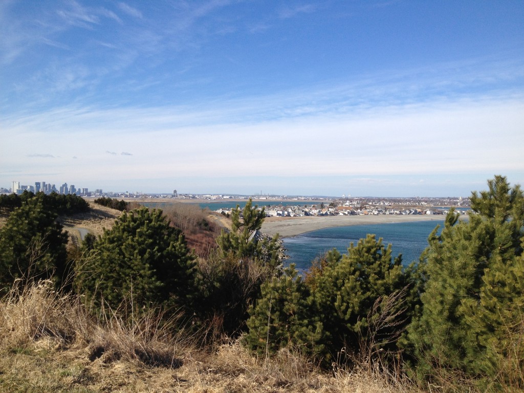
A view from the hilltop trails of Deer Island, which are deceptively high and provide sweeping views of the Boston Harbor and city skyline:
Boston Harbor Islands

Deer Island, lying at the end of Winthrop’s Point Shirley peninsula, is the outermost point of Boston Harbor’s northern shoreline. Much Like Castle Island, Deer Island is actually a peninsula, as a road was placed across the Shirley Gut, the narrow body of water which once separated this former island from the mainland. As such, this is one of the few islands not requiring a boat to access.

Deer Island has been used in the past as a prison, a quarantine station and a military fort. Today, Deer Island may be most famous for its water treatment plant, which has done wonders for improving the water quality of the harbor. However, there is a large part of the island unencumbered by the plant, and this part has been converted into a large public park, thanks to the folks at the MWRA.

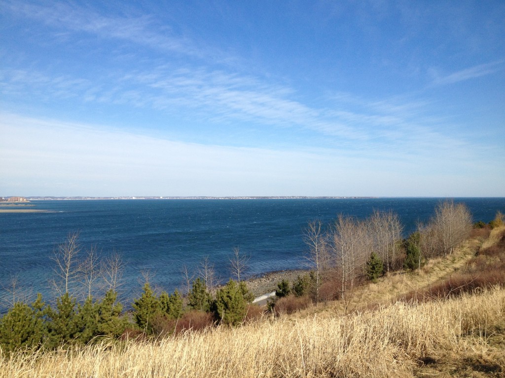
The size of Deer Island-in both the height of its bluffs and the circumference of its waterfront-is deceptively large: much more so than it appears when viewed from the water. As the outermost island on the North shore of Boston Harbor, Deer Island offers unobstructed views of the ocean and the Boston Harbor Islands. Visiting on a bright winter day provides particlarly gorgeous view: The light brown winter straw grass blowing in the wind and reflecting the sun’s light makes a bright contrast against the deep blue January sky. Below is a view looking North, towards the North Shore:
Boston Harbor Islands

A boater’s view of Deer Island:

Deer Island as it appears from the water, with a view of the water treatment plant and wind turbines on the Southern end of the peninsula. Also visible is Deer Island light, that small object in the right foreground warning shipping traffic to steer clear of the rocks:

boston harbor islands

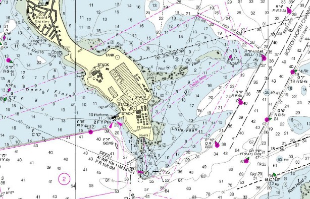
A nautical chart depicting Deer Island. Deer Island light is located at the Southern end of the Peninsula and the the East is the nearby Boston North channel and the Great Fawn. The latter is one of the major boating dangers of Boston Harbor (more on this below):
Boston Harbor Islands

Clip from NOAA Nautical Chart. Not for official navigational purposes. See disclaimer at NOAA.com

Deer Island’s Treatment Plant:

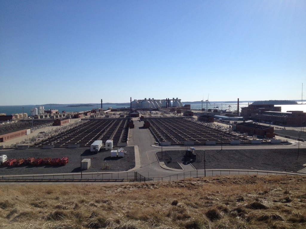
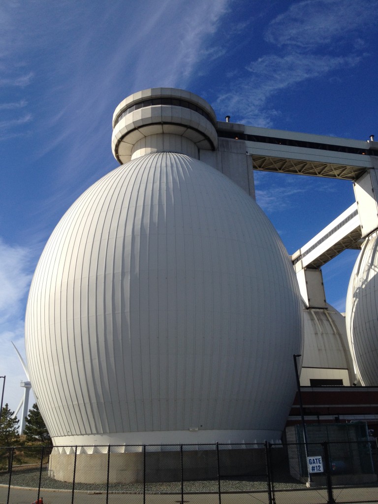
A sweeping view of Deer Island’s water treatment plant, which occupies most of the island. Built in the early 1990s, this plant has been highly effective at improving the water quality of Boston Harbor and insuring that sewage would not end up in the water. Recall that before this plant was built, Boston Harbor was ranked as one of the dirtiest harbors in the country. Following a series of incidents in which raw sewage was released into Boston Harbor waters, federal judge Mazzone ordered this facility to be constructed in 1985, making it the second largest such facility in the world. It was a major undertaking to clean up the nation’s dirtiest harbor, one that would cost multiple billions of dollars and take years of engineering investment and implementation. But the most permanent cost of the project was that its construction tragically claimed several lives, in both the construction phase of the plant and the opening of the outfall tunnel.
boston harbor islands

A view of one of the egg-shaped towers up close. Thanks to the construction of the new park, one can walk all the way around the perimeter of the plant, down to the southern tip of the island where the tanks are located. While walking along the southern side of the island, one can see the massive concrete seawall that was built to protect the exposed eastern shore of the island during a storm.
boston harbor tank

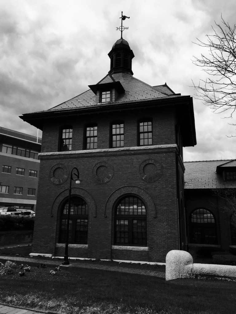
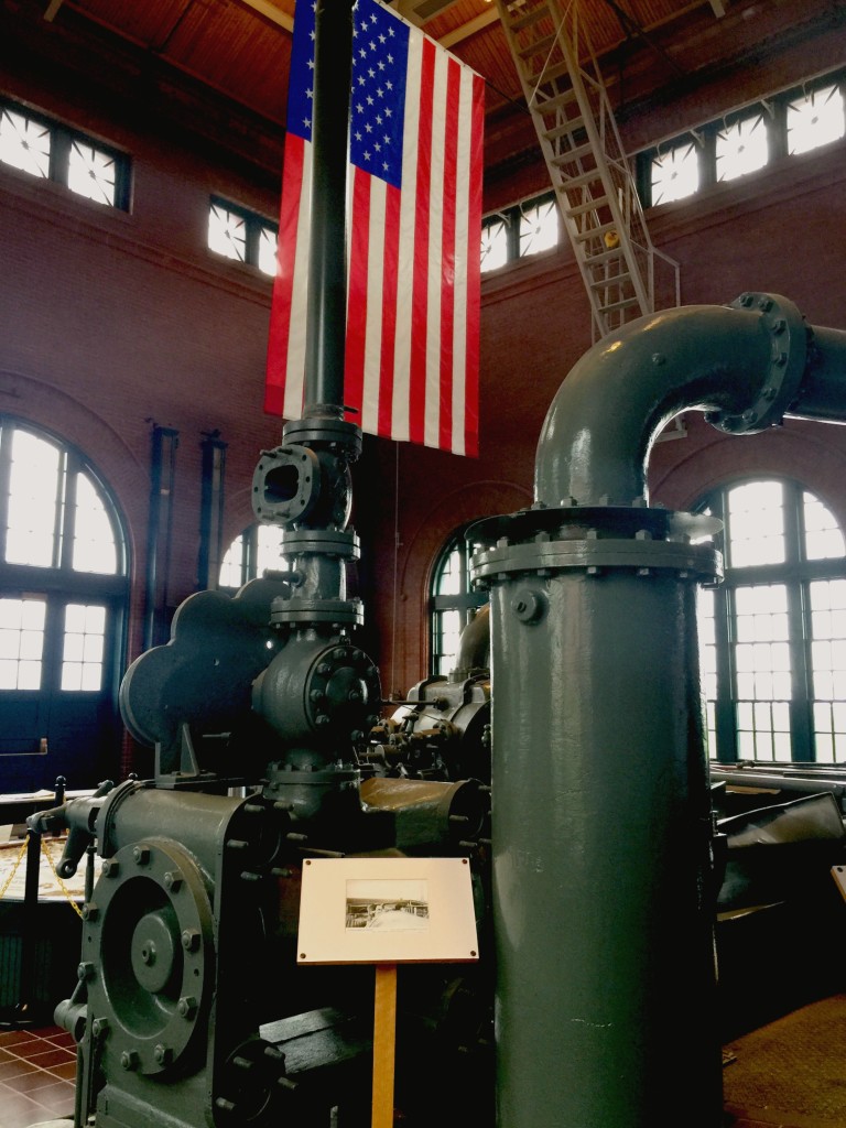
Prior to the large modern treatment plant, Deer Island was home to a the sewage treatment system of the last century. In 1899, a pump house was constructed on the island, and the historic pump house and its actual pump remain today, preserved by the MWRA. Operated up until 1968, the historic pumping station served fourteen municipalities around the Boston area and discharged untreated wastewater directly into the water. The historic pump house:
deer island

The actual pump mechanism itself, which has been restored and is on display:
deer 3

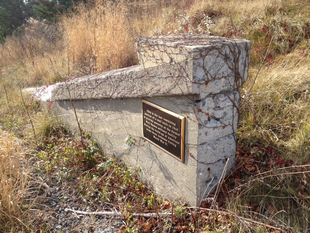
Military History: Like most of the other islands, Deer Island was once occupied by a military fortification during the earlier parts of the 20th centuries. Fort Dawes guarded the harbor from Deer Island, and was the largest of the Boston Harbor military forts, which was logical given Deer Island’s long North-to-South exposure near the Harbor’s entrance. The fort was demolished in the 1980’s to accommodate the plant, and there are some great photos of the demolition process here. Today, all that remains of Fort Dawes is this small section of concrete wall from one of the battery casemates:
deer island

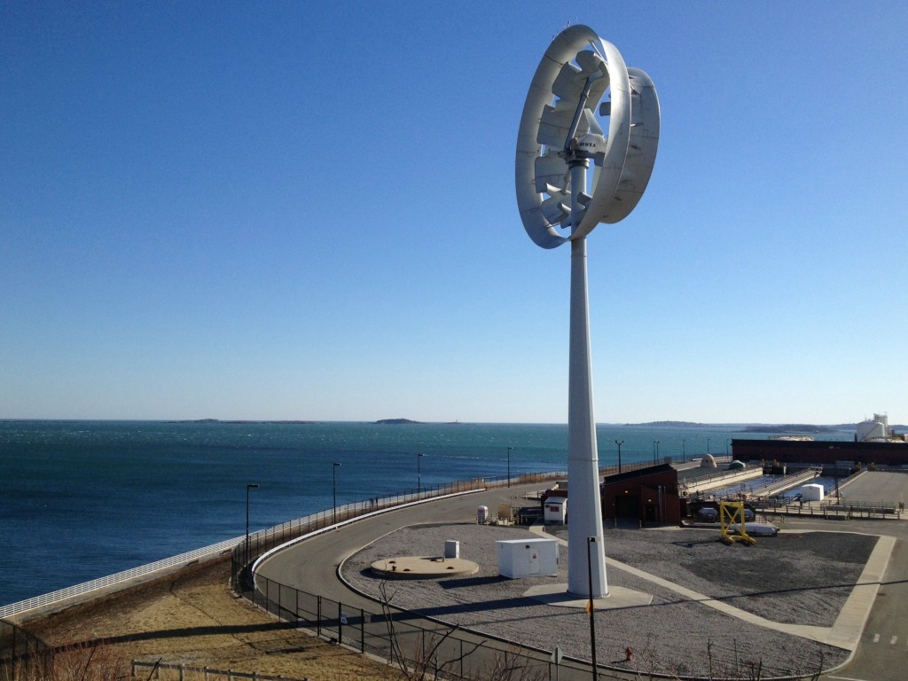
Today the island is powered by multiple types of renewable energy sources, including solar panels and at least three different types of wind generation structures. Here in the picture below, a strange wind turbine sits atop one of the hills:
boston harbor islands

Harbor Views from Deer Island:

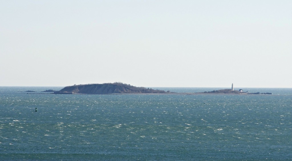
Deer Island offers an unobstructed view of the outer Harbor islands. Here one can see The Brewsters: The dunes of Great Brewster Island in the center, and Boston Light on little Brewster island to the right. These islands lie approximately three miles East of Deer Island:
boston harbor islands

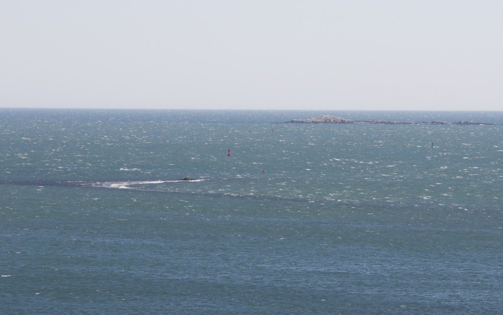
With it being close to low tide, the Great Fawn, one of the top boating dangers of Boston Harbor, was clearly visible. This is a good reminder to steer clear of this area:
deer island

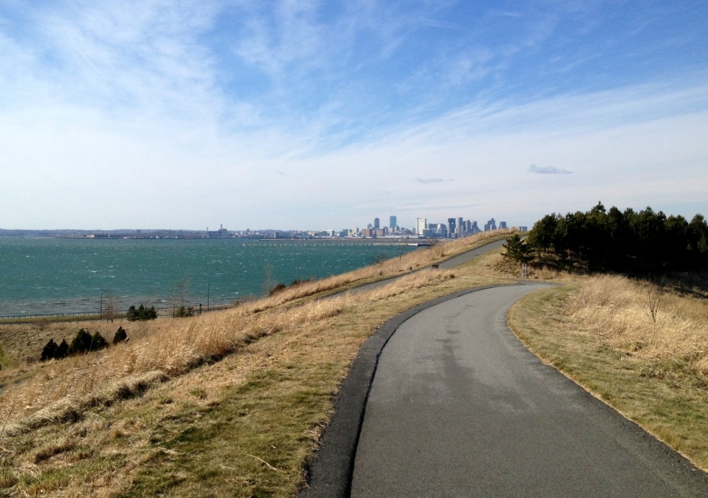
A view to the Southeast, with the harbor and city skyline in view. Deer Island’s yellow grass hills and dark pines provide a nice contrast to the blue sky and green harbor water:
boston harbor islands

To the north lies Point Shirley and the Town of Winthrop. Locted near what is today the public parking lot at Deer Island, Shirley Gut was the narrow body of water that once ran between Winthrop and Deer Island, making it actually a true island. While the gut was narrow, it was often used in colonial times to circumvent the British Blockade of the harbor, as the legends go. The great hurricane of 1938 put an end to Shirley Gut: The storm’s powerful winds and waves shifted sands to an extent that the gut was filled in, and Deer Island was no longer a true island, but a peninsula.
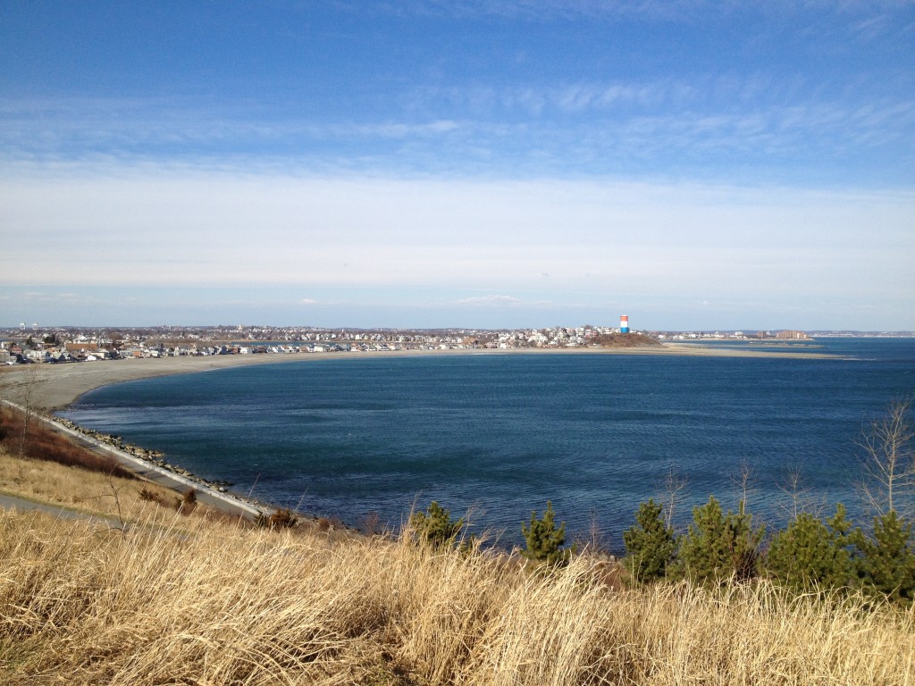
Winthrop

The former Shirley Gut as seen from high atop the North drumlin of Spectacle Island. The small stretch of land right above where the ferry is in the picture is where the gut existed until it was closed during the storm of 1938:

shirley gut ferry

Posted in Boston Harbor in the Winter, Boston Harbor Navigation, good views, Uncategorized, Visiting Boston Harbor | Tagged , , , , | Comments Off on Deer Island in the Winter

Offshore LNG terminals in Massachusetts Bay

Today, The Boston Globe ran a great article about Boston’s two offshore LNG terminals, which are now sitting idle due to depressed natural gas prices. This is unfortunate, as the installation of these terminals caused some controversy amongst members of the fishing industry and represented a $750 million of investment. They are located in the middle of Massachusetts Bay, about 13 miles south of Gloucester, and Northeast of Boston Harbor.

More about the terminals in a minute: This is relevant to boaters in the Boston Harbor and Mass Bay areas as these terminals represent a dangerous obstacle to recreational boaters, especially in fog or low visibility situations. Fortunately, the area is remote and is very well marked by buoys and patrol boats, as federal law keeps this area off limits to other vessels. You may be within visual distance of these terminals when heading to fish out in Stellwagen Bank, and the large tankers which tie up here are visible from shore on a clear day.

The location of the terminals in Massachusetts Bay and the restricted area around them is marked by the purple circles on the center right of the clip below:

boston harbor

The view of the area up closer:

boston harbor

Note: Both chart clips above are from NOAA Nautical Charts. Not for official navigational purposes. See NOAA.gov for official disclaimer.

The two LNG terminals are the Northeast Gateway and Neptune terminals. Completed in 2008, the terminals were built with the expectation of increasing future import demand for natural gas. However, with the great amount of natural gas having been subsequently found onshore in the US in recent years, importation has become less economic, and therefore these ports are not being used. Ships can still be regularly seen docking in this area, as seen in the photo below (which was taken from shore):

lng terminal

Posted in boston development, Boston Harbor Navigation, Uncategorized | Tagged , , , | Comments Off on Offshore LNG terminals in Massachusetts Bay

Boston Harbor picture of the week: Lobster boat at sunrise

Winter sunrise: A lobster boat passes by on a cold, clear January morning as the sun rises over the Boston Harbor Islands.

Boston Harbor

Posted in Boston Harbor in the Winter, Boston Harbor Picture of the Week, Uncategorized | Tagged , , , | 1 Comment

Boston’s seaport district over the last ten years

Pictured below is a photo of the Boston skyline as taken from the Seaport District just the other day. The second picture below that, is a photo I took over twelve years ago while standing in a similar place. The older photo while the BCEC was in its initial state of construction. See any similarities?

Just the other day:

Construction

Sometime around 2001:

seaport district old

Posted in boston development, Boston Harbor History, boston local issues | Tagged , , , , , | Comments Off on Boston’s seaport district over the last ten years

Historical Place of the Week: Abigail Adams birthplace

The Abigail Adams Birthplace

Located in North Weymouth’s historic district, the birthplace of Abigail Adams has been recently restored and is a reminder of the colonial-era history of the Boston Area. Abigail Adams, as you may recall, was the wife of 2nd President John Adams, and mother to John Quincy Adams. Built in 1685, the house has been recently restored to look as it appeared in the mid 18th century, when Abigail lived there.

The Abigail Adams Birthplace, located on Norton Street in Weymouth, MA:

colonial boston

This particular area was well settled in colonial times, as one can see from its many colonial homes that are still standing, as well as the nearby Weymouth central cemetery. The Boston Harbor and Weymouth Fore River area was likely integral to the early settlers of this area. Access to the harbor for transportation as well as fish proved important, which can be seen in the location where these early homes were built. This particular structure stands less than one hundred feet from the marshes adjacent to the Fore River.The House is not currently open for visitation, but is a museum so will likely open to the public again soon now that the renovations are complete.

The Abigail Adams memorial statue in Quincy Center:

Quincy, ma

Posted in Boston Harbor History, historical place of the week | Tagged , , , , | Comments Off on Historical Place of the Week: Abigail Adams birthplace

USS Constitution – Photos from summer 2012

Boston Harbor’s own USS Constitution, the oldest commissioned warship in the US navy, got a lot of time out on the Harbor this year- even some time under the power of its own sail at one point toward the end of the summer. This was only the second time in the past 100 years that the ship sailed under its own sail.

The purpose of these was largely to commemorate the 200th anniversary of the war of 1812.  Its pretty amazing how many thousands of boats and spectators came to visit her. Here are some amateur photos of the USS Constitution in action from the summer of 2012. There are all taken from on the water. Don’t forget, you can visit the USS Constitution in her home slip in Charlestown, MA and see the Constitution museum nearby.

Here, she sails back toward the city, surrounded by a throng of recreational and commercial boaters:

boston harbor

Here she is on her sailing event getting ready to turn, with the help of a tug boat:

boston harbor


Putting the sails up to turn back in towards the inner Boston Harbor

boston harbor


A closer version as she sits in front of Deer Island:

Charlestown


Constitution and Coast Guard Eagle as they get navigate their way through a pack of recreational boats and get a flyover by the Blue Angles on the Forth of July:

USS constitution

This is actually a picture of the USS Constitution at dock in the summer of 2009. It looks as though she is getting her sails repared:

charlestown navy yard


Related Posts Plugin for WordPress, Blogger...
Posted in Boston Harbor Cruises, Boston Harbor History, Uncategorized, Visiting Boston Harbor | Tagged , , , | Comments Off on USS Constitution – Photos from summer 2012