Winter birdwatching in Boston Harbor: The Common Eider

boston harbor

January leaves us with few options for recreational boating in Boston Harbor, but one thing that is great about this area in winter is the vast number of migratory birds that flock here. With calm waters, today was a great day to go see some of the cool migratory birds that hang out around here, including Eiders and Surf Scoters, (not to mention seagulls and geese)…Pictured above is a closeup shot of the Common Eider as it comes up for air.

This species migrates down from Canada in the winter, and hangs out along the shoreline, periodically diving under to find food. Essentially a type of Northern duck, these birds make their nests near shore, so are often found in places with offshore islands where they are less likely to be disturbed.

Above is a picture of a flock of Eiders talking flight (notice the cargo ship in the background if you look carefully).

boston harbor birds

 The same species can be seen in the two photos below:

eider

 common eider

A Common Eider as it sits beside a seagull. See the difference?

common eider

Here, the Eider dives below the surface to swim around and look for food:

Boston Harbor Birds

An ordinary seagull looking for a snack near the beach:

boston harbor birds

Another eider, caught on camera as he comes up for air after diving below in search of food:

boston harbor

Sometimes you watch the birds, and sometimes the birds watch you!

seagull

Posted in Boston Harbor Birds, Boston Harbor in the Winter, Weather | Tagged , , , , , | Comments Off on Winter birdwatching in Boston Harbor: The Common Eider

Views of Cape Cod Bay from Plymouth: Manomet Point and the Mary Ann Rocks

Plymouth, Massachusetts is well known not only for its early Colonial American history, but also for the sweeping view it provides across Cape Cod Bay. As the largest town in the state in terms of area, Plymouth has a long coastline opposite Cape Cod. The tip of the cape at Provincetown lies roughly twenty miles to the East. Below is a view of Gurnet Light and Saquish Head from Plymouth Beach:

Plymouth

Plymouth is unique to the South Shore as from its hills, one can see gaze across almost the entire inner coast of Cape Cod- from Sandwich to Provincetown. Viewing the area from this perspective is very helpful to boaters looking to get a broad visual layout of the area surrounding Cape Cod Bay.

I most often come to this area by land instead of boat given its relatively far distance from Boston Harbor, and for the excellent views that can be had from land- particularly Manomet Point. There are several good, visible landmarks for boaters in this area, including the stack of the Cape Cod electric plant, which lies opposite Scusset beach in Sandwich, MA right at the entrance to the Cape Cod Canal. This stack given boaters a great heading point to the canal as it is visible from many miles away. The stack is visible in the picture below, looking South from Manomet Point:

plymouth

Below is a nautical chart of the Plymouth area for reference points. From Boston, a trip to Plymouth will take at least an hour in a fast boat, and potentially a few more depending on your speed, as Plymouth Harbor is located 32 miles from the Southern entrance to Boston Harbor at Allerton Point. Located directly south of Duxbury Bay, Plymouth Harbor is really the last stop of protected water heading South before hitting the Cape Cod Canal. Plymouth is in fact the largest town in Massachusetts in area, and so the trip to the canal is still a 17 mile long haul without any inlets, as seen in the photo above.

Manomet

NOAA Nautical Chart, not for official navigation purposes. See disclaimer at NOAA.gov

Upon reaching Plymouth Bay, there is ample beach space to anchor or beach a boat, tide permitting. Across from Duxbury’s Saquish Head lies Brown’s Bank, which is a popular spot for boaters to beach in the summer months during low tide.

Heading further down the map, Manomet point is visible. Mariners passing here en route to the canal will need to use caution and stay far from shore given the rock outcrops off this point, which are know as the Mary Ann Rocks. Fortunately, these obstructions are well marked with a red can (bottom left corner of chart above). The wreck of the steamship Robert E. Lee was a well known tragic event took place at the Mary Ann Rocks. On the night of March 9th, 1928, in a blinding snowstorm, The steamship fell off course on its way from Boston through the canal and onto New York. With 273 people aboard, the ship crashed into the Mary Ann Rocks. Heeding the distress call early on the morning of March 10th, a rescue effort from the nearby Manomet Coast Guard Station ensued, which resulted in the death of three rescuers after a lifeboat overturned. Their courageous deed is memorialized on a stone that lies overlooking Manomet Point:

Robert E. Lee

Several excellent photos of this tragic event such as this one were taken by Photographer Leslie Jones and are now part of the Boston Public Library photo collection, which can be viewed here.

On most clear days, Provincetown and Race Point are clearly visible across the great expanse of Cape Cod Bay from Manomet Point. This is really an incredible view given the perspective it provides. Below is a photo taken from Manomet in which Provincetown’s water towers as well as the Standish Monument are clearly visible:

manomet

To the North, one can take in a great view of Saquish Head and Gurnet Point at the Southern end of Duxbury Bay, as seen in the top picture of the post. Gurnet Light, seen up close below sits at the end of the Peninsula:

plymouth

While visiting Manomet point and admiring the incredible view, don’t forget to stop in at the Lobster Pound and pick up dinner- its great!

Plymouth

Posted in Boston Harbor Day Boat Trips, Boston Harbor in the Winter, good views | Tagged , , , , , | Comments Off on Views of Cape Cod Bay from Plymouth: Manomet Point and the Mary Ann Rocks

Boston Harbor picture of the week: Waterfront Architecture

Boston Waterfront Architecture….

Boston Waterfront architecture

The profile of the Boston skyline as seen from the waterfront is one of the coolest of any city in the country, with a mix of modern structures and century old elaborate architectural designs. The latter is definitely reflected here with the old Grain and Flour Exchange building in the foreground and the Customs House Clock tower in the background. Such lovely waterfront architecture reminds one how lucky they are to be able to walk through this gorgeous city and see sights like this on a daily basis!

As for the Customs House, the original structure was built in 1847. Conveniently located across the way from Long Wharf, this was the first stop of internationally arriving visitors and their imported cargoes.  The tower, which was added in 1915, was the tallest building in Boston from the time it was build up until 1964 when the Prudential Tower was completed in the Back Bay. Today, the structure serves as a hotel, in addition to a historic landmark and a beautiful addition to our city skyline. A more complete description is available here.

In the foreground is the old Grain and Flour Exchange building at 177 Milk Street. This building was evidently restored in the late 1980s, and was subsequently fitted with a large red bow of an advertisement around the holidays (this was back in the Central Artery days).

Posted in Boston Harbor History, Uncategorized | Tagged , , , | Comments Off on Boston Harbor picture of the week: Waterfront Architecture

Black Rock Beach and Straits Pond

Calm black rock beach

Black Rock beach is a stretch of shoreline that lies just South of Boston Harbor, reaching around the outer side of South Hull and reaching into North Cohasset. The beach is named for the Black Rocks- two small islands lying about a quarter mile offshore. Located on the larger of the two Black Rocks is a small cottage that continues to be seasonally occupied. On its Southern side, Black Rock Beach divides the ocean from Straights Pond, a tidal pond which empties through its Western side into the Weir River in Hingham.

The Cottage on the Black Rocks, as seen from sea, looking back toward the shore of Hull:

black Rocks

Looking Southeast toward a distant Minot Light as the smooth sea reflects the seaweed covered rocks:

Cohasset

Sunrise at Black Rock Beach, with Minot Light on the horizon:

Minot-Rock

A notable historic structure was the Black Rock House*, a summer resort located on a rocky bluff overlooking the beach. The resort was built in the 1880s and remained a popular summer location until it was demolished in the 1960’s. Some relics of the resort remain today, such as a rusty old ringbolt on Jerusalem Road, presumably used to tie down horses.

The Black Rock House: 

Black Rock House

*Courtesy of the Boston Public Library, public domain photo edited and posted under this creative commons license.

Legend has it that there was once an inlet across Black Rock Beach, connecting the Weir River to the Atlantic Via Straits pond. However, most old maps and charts would suggest otherwise, so any opening may have been temporary. There are documented times when the ocean has damaged the seawall and flowed across to Straits Pond, such as the great winter storm of January 30th, 1933, the same storm which resulted in breach of the big granite Dog Bar across Gloucester Harbor and the temporary shutting of Green Harbor in Marshfield.

Sunset over Straits Pond: The silhouette of the Cohasset Green Church in the backdrop. This structure was built as a memorial by summer resident Colonel Albert Augustus Pope, for his son, who drowned in the pond during the summer of 1898:

straights pond

Moonrise over Black Rock Beach:

Cohasset-Moon

The photos below were taken on an unusual winter day at the beach. In addition to bright sun and warm temperatures, the ocean was quite still due to lack of wind. This caused the water to take on a glass-like reflection of the sky and surrounding rock outcrops. The date was January 6th, 2013.

Snow continues to cover some of the rock outcrops toward the Northern end of the beach near Hull:

cohasset Beach

 A pool of water lies tranquilly trapped in the crevices of some boulders:

black rock

Wreckage of lobster traps smashed into the rocks during a recent storm:

black Rock Beach

Lobster traps and buoys lie in a mangled heap against the sea wall, the likely outcome of a recent strong storm:

black rock beach

Minot Light stands in the distance over seaweed covered rocks:

Cohasset Beach

Some snow remains from last week’s storm:

Black Rock Beach

Looking out at the Black Rocks, for which the beach was named:

Cohasset

Posted in Boston Harbor in the Winter, Uncategorized, Weather | Tagged , , , , , | Comments Off on Black Rock Beach and Straits Pond

Navigating under bridges in the Boston Harbor area

“Can I fit my boat under that bridge??!!”

Bascule Bridge

This is a frequently asked question among boaters, especially around the Boston Harbor area. Like many urban areas, the Boston Harbor area contains many canals, rivers and waterways through dense urban or thickly settled areas. These passages are most often navigable but can pose challenges and the ability to get through may be subject to the tide.  There are at least four different types to be found in Boston Harbor and along the Massachusetts Bay coastline: Fixed, lift, swing, and bascule. (A bascule bridge is a fancy name for a drawbridge). Fixed bridges are the most straightforward, as they are usually high enough for shipping traffic to fit through at all tides. The other three, which all have an opening function, often require a radio call to an operator, or adherence to an opening schedule.It is a little known fact that the helpful folks over at the NOAA include updated bridge height data right on nautical charts. It is usually marked close by to the actual location of the structure in small type. The text will usually describe the type of bridge (as discussed below), the vertical clearance and the horizontal clearance. Charted clearance levels are reported at mean high water level (meaning essentially high tide, more detail about this can be viewed here).

Here are examples of the different types of bridges found around the Boston Area:

The Fort Point Channel, has both a swing bridge, with seven feet of clearance when closed, and a fixed bridge with 16 feet of clearance, as seen on the chart* below:

boston harbor bridge

The swing bridge opens with a wave or radio call to the operator. Below is a photo taken as it opens:

fort point

Further south, the Fore River is spanned by a lift bridge. This is usually the type of structure seen when heavy traffic must cross a busy waterway accommodating large ships. It is also often used for rail bridges given the weight of trains. The Fore River overpass is part of busy Route 3A, so an opening is a relatively rare occurrence which requires advanced notice. Given that it has 54 feet of clearance when closed, only very large vessels would require an opening. Here is chart* of this lift structure spanning the Fore River below:

Boston Harbor bridges

The Fore River’s lift bridge:

Bridge

The large fixed structures over the Cape Cod Canal, the Bourne and the Sagamore, are good examples of fixed bridges, although the canal is also crossed by a lift bridge for the railroad. Below is the labeling of the Sagamore bridge on a Cape Cod Canal chart*:

cape cod canal

A view of the Cape Cod Canal looking South from a high point on the Sagamore. Further down the canal in the distance, one can see the railroad bridge, which is a lift structure:

Bridge

Finally, a “bascule” or draw bridge. There are two of these crossing the Annisquam River in Cape Ann. The picture at the top of the post is of the Blynman Bridge, which opens by radio call and can be seen in the chart* below:

boston harbor bridges

The Annisquam River in fact has TWO bascule bridges! The bridge at Blynman Canal (which is pictured at the top of this post), and the rail bridge supporting the Rockport commuter rail line, seen below:

annisquam

The McArdle Bridge in Chelsea, another bascule bridge:

chelsea

This is only a very partial summary of the bridges that will be encountered in the Boston area. Other well known bridges in the area cross all the major rivers, including the Mystic, the Neponset, and the Charles (where locks add another level to the complexity). further out in Massachusetts Bay, boaters will also encounter bridges in Salem Harbor, the North River, and the Merrimack River.

*All chart clips contained herein are NOAA Nautical Charts. These are not for offcial use or Navigation. See disclaimer at NOAA.gov.
Posted in Boston Harbor Day Boat Trips, Boston Harbor Navigation, Boston Harbor Tides, Uncategorized | Tagged , , , , , | Comments Off on Navigating under bridges in the Boston Harbor area

Off Course: The Erie Canal

The Erie Canal: Today, a corridor of rust and blight runs along the outline of this once prosperous waterway.

The Erie Canal is a topic I took interest in after visiting Central New York over the holiday. While this is a bit “off course” from the topic of Boston Harbor, I think it is relevant as it is a meaningful piece of American nautical history. While still used for recreation and the occasional commercial traffic, the Erie Canal faded into obsolesce almost a century ago as it was replaced by rail and then road. However, the footprint of the canal and all it left behind remains in place to be seen today.

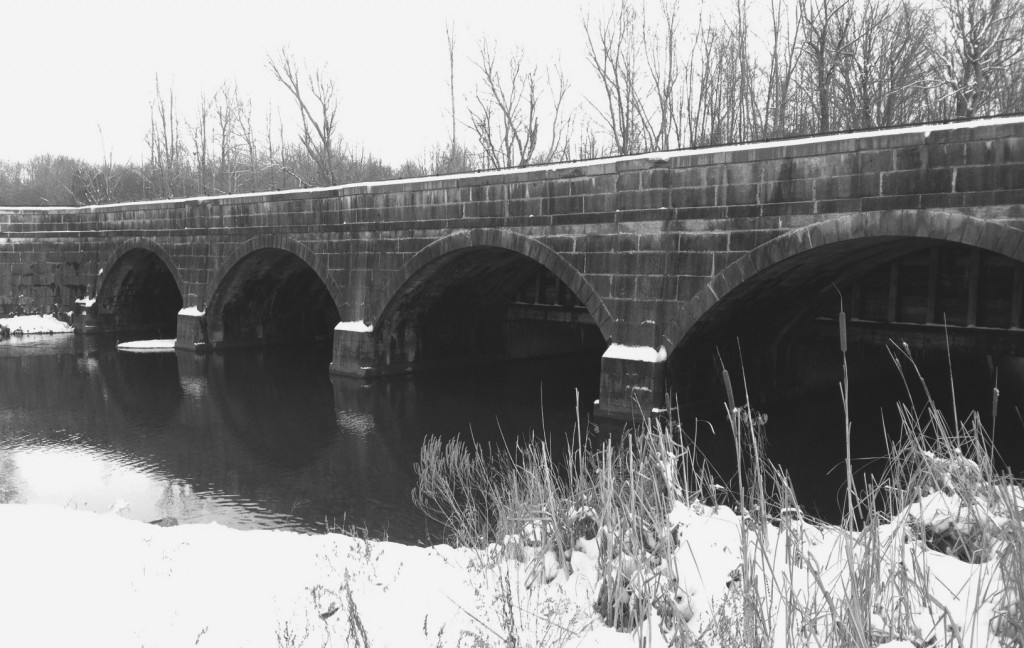
A part of the old lock system over the Erie Canal west of Syracuse, NY:
erie canal

Commenced in 1807, the Erie Canal project was one of the greatest works of American engineering of the era. The original intent of the canal system was to create a domestic shipping link between the Great Lakes and the Atlantic Ocean. Such could be done with this canal, flowing from Lake Erie in Buffalo, NY, all the way to the Hudson River, which empties into the Atlantic Ocean at New York City.

As a glacially-carved pathway, the Mohawk River valley at its intersection with the Hudson is the only cut through the Appalachians North of Alabama. This geological characteristic made the area perfect for a canal system connecting the Atlantic with the Great Lakes.

The complex system connecting these ends was done with the help of a system of over 50 locks, to adjust for the great changes in elevation between Lake Erie and the Hudson. To this day, the mouth of the Mohawk at Cohoes, NY where it empties into the Hudson, is subject to large tidal fluctuations, despite its source being located several hundred miles inland, and over one thousand feet higher in elevation.

A map of the Erie Canal near its peak of usage, 1853:

Erie Canal Map 1853

 Unknown author, Creative Commons license.

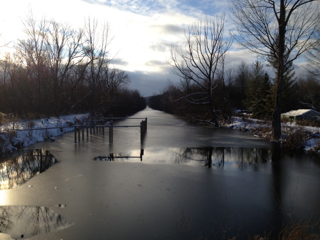
Looking at a rural section of the remains of the Erie Canal today, just west of Syracuse:
erie canal


The Erie Canal sparked an industrial boom through the center of New York, creating an economic super-center which may have in its time been the equivalent of California’s Silicon Valley or Boston’s Route 128 belt today.

The evolution to rail and road followed, with today’s interstate route 90 somewhat closely following the path of the Erie Canal.Sadly, the canal became less relevant over the years as more efficient, alternative means replaced horse-drawn canal boats. Subsequently, the post WW-II de-industrialization of America, and the trend of offshoring of American industry has proven disastrous to most of the factories and plants that were located adjacent to the canal, and are now left in its footprint. Today, a corridor of rust and blight runs along the outline of this once prosperous waterway.

Along the Erie Canal today:

Below are some photos I took near Syracuse, NY of the area adjacent to the path of the Erie Canal. In doing some research, I came across a very cool website called Yestercuse, which contains a vast amount of historical information about the city.

Clinton Square, in downtown Syracuse, NY, taken in 1904. Note the Erie Canal runs right through the center of town:

Erie Canal at Salina Street, Syracuse

Creative Commons License. 1904, Library of Congress.

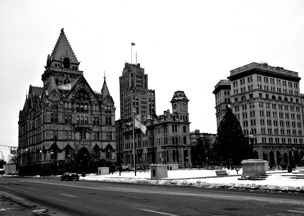
A photo of the same location in Syracuse, NY as it appears today. This photo was taken yesterday, 12/26/12. Note the space which the Erie canal once occupied has been replaced by a major road, Erie Boulevard:
syracuse

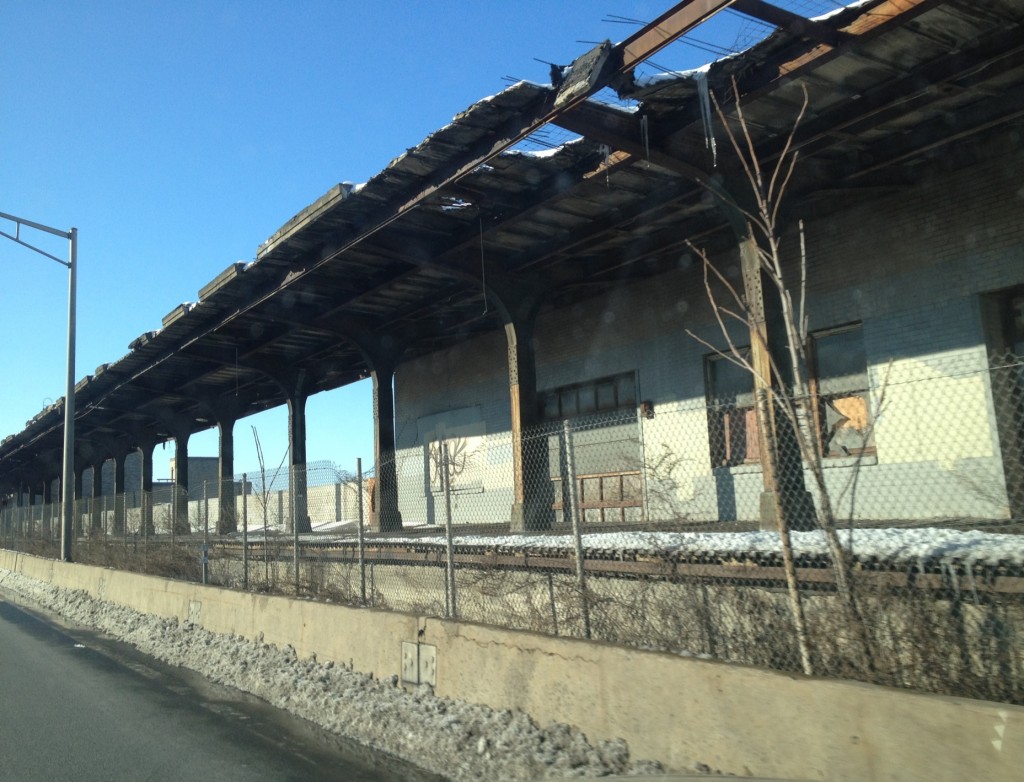
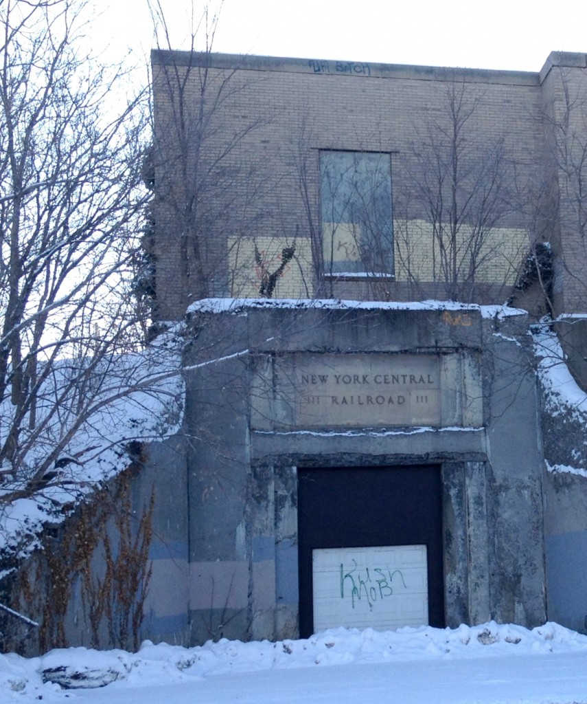
Some of the structures that the Erie Canal has left behind: An abandoned railroad station, belonging to the New York Central Railroad. Located just two blocks South of the above square, this station was part of an elevated rail system which is now interstate route 690. This station was shut down in the early 1960s:
erie canal

syracuse

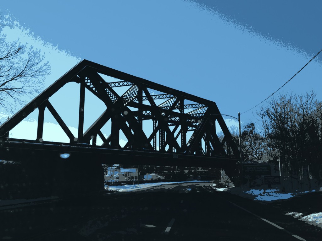
Major rail lines now run parallel to much of the Erie Canal. Here, an iron rail bridge, still in use today, crosses Erie Boulevard, just west of the City of Syracuse:
erie canal

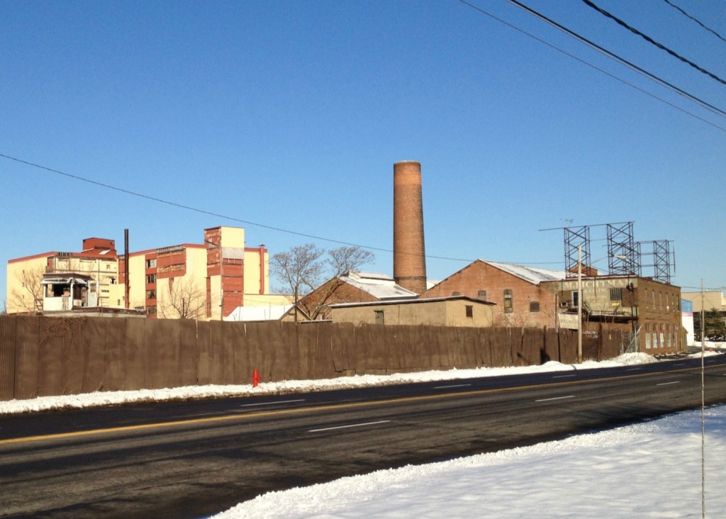
Just west of the City of Syracuse lie several abandoned industrial buildings. Visible below is the Marsellus Casket factory to the left, along with what appears to be a closed sign manufacturing plant to the right. The casket factory closed in 2003, while the outline of its logo still appears on the faded side of the building.
syracuse

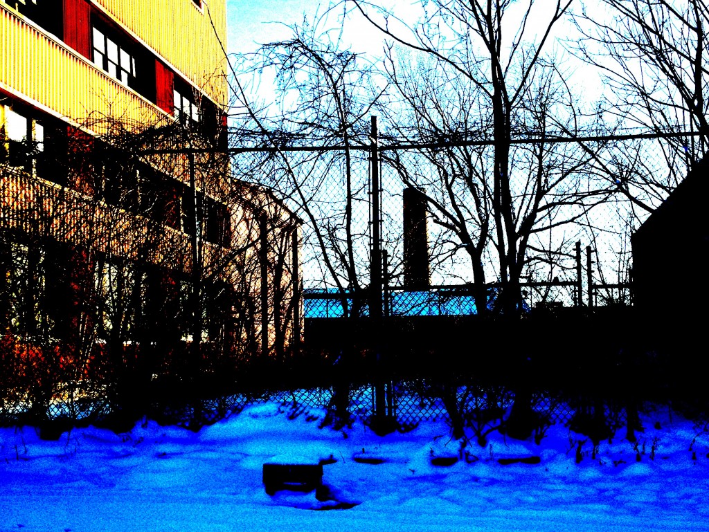
The alleys between the abandoned factories have started to become overgrown:
Syracuse

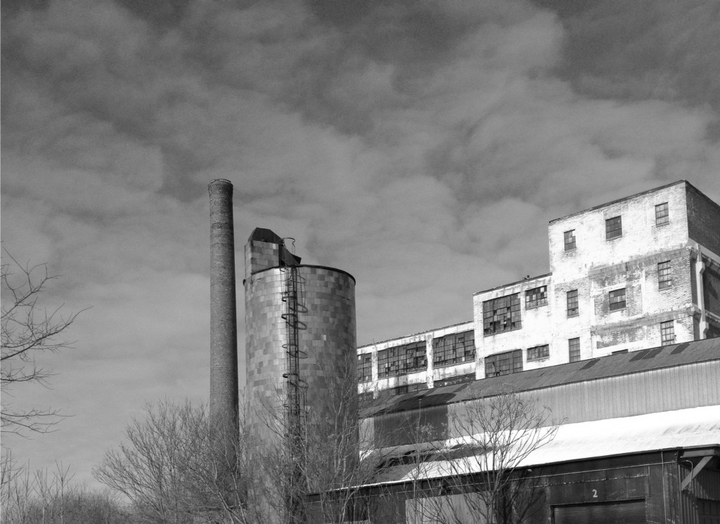
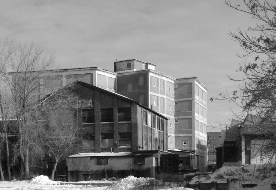
Below is a photo of another abandoned factory off the old path of the Erie Canal, near the intersection of Erie Blvd. and West Fayette St. This factory, near the present day Fowler School, was likely once part of the Franklin Automobile manufacturing complex, which was closed in 1934:
syracuse

warehouse

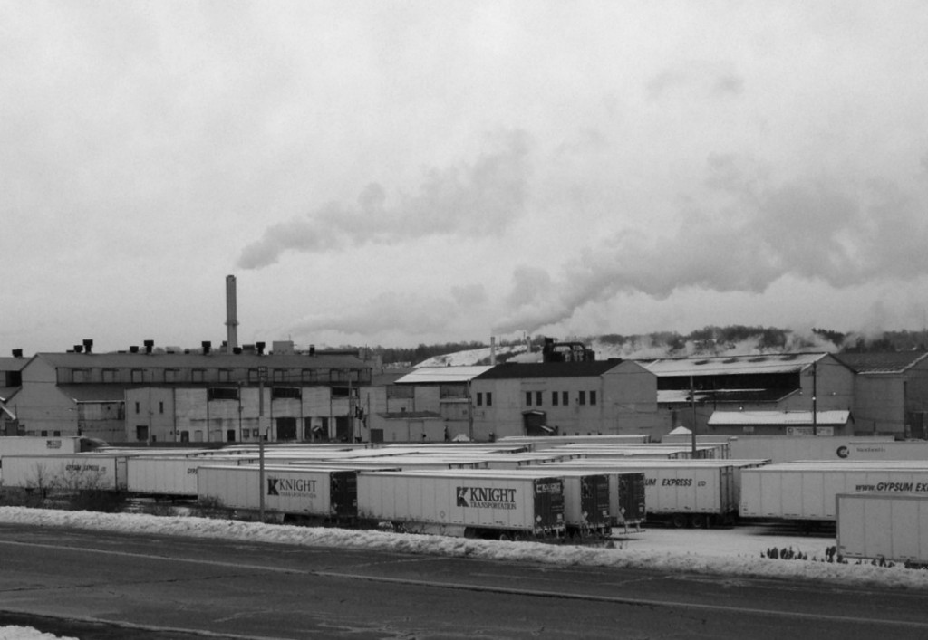
A metal plant which remains operational, near the west side of Syracuse:
Syracuse

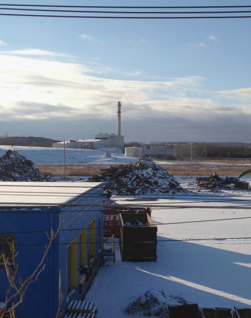
The present day landcape adjacent to the Erie Canal, west of Syracuse:
erie canal

The path of blight subsides away from city centers as the Central New York landscape quickly shifts from industrial to agricultural once the city limits are left behind. However, the common trend of abandoned industry persists through the whole Mohawk Valley corridor. A similar landscape exists here in the cities of Utica and Ilion, some 70 miles away, and Amsterdam, some 50 miles beyond that.

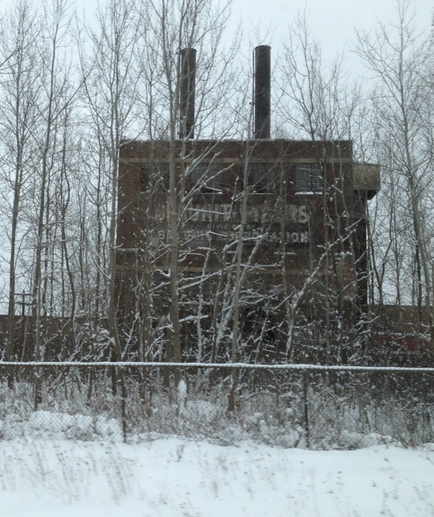
The former Beaunit Fibers plant in Utica, closed in the early 1960s:
blight

The cityscape of Amsterdam, NY, as seen from the New York State throughway, I-90:
factory

Posted in Boston Harbor History, Off course, Uncategorized | Tagged , , , | Comments Off on Off Course: The Erie Canal

Last Boston Harbor Photo of the Week of 2012: Scituate Light

Happy Holidays from Boston Harbor Beacon! Here is a photo of Scituate Light, all decorated for the holidays:

lighthouse

This will likely be the last BHB photo of the week of 2012. This makes me look back on the last twelve months and makes me thankful for all of the beautiful Boston Harbor scenes I have gazed upon over year.

I hope my photos did them justice, and I hope you enjoyed seeing them. If you are reading this, I wish you a great holiday and a great New Year.

Posted in Boston Harbor History, Boston Harbor in the Winter, Boston Harbor Navigation, Uncategorized, Visiting Boston Harbor | Tagged , , | Comments Off on Last Boston Harbor Photo of the Week of 2012: Scituate Light

Last boat ride of 2012, on the winter solstice!

Today was December 21st, the shortest day of the year- also known as the Winter Solstice. Being the Friday before the week of Christmas, I realized that today would likely be my last boat trip of 2012. This was a bit nostalgic, since I have had so many good boat trips this year. This is certainly something that I am thankful for!

The following few pictures were taken this afternoon from the 3:30 PM ferry from Rowes Wharf to Hingham. By the time the afternoon rolled around, the driving rain that we had this morning had dissipated, although the wind remained and may have even strengthened. Here is the Boston Skyline as the sun is close to setting by 3:30:

boston sunset

Sunset over the Seaport District as the ferry pulled out of the inner harbor around 3:45 PM this afternoon:

seaport district

Heading under the long island bridge around 3:45PM:

long island

The sun starts to drift behind the clouds and slowly disappear from view, behind the Weymouth Fore River:

winter solstice

By 4:30, the sun is gone, as can be seen in this shot looking West from the Hingham Shipyard Marina. Today was a strange day weather wise, but it was a wonderful Winter Solstice!

Hingham dock

Happy holidays!!!

Posted in Boston Harbor in the Winter, Uncategorized, Visiting Boston Harbor, Weather | Tagged , , , | Comments Off on Last boat ride of 2012, on the winter solstice!

An old chart of Baker’s Island and Salem Sound

Baker’s Island in Salem Sound, and its lighthouse. There is only one light house today, but up until the late 1920s there were actually two…

salem sound

The twin lights of Baker’s Island: After making a boat trip to the islands of Salem Sound this summer, I found myself doing some research on the nautical history of the sound and surrounding harbor. Of particular interest is that Baker’s Island, the sight of a large and highly visible lighthouse today, once had twin lighthouses. I am lucky enough to own a 1869 Coast Guard survey chart of Salem Sound that belonged to my grandfather. The sound is labeled on this chart almost exactly as it is today, dimensions and all. However, the chart indicates that there were once two lighthouses on the island. A little further research confirms this.

A broad view of Baker’s Island today, as seen when approaching Salem Sound from the North Channel:

Salem sound

Below is the depiction of the view of Baker’s Island twin lights on the 1869 chart:

Baker's Island

It turns out that the second lighthouse was taken down in the late 192os as it was viewed as an unnecessary expense. A broader view of Salem Sound, with Misery Island and Baker’s Island as shown on the 1869 nautical chart:

Baker's Island

These lighthouses were designed to warn of the great dangers of Salem Sound- mainly its many rock outcrops and shoals which lie around the vicinity of Baker’s Island. Despite the prominence of these guiding lights, there were still mishaps. One particularly strange event happened in August 1901*, when a cargo ship called Ethelwold ran abound off Baker’s Island in a dense fog. The ship was a fruit carrier, on its way from Puerto Plata to drop off its cargo of Bananas at Boston’s Long Wharf. All were reported to be ok, and the ship sustained only minor damage. However, the crew’s method of becoming dislodged from the rocks was to lighten the ship’s load was to throw bananas overboard. Some 3,000 bunches of bananas floated across Salem Sound that August afternoon, and fisherman promptly left their traps and lines to go catch some tropical fruit!

Not much has changed: A similar view of the area as seen on GPS display in 2012:

chart

Salem sound makes one of the best day trips from Boston Harbor given its natural beauty and many secluded places to drop an anchor. It is a large protected area, almost the size of Boston Harbor itself. It is also full of rock outcrops, shoals and other navigational hazards, making it a true challenge for boaters who are up for it.

*Source: “In a Dense Fog. Ethelwold Ran on the Rocks off Baker’s Island”. The Boston Daily Globe, August 16th, 1901.
Posted in Boston Harbor Day Boat Trips, Boston Harbor History, Boston Harbor Navigation | Tagged , , , , | Comments Off on An old chart of Baker’s Island and Salem Sound

The Central Artery: How Boston’s waterfront once looked

The Central Artery, the giant metallic green overpass that once wound its way through Boston’s busiest downtown streets, is now long gone. However, it defined the waterfront cityscape for a great many years, which is why I wanted to share these cool pictures I once took of the central artery at twilight, in the twilight of its useful life, back in the summer of 2001:

Boston Skyline

This photo, along with the next three, was taken using a tripod and an old-school Canon 35 mm camera from the roof of the New England Aquarium parking garage on a summer evening back in 2001. The light of the city reflects the massive green steel structure that would rival in size only Fenway Park in this city. To the Northwest, the sun sets against a clear sky. Doesn’t the city look busy with traffic for this late on a mid-summer evening? To me, it actually felt pretty empty at the time.

International Place and the State Street building (at the time) with its large light-up sign. Below, the traffic on Atlantic Avenue rushes by barriers set up to wall off construction on the big dig. There was a time where it seems like one would have to navigate a maze of concrete barriers to get from downtown to the North End.

Financial district boston

Looking North again, this time with the Zakim bridge visible:

North End Boston

A zoomed in shot of the main stretch, looking North toward the North End. Note the exits for Causeway Street and the Callahan Tunnel to Logan Airport. Below, lies equipment and space used on constructing what was at the time a new, state of the art underground tunnel.

Boston waterfront central artery


The Customs House, Boston’s Original Skyscraper:

Central artery

A final photo, taken on a different night from a different place (Dock Square Garage) with  different camera (this time digital, so no time lapse light streaks!!). Note the Old North Church and the Fleet Center:

Boston North End


Related Posts Plugin for WordPress, Blogger...
Posted in Boston Harbor History, Boston Harborfront Development, Uncategorized, Visiting Boston Harbor | Tagged , , , | Comments Off on The Central Artery: How Boston’s waterfront once looked