Wompatuck State Park – A park with some Naval History

After five days in a row of being out on the harbor, I thought it would be a good idea to stay on land for a day. Yesterday, I decided to head to Wompatuck State Park to do some biking on the vast network of trails through these gorgeous woods. The park lies largely in the town of Hingham, but also touches parts of Cohasset, Norwell and Scituate. It has multiple entrances in each of these places. This vast expanse of woods was named for its prior owner, Josiah Wompatuck, who was chief of the Mattakeessett and grandson of Chief Chickatawbut.

In addition to being open to the public for recreation, Wompatuck State Park has an interesting history: Particularly its use as an ammunition depot for the United States Navy during WWII. The depot was connected to what is now the Greenbush line for easy access to both the Fore River and Hingham Shipyards, which were major shipbuilding ports in WWII. We have written a few posts in the past about the WWII history of the South shore, which can be seen here. One can see the vast infrastructure dating from the WWII era when walking through the Wompatuck State Park. Some areas of the park contain standing military structures are still closed off to the public due to several hazards, including contamination and unexploded ordinance. The park is full of the remains of old rail lines, which have been paved over and made into trails. Some of the old rail lines can be seen here:

 Old rail lines that have since been overtaken by forest growth:

A view of the remains of some of the old bunkers used to store ammunition during WWII:

military bunker

The collapsing old roof of one of the bunkers is a reminder of why this place is not safe:

hingham

The brick exterior of one of the main bunkers. The ample coating of spray paint graffiti on the walls is evidence that many have ignored the restricted area warning over the years:

bunker

During the summertime, the park is particularly nice to visit. There are many other attractions to see beside the military ruins, including several ponds throughout the woods, and the Weir River Farm at the North side of the park. Below is a photo of the Weir River Farm in late spring. Note the city skyline in the distance:

hingham

Reflections on the calm waters of the Aaron River Reservoir on a calm day. The reservoir is  located deep in the Wompatuck Woods, near the Cohasset side:

boston

 A link to the official Massachusetts DCR website of Wompatuck State Park can be found here, while a link to the Friends of Wompatuck website can be found here. I would highly recommend a visit to the park if you are in the South Shore area.
Posted in Boston Harbor History, Uncategorized, Visiting Boston Harbor | Tagged , , , , , | Comments Off on Wompatuck State Park – A park with some Naval History

Cruising around Salem Sound: Baker’s Island Light & Misery Island

Baker’s Island Light, visible while entering Salem sound and heading toward Misery Island:

This weekend, I made the hour long ride up to Salem Sound. Having passed by the area many times on trips to Gloucester, it was about time I stopped in to explore. I was also quite compelled to visit, after discovering an old map of the sound published in 1869 which was owned by my grandfather- more about this later. Finally, I wanted to dispel views that this blog is biased in favor of the South Shore- we love the North Shore too!

Salem sound encompasses a large area extending from Marblehead up up Manchester and Gloucester. The sound is a real challenge for mariners as it full of hazardous rocks, ledges and islands, the largest of these being Baker’s Island and Great Misery Island. Great Misery Island was evidently named by a shipbuilder for the miserable time he endured while stranded there in a winter storm.

There are several entrances to Salem Sound, which are seem to twist around the many rock outcrops, including The Gooseberry Rocks, Satan Rock, Tinker’s Island, Marblehead Rock, and the Bowditch Ledge. In the Northern part of the sound are where the two large islands, Baker’s and Misery are located. Boaters can enter the sound from its Southern Entrance, past Tinker’s island and the Marblehead Light tower. The Northern channel, which I took, comes around the North side of Baker’s Island and into Manchester Harbor.

Salem Sound

Here is the approximate route I took. The way up (in red) shows me departing Hingham Bay, heading out Nantasket Roads, and heading directly for the North Channel at Bakers’s Island before anchoring at Misery Island. The way home (in green) outlines my approximate route around Bowditch Ledge, off Marblehead out the Southern channel, and rounding the B-Buoy outside Boston Harbor before heading back in. All in, this trip was approximately four hours, which included anchoring for over an hour to have lunch.

The chart images contained herein were obtained by the NOAA and are being used in accordance with their terms of permitted use. Altered and redistributed charts such as those shown below should not be relied on for navigational purposes. Please download the full version from “www.charts.noaa.gov” and please see terms of service at “http://www.charts.noaa.gov/RNCs/Agreement.shtml?13270


Anchoring at Great Misery Island. A popular spot seems to be the small gut between Great Misery Island and Little Misery Island:

Boats moored between Misery and Little Misery Islands:

Ruins of an old 19th century resort located on Misery Island:

salem sound

GPS view while rounding Baker’s Island and heading toward Misery Island:

 Passing by Bowditch ledge in the middle of the Salem sound:

A closer view:

Boston Harbor


View of Marblehead Harbor and the light house structure to the far left:

Rounding the B-Buoy on the way back home. Nice view of the city skyline from about ten nautical miles out:

My old map tells me that there were once two lighthouses on Baker’s island, and shows that there was once a solid structure of a lighthouse at Marblehead Neck, not just the skeletal tower that stands there today. The marker of Bowditch ledge appears on the old map exactly as it looks today. For more reading about Boston’s North Shore, some of our favorite posts can be seen here and here.

Posted in Boston Harbor Day Boat Trips, Boston Harbor Navigation, Uncategorized | Tagged , , , , , | Comments Off on Cruising around Salem Sound: Baker’s Island Light & Misery Island

Boston Harbor Picture of the week: Another nice sunset over Hingham Harbor

This August has brought many beautiful sunsets over Boston Harbor. Here is one of Hingham harbor taken on Friday August 24th. This shot was taken from the East of Hingham Harbor, off summer street. If you have been too busy to get out on the harbor in a boat, no more excuses- this week is the time!

Posted in Boston Harbor Picture of the Week | Tagged , , , , | Comments Off on Boston Harbor Picture of the week: Another nice sunset over Hingham Harbor

Tankers in Boston Harbor – Where is Majuro?

A large tanker gets pushed through the inner harbor by tug boat, presumably on its way to the fuel terminal up in Chelsea.

Boston Harbor Tanker

Many cargo ships and tankers in Boston Harbor list a place called Majuro as their home port. I didn’t know where it was, so after seeing it on many ships, I referred to the world wide web for some insight. It turns out that this is a city in the Marshall Islands in the center of the Pacific Ocean. Many maritime companies are incorporated there due to favorable regulatory status, in addition to what is probably a fairly central location for global shipping….so now we know next time we see a tanker in Boston Harbor that is from Majuro. Just think how long these tankers must travel to get from Majuro to Boston Harbor!

Posted in Boston Harbor Navigation, boston local issues, Commuter Boat | Tagged , , , , , , | Comments Off on Tankers in Boston Harbor – Where is Majuro?

Boston Harbor Picture of the Week: Early Morning over Hingham Bay

A view of the Boston skyline over Boston Harbor while departing from Hingham Bay on the 6:00AM commuter ferry. The days are starting to get shorter, as a sky like this is rarely visible after the ferry service starts until fall and winter.


Posted in Boston Harbor Picture of the Week | Tagged , , , | Comments Off on Boston Harbor Picture of the Week: Early Morning over Hingham Bay

USS Constitution under sail

 The USS Constitution, the oldest commissioned vessel in the United States Navy, was paraded out President roads to sail under its own sails this past Saturday.

The USS Constitution was paraded around the harbor today under sail power for only the second time in over one hundred years. The historical ship is getting a lot of use this summer, and this is primarily to do with commemorating the 200th anniversary of the War of 1812. The USS Constitution was made famous in that war for its defeat and capture of several British ships, earning it the name “Old Ironsides.”

The ship got off to a bit of a slow start today. Its appeared that there were some technical difficulties with the sails at first….then, the ship had a tough time getting going as there was not a lot of wind. But she finally headed back into toward the city, which was a marvelous sight. Don’t forget, you can visit the USS Constitution anytime at the Charlestown Navy Yard.

Posted in Boston Harbor History, Visiting Boston Harbor | Tagged , , | Comments Off on USS Constitution under sail

The Bonito Run

Bonito are one of the most fun fish to catch, and are also great tasting. You won’t find them in Boston Harbor, but if you are lucky enough to get down to the Cape Cod and the islands this time of year, you can make a run at catching these great fish. I was able to catch two Bonito in the shoals around Muskeget Channel, which runs between the West side of Nantucket and the East side of Martha’s Vineyard.


On the day I caught the Bonito pictured above, I got out on the water by 6AM and used 4-6 inch diving plugs. I picked a good day with overcast skies and light rain. I’m not sure that was a factor, but we had great luck as we also caught several Bluefish along with the Bonito. By noon, we had these fish on the grill for a delicious Bonito lunch!


The shoals along the Muskeget Channel, at the center of the chart shown below, are prime grounds for Bonito fishing. But be careful out there! It can get shallow, and the fast running water creates big rips over the shoals.

The chart images contained herein were obtained by the NOAA and are being used in accordance with their terms of permitted use. Altered and redistributed charts such as those shown below should not be relied on for navigational purposes. Please download the full version from “www.charts.noaa.gov” and please see terms of service at “http://www.charts.noaa.gov/RNCs/Agreement.shtml?13270

Posted in Boston Harbor Navigation, Fishing, Uncategorized | Tagged , , , , , | Comments Off on The Bonito Run

Spending the day on Casco Bay

Just to the east of Portland, Maine is a great, bright, blue and calm body of protected water, that is lined with the most jagged outcrops of rocks and islands. The coastline here is quite a contrast to a long smooth breaking beaches of Southern New England, as here the surf breaks so unevenly against these scattered rock ledges. Great fluctuating seas leave exposed long stretches of the ocean’s kelp-lined floor and a reveal a pleasant salty sea aroma at low tide. This would be no other than the Casco bay, which I had the pleasure of visiting this past weekend.

Here are a few of the gorgeous places I visited while on Casco Bay, while being the guest captain of an 18 foot Holland launch boat (pictured below). It was little change from my 28 foot, twin-screwed, 500HP beast of a Boston Whaler, but it was quite nice.

-The monument at Little Mark Island, at the entrance to Merriconeag sound, looking south toward Yarmouth and Portland:


-A rock outcrop off the desolate Eastern edge of Casco Bay looking East toward open ocean:


-The granite causeway linking Bailey Island to Orr’s Island on the North side of the bay:


-The WWII-era sub spotting towers on the southern tip of Bailey Island…just goes to show how paranoid we were in the 1940s….they are everywhere along the coast!!


Casco bay is probably the best saltwater boating on the East Coast. This time, I travelled by car to get here from Boston, but every minute being here made me think about taking the 4+ hour boat trip north to Casco Bay from Boston Habor. It can be done!  Recall we did the trip to Nantucket Sound along the Eastern route– a similar distance at 115 miles- so this hold be achievable!

Making the trip: I will likely try this on Labor Day weekend and report back to BHB my findings. The furthest North I have taken my 28 foot Boston Whaler from my Boston Harbor home port is Thatcher Island East of Rockport. This is about an hour trip from Graves Light at the outer harbor entrance. From here, I would think about an hour to the Isles of Shoals off Portsmouth. I have navigated this area before out of Kennebunkport, so I think it would be about another half hour to Boon Island Ledge off York. From this Ledge, its another hour to the lighthouse at Halfway Rock- The Southeastern Entrance to Casco Bay. A half hour from here, I would be safely at dock in Harpswell Sound, on the North side of Casco Bay.

See labeled chart below: 1) Downtown Portland, 2) The Southern edge of Bailey Island, where WWII sub lookout towers are located, 3) Halfway Rock lighthouse, 4) The granite causeway between Bailey Island and Orr’s, and 5) The monument at Little Mark Island.


With much greater fluctuations in tides that Boston Harbor, a much rockier coast, and the potential for fog to roll in quickly, boaters need to be very cautious in Casco Bay. Sometimes it it tough to get out all together. For example, the first morning, the low tide got us by surprise, while the second morning, the fog was extremely thick.

The think fog can get you….


…and you have to time the tides right up here, or else no boating!


We will post more on the Boston Harbor to Casco Bay run in the next several weeks!

Posted in Boston Harbor Day Boat Trips, Boston Harbor History, Boston Harbor Navigation, Boston Harbor Tides, Boston Whaler, Uncategorized | Tagged , , , , , , , | Comments Off on Spending the day on Casco Bay

A beautiful day along the Connecticut Coast

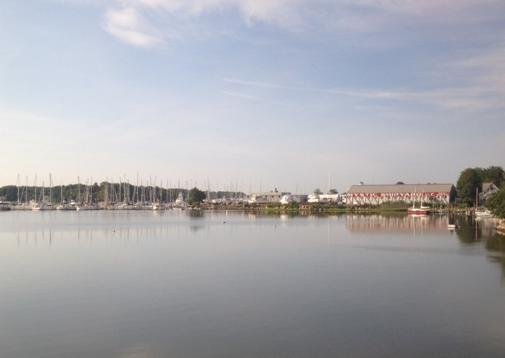
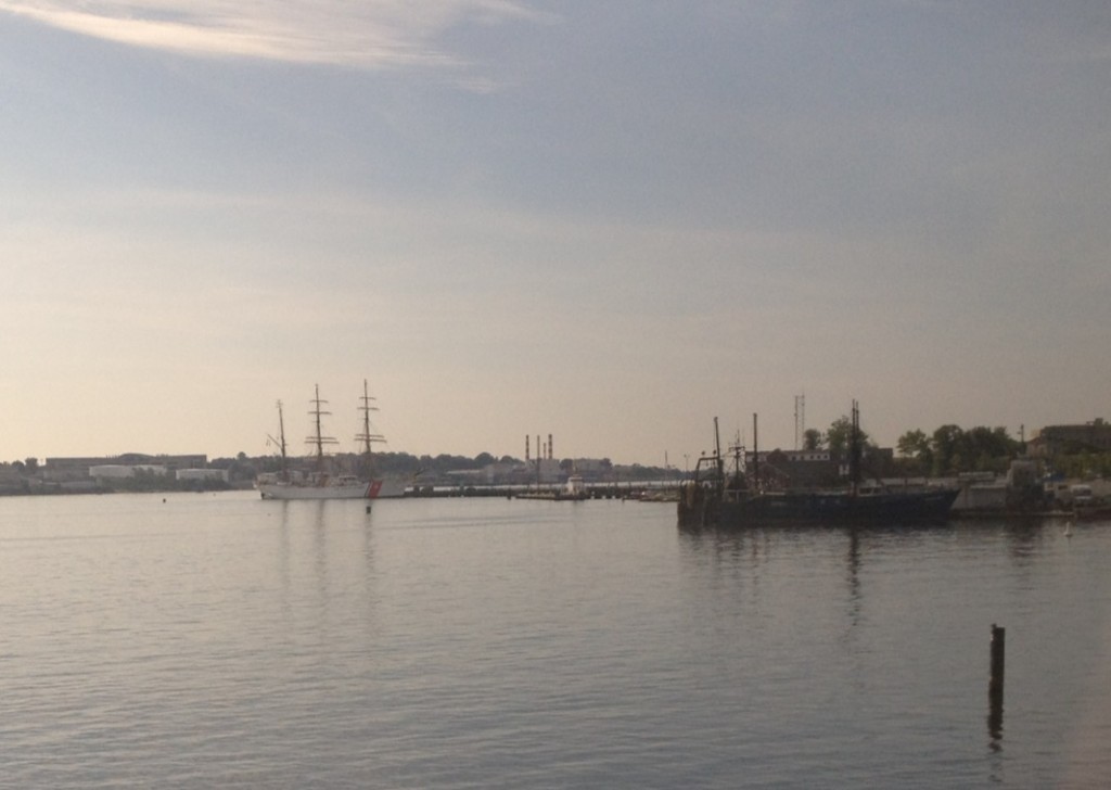
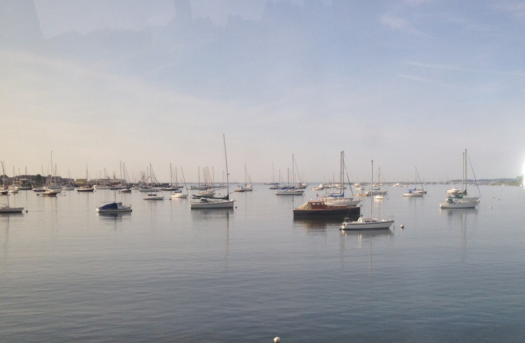
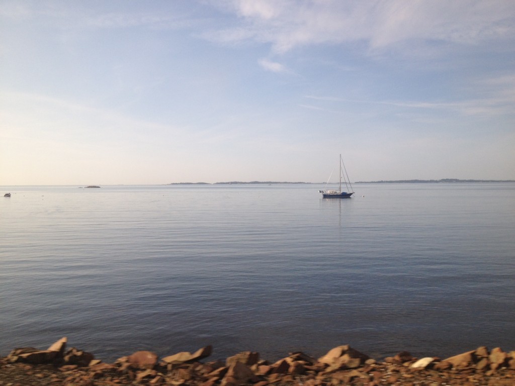
Today was a great day- although I wasn’t out on Boston Harbor, I was on the train down to New York City for the day. I passed by the beautiful Connecticut Coast today, which is one of my favorite parts about going to New York on the train.

It as been an aspiration of mine to take the boat out of Boston Harbor down through the Cape Cod Canal and tie up somewhere along the Connecticut Coast- perhaps Stonington or Mystic. I wrote about the Connecticut Coast last time I went down to New York City. I don’t know if I will make this trip this summer, but it is definitely on my list.  If anyone has made the trip down to the Connecticut Coast from Boston I would love to know details!


A beautiful day along Stonington:


Mystic Shipyard:


After living in Connecticut for a short time, we know a little bit about the area- The area around Stonington is a great boating spot, which we have visited several times in the past (but never by boat from Boston). It is protected by some offshore islands such as Fishers Island, which makes the sound particularly boater friendly. The bad news is, its about 125 miles each way from Boston Harbor. I have not done this yet, but may try this trek later this summer, so I would appreciate any comments from anyone who has made this trek (or a similar one) lately. Her is the chart of the Fishers Island Sound and the nearby ports of Stonington and Mystic:

The chart images contained herein were obtained by the NOAA and are being used in accordance with their terms of permitted use. Altered and redistributed charts such as those shown below should not be relied on for navigational purposes. Please download the full version from “www.charts.noaa.gov” and please see terms of service at http://www.charts.noaa.gov/RNCs/Agreement.shtml?13270.

Coast Guard Eagle this morning in her home port of New London on the Connecticut Coast:


A dark and rainy afternoon- August 14th, 2012 in New York City:


Posted in Boston Harbor History, Boston Harbor Navigation, Weather | Tagged , , , , , | Comments Off on A beautiful day along the Connecticut Coast

Boston Harbor Picture of the Week: Morning Fog in Scituate

Morning fog in Scituate: A photo of some boats enshrouded in the the fog that was rolling in on Scituate’s Peggotty Beach on Saturday Morning.

Related Posts Plugin for WordPress, Blogger...
Posted in Boston Harbor Picture of the Week, Boston Harbor Tides, Weather | Tagged , , , , | Comments Off on Boston Harbor Picture of the Week: Morning Fog in Scituate