The extremely useful NOAA buoy system

While offshore the other night, I was in the area of one of the NOAA buoys off Boston Harbor, the 44013 buoy. I was within visual distance of the buoy, which was kind of cool as it is hard to find in such a remote area. This buoy is 16 nautical miles East of Boston.

These NOAA buoys are located all up and down the coast and provide valuable information about wind, weather and wave height. You can go to one of my favorite websites,  www.wunderground.com, and go to the marine forecast section, to get real time data from these stations about conditions offshore. If you zoom in the picture below, you may be able to see the distant Boston skyline in the background:

I monitor the data out of these stations frequently, and one of my most interesting stories about station 44013 was during a Nor’Easter in late December 2008. It was not long before Christmas, when a snow emergency had been called in the city and cars had to be evacuated. As I walked home after dropping my car off at a parking garage in South Boston, I remember the abnormal size of the waves and the force of the wind across the Summer Street bridge. When I got home, I looked up the NOAA buoy data, and found that the wave height at 44013 that evening was over 20 feet!

Posted in Boston Harbor History, Boston Harbor in the Winter, Boston Harbor Navigation | Tagged , , , , | 1 Comment

The “State of Maine” in Boston Harbor

Today the State of Maine, a Maine Maritime Academy training vessel was tied up on the South Boston waterfront. This is a pretty big and impressive boat, and it looked cool in front of the skyline. It is uncertain why it is in town today, but here is a photo of the ship:

Posted in Boston Harbor History, Boston Harbor Navigation, Boston Harborfront Development, boston local issues | Tagged , , , | 2 Comments

Boston Harbor Picture of the Week: Boston Light at Sunset

Boston Light: In honor of National Lighthouse Day, here is a photo of Boston Light taken last night, in front of a nice summer sunset.

Posted in Boston Harbor History, Boston Harbor Picture of the Week | Tagged , , , , | Comments Off on Boston Harbor Picture of the Week: Boston Light at Sunset

Views from Fort Revere in Hull

image-99

Above, a panoramic view of the structure of Fort Revere looking North. Below is a view looking East over Point Allerton and Hull Harbor from the top of the fort.

Fort Revere is a less well known landmark, which is what I found compelling about going there. The fort has a strategic location on a hill high above Hull’s Northwestern most point, Pemberton Point. The fort which stands today was built in the 1890s and was named for Paul Revere (as in the midnight ride). The present fort was evidently used as a fortification of the harbor and city in both World Wars. At the top of the fort there are some monuments placed during the bicentennial in 1976 honoring French soldiers who died in Hull in 1782, toward the final days of the Revolutionary War.

image-100

I stumbled upon this when reading about the “old fort” at Hull that Henry David Thoreau referenced in his essay The Shipwreck, about this visit to Cohasset and Hull in 1849. I suspect that this was the location he was referencing, which suggests that Fort Revere was built on the sight of a much older fort dating back to the American Revolution. For more on Fort Revere, see here.

Fort Revere

After visiting, I’m convinced that this location is more well known to graffiti artists than people interested in history or those out for a beautiful view. I had to edit out some of the more vulgar griffitti in these pictures, as we are committed to keeping BHB a family friendly website. As a result, you may see some blurry areas.

The tower atop this fort can be seen well by boaters when entering or exiting the Harbor via Nantasket Roads. Note in the picture above, the distant view of the Boston Harbor Island and Boston Light. Below, looking South, one can see the cemetery and the bridge to Spinnaker Island. Now converted to a condo complex, Spinnaker Island was once the sight of a control station for a the missiles once held on nearby Webb Memorial State Park. Further in the background is the town of Hull and a distant view of Cohasset:

spinnaker island

A look out at the Brewster Islands and the two lighthouses, Boston Light and Graves Light, as seen from the hill on Fort Revere:

Fort Revere Steps

Fort Revere Wall

One of the many old iron ring bolts around the perimeter of the fort:

image-102Inside the WWIera bunker at Fort Revere. The tunnels extend deep underground and I did not venture very far. It is obvious that the graffiti artists got here before I did. So did some bats and spiders:


fort revere

hull

Posted in Boston Harbor History, Boston Harbor Navigation, Visiting Boston Harbor | Tagged , , , , , | Comments Off on Views from Fort Revere in Hull

Boston Harbor picture of the week: Turkey Hill

Looking East out over the Atlantic Ocean and the Hull wind turbine from the top of Turkey Hill in Hingham.

Posted in Boston Harbor Picture of the Week, Visiting Boston Harbor | Tagged , , , | Comments Off on Boston Harbor picture of the week: Turkey Hill

A trip to Spectacle Island

Today made me realize why we all pay up to live in this beautiful but expensive greater Boston area. Our own Boston Harbor Islands National Park is an incredible asset, and a great place to visit.  Spectacle Island is one of the easier islands to access.

I had not been to Spectacle Island since 2006. I have always loved this island, but thought of it as more of a tourist attraction than a locals hang-out (and when it comes to Boston Harbor, I’m a local down to the bone!) But with today’s gray sky and nasty Northeast wind keeping me from an ocean excursion, it was an ideal day to go explore this island.

Easy docking -A nice open concrete dock and just $20 for the day:

My quick 30-second version of a proper spring line:

No issues with bringing the stroller for the little one:

The view. A short hike to the top of the North Drumlin reveals a wonderful view of the City. It is a unique perspective- an elevated view of the city from the East. Clearly visible is South Boston, Logan Airport, Castle Island and the Punch Bowl. Even for a gray day, there was plenty of boat activity in and out of the city.

A view to the SouthEast toward Hingham, over the outer Harbor Islands National Park:

Northeast: Long Island is in the foreground, with the Outer Brewsters and Graves Light barely visible in the distance.

Heading back to the Marina. Glad I could see my boat was still there from all the way up on the hill (she is distantly visible on the dock).

Posted in Boston Harbor Day Boat Trips, Boston Harbor Walks, Visiting Boston Harbor | Tagged , , | Comments Off on A trip to Spectacle Island

U-boats around Boston Harbor made it a tough summer for boating in 1942

Tonight’s news from multiple sources of the discovery of a WWII-era German U-boat wreck South of Nantucket makes me think about what boating might have been like while the war was going on….

U-boats in Boston Harbor

That summer 70 years ago was probably not a good one for recreational boating or commercial fishing, given that the entire harbor was on the defensive and rigged with mines to prevent German U-boat attacks. Here is an Army Corp of Engineers map of Boston Harbor’s mine defense in the summer of 1942:
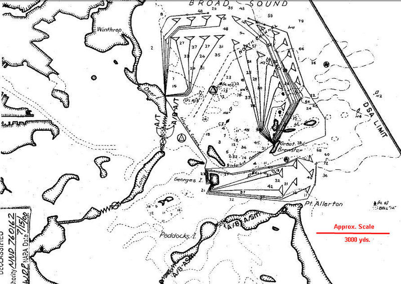
Per Wikipedia: This image is a work of a U.S. Army Corps of Engineers employee, taken or made as part of that person’s official duties. As a work of the U.S. federal government, the image is in the public domain. See this the history and usage disclaimer of this image here.

Germany declared war on the United States on December 11th, 1941, only four days after the attack on Pearl Harbor by Japan. Over the subsequent six months, there would be more ships lost off the coast of Boston to U-boat attacks than there were lost to Japanese attack at Pearl Harbor. Many of the ships lost during these six months were leaving the Fore River Shipyard in WeymouthI think this is a less often taught point in American History, as it could have compromised the American psyche and challenged the perception of security through geographic isolation.

Pictured below is an Ameican WWII-era mine, which was one of the many devices protecting the harbor, per the diagram above. Legend has it that this mine was hit by a submarine-presumably a German U-Boat one night in 1942. The disturbance detected, causing the network to be activated, and putting the entire harbor defense system on high alert. The vessel in question slipped away into the night unscathed, but a later examination o the mine in question revealed that it had a large gash on its side, most likely the work of a submarine propeller! This mine can be seen today on Georges Island.
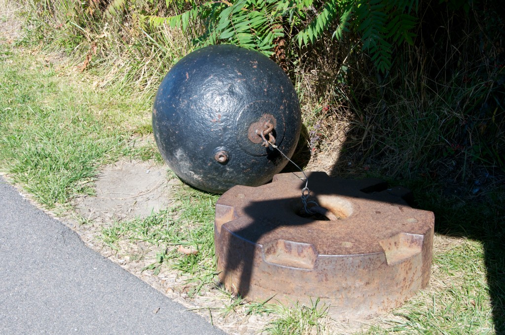
Georges Island

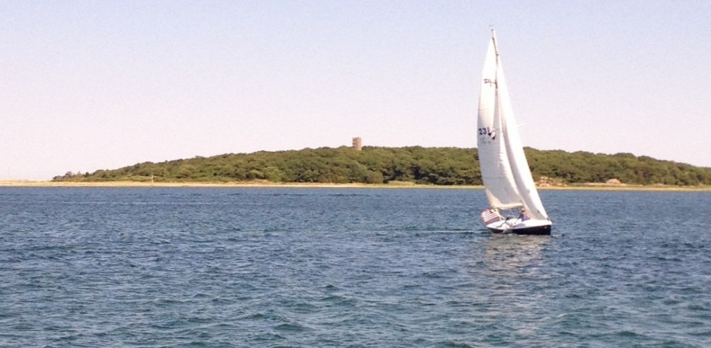
I remember learning about our harbor defenses at a young age from my Grandfather, who was a WWII veteran. One afternoon many years ago while we were fishing near Loblolly Cove in Rockport, he pointed out a big concrete tower up on the hill (the one near Penryn Way, for you North Shore locals out there)….He told me that the Government constructed these towers in order to survey the coastline for enemy intruders, particularly U-boats. They would then use triangulation to pin point the U-boat locations and coordinate defenses. Today, several other similar towers remain standing on both North and South Shores in places like Halibut Point State Park in Rockport, Lodge Park in Nahant, Lovells Island in Boston Harbor, The Northern end of Humarock near the mouth of the North River, Brant Rock in Marshfield, and finally, the Glades in Scituate.

Pictured below is the WWII-era lookout tower located on the Glades in Scituate:
 

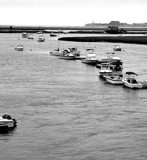
A distant view of the Humarock Tower from the North River Bridge on Route 3A:
So there is a little coastal WWII history for you…..more to come!

Posted in Boston Harbor History, Boston Harbor Navigation, Uncategorized, Visiting Boston Harbor | Tagged , , , , , , , | 1 Comment

Crossing Nantucket Sound

After heading down to Nantucket Sound two Saturdays ago via the Eastern Route, my pal Captain Jack headed over to Madaket, on the West Side of Nantucket yesterday from Yarmouth in fairly rough conditions. The trip took approximately 1 hour 50 minutes.

I wasn’t with him for this leg, but he sent me some interesting real-time details about the conditions during the trip. Recall, the first leg of this trip took us around the outer Cape, which I documented here (4 hour 15 minute trip). Approximate trip route for reference:

Note: Route is approximate. Not for Navigation. See NOAA disclaimer for details.

A trip across Nantucket Sound is not an easy quest in a 25 foot boat, although it may look that way from the top deck of one of the ferries. Along the trip, Jack passed buoy #17, which serves as NOAA station 44020. I have marked this buoy in the map above with the green circle. It is essentially right in the middle of the sound. Conditions at the NOAA stations are visible real time on wunderground.com and at the time the buoy was showing a 15kt NW wind, a dominant wave height of 3.5 feet and a 3.4 second wave interval. This is known as “tight chop”. A small craft warning has been in effect earlier in the morning, but subsided by early afternoon.

NOAA Station 44020:


 With a NW wind and large, tight chop, Captain Jack found himself in a following sea– a condition where mariners need to make sure they don’t bury the bow as they coast over the crest of a wave and into its trough. For these conditions, I find that keeping a moderate speed is more important than trim position.

Madaket Harbor on the West side of Nantucket Island:

Tying up on a crowded Madaket beach:


A typical foggy morning in Madaket Village:

Posted in Boston Harbor Day Boat Trips, Boston Harbor History, Boston Harbor Navigation, Uncategorized | Tagged , , , , , , , , | Comments Off on Crossing Nantucket Sound

Dogfish: A Boston Harbor pest, but good eating

 I have become frustrated recently by the large number of Dogfish I have been catching relative to Cod, Stripers and Blues. So I decided to do something about it.

As many fisherman know, the Dogfish is practically an invasive species with a voracious appetite, and has crowded out the Cod population of Massachusetts Bay. These fish have been called the most detested fish in local waters, and also rank highly on the list of ugliest fish. While recently reading about Dogfish, I came across a great website, Garbagefish.com, which inspired me to think about having some Dogfish for dinner!

It turns out that Dogfish is regularly harvested in New England and is eaten as the fish in Fish and Chips. It has also been compared to Monkfish, which was considered garbage due to its hideous looks, until someone figured out that it tasted pretty good. I caught this fish using frozen squid, near thieves ledge in Boston harbor (That #1 Green Bell about 3 miles east of Allerton Point).


I cleaned the fish and cut it into steaks quickly, which evidently needs to be done with this type of fish to prevent the urea in the fish’s guts from leaking into the meat. I threw the steaks in a plastic bag and brought them home. We covered the fish in batter and Panko bread crumbs and threw them on the frying pan for about 8 minutes per side.


The result was delicious. Thanks garbagefish.com for the idea!!! The fish is white, tender and meaty fish….but not too fishy. We  enjoyed it thoroughly, although we didn’t give our young son any (since mom was concerned about the potential for high mercury levels).


Here is a very appropriate beverage to wash it down with:


Posted in boston local issues, Fishing, Uncategorized | Tagged , , , , , | 1 Comment

New public dock at Atlantic Wharf

I walked by the new public dock at Atlantic Wharf the other day. This could be interesting for boaters who want to tie up and be close to downtown Boston. Just make sure that your vessel fits under the Northern Ave Bridge at high tide, or you might get stuck for a while. The dock is located on the Western side of Fort Point Channel, right at the intersection of Dorchester Ave and Congress Street. The dock is very close to the Boston Tea Party Museum as well.

It looks like someone is operating a ferry and sightseeing tour service from this dock as well.

Related Posts Plugin for WordPress, Blogger...
Posted in boston development, Boston Harbor Day Boat Trips, Boston Harbor History, Uncategorized | Tagged , , , , , , | Comments Off on New public dock at Atlantic Wharf